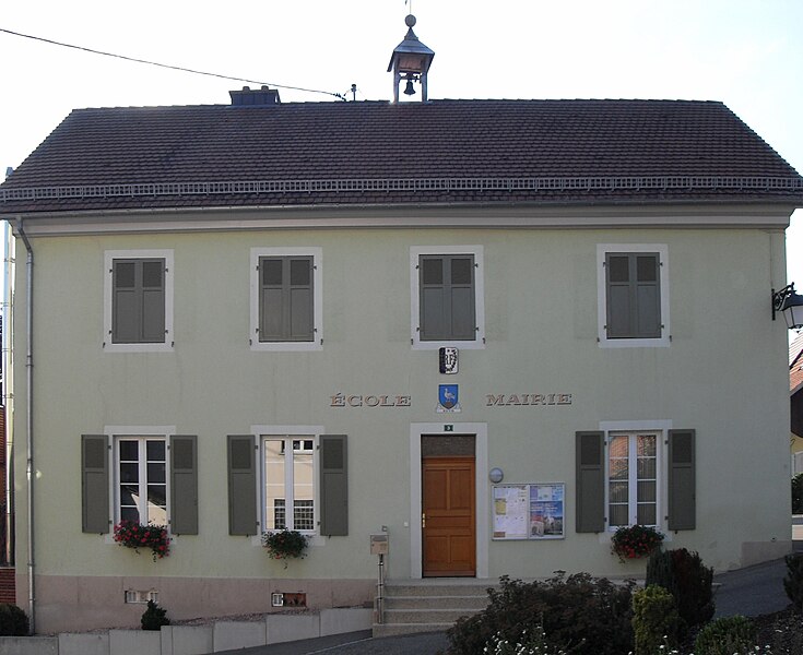
Wolschwiller (Wolschwiller)

- commune in Haut-Rhin, France
 Hiking in Wolschwiller
Wolschwiller is a charming village located in the Alsace region of France, near the border with Switzerland. The area is known for its beautiful natural scenery, making it a delightful destination for hikers. Here are some key points about hiking in and around Wolschwiller:
Trails and Routes
-
Local Trails: The region offers a network of hiking trails that cater to a variety of skill levels. Trails can vary from easy walks suitable for families to more challenging routes for experienced hikers.
-
Scenic Paths: Many of the hiking paths will lead you through picturesque landscapes, including forested areas, meadows, and panoramic views of the surrounding Alsatian countryside and the Jura Mountains.
-
Cross-Border Hikes: Given Wolschwiller's proximity to Switzerland, you can easily access hiking routes that cross the border, allowing for diverse experiences and stunning views.
Points of Interest
- Natural Reserves: This region is home to various natural reserves where you can observe local flora and fauna. Some trails might guide you through these beautiful protected areas.
- Historical Sites: Along the hiking trails, you might encounter historical sites or villages that reflect the local culture and heritage.
Seasonal Considerations
- Spring and Summer: Hiking is particularly enjoyable during these warmer months when the landscape is vibrant and alive. Wildflowers bloom, making for picturesque scenery.
- Autumn: The fall foliage can create stunning vistas, making autumn a great time for hiking as well.
- Winter: Depending on the snowfall, some trails may be suitable for winter hiking or snowshoeing. Always check conditions before heading out.
Practical Tips
- Weather: Always check the weather forecast before you set out, as conditions can change quickly in the mountains.
- Gear: Good hiking boots are essential, and depending on the season, you may need additional gear like trekking poles, rain jackets, or warm clothes.
- Maps and Guides: It's helpful to carry a map or download a hiking app with trail information to stay on track.
Safety
- Always tell someone your hiking plans, especially if you're venturing into less populated areas.
- Stay hydrated and carry snacks, especially on longer hikes.
- Know your limits and choose trails that match your fitness level.
Local Resources
You may find local visitor centers in Wolschwiller that can provide maps, trail information, and tips on the best hiking spots in the region. They can also inform you about any guided hikes or events that might be taking place during your visit.
Overall, hiking in Wolschwiller offers a unique blend of natural beauty, cultural experiences, and outdoor adventure. Enjoy your time exploring this wonderful region!
- Country:

- Postal Code: 68480
- Coordinates: 47° 27' 41" N, 7° 24' 29" E


- GPS tracks (wikiloc): [Link]
- Area: 10.14 sq km
- Population: 469
- Wikipedia en: wiki(en)
- Wikipedia: wiki(fr)
- Wikidata storage: Wikidata: Q653653
- Wikipedia Commons Category: [Link]
- Freebase ID: [/m/03nsvfs]
- Freebase ID: [/m/03nsvfs]
- Freebase ID: [/m/03nsvfs]
- GeoNames ID: Alt: [2967290]
- GeoNames ID: Alt: [2967290]
- GeoNames ID: Alt: [2967290]
- SIREN number: [216803809]
- SIREN number: [216803809]
- SIREN number: [216803809]
- BnF ID: [152720829]
- BnF ID: [152720829]
- BnF ID: [152720829]
- INSEE municipality code: 68380
- INSEE municipality code: 68380
- INSEE municipality code: 68380
Shares border with regions:


Lutter
- commune in Haut-Rhin, France
Hiking in Lutter
Lutter, located in the Haut-Rhin department in the Alsace region of France, offers a variety of hiking opportunities for outdoor enthusiasts. The region is characterized by its picturesque landscapes, rolling hills, vineyards, and charming villages, making it an attractive destination for both casual walkers and seasoned hikers....
- Country:
- Postal Code: 68480
- Coordinates: 47° 27' 58" N, 7° 22' 52" E
- GPS tracks (wikiloc): [Link]
- Area: 8.46 sq km
- Population: 277

Kiffis
- commune in Haut-Rhin, France
Hiking in Kiffis
Kiffis doesn't appear to be widely recognized as a prominent hiking destination, so it's possible that you may be referring to a less-known area or a local name. If Kiffis is a specific location you're interested in, it would be helpful to know its geographic context or features....
- Country:
- Postal Code: 68480
- Coordinates: 47° 26' 25" N, 7° 21' 25" E
- GPS tracks (wikiloc): [Link]
- Area: 6.55 sq km
- Population: 248


Oltingue
- commune in Haut-Rhin, France
Hiking in Oltingue
Oltingue is a small commune located in the Haut-Rhin department of eastern France, near the border with Switzerland. Hiking in this area can be quite rewarding, as it offers beautiful landscapes and the chance to experience the unique flora and fauna of the region....
- Country:
- Postal Code: 68480
- Coordinates: 47° 29' 29" N, 7° 23' 30" E
- GPS tracks (wikiloc): [Link]
- Area: 13.42 sq km
- Population: 721
- Web site: [Link]

Biederthal
- commune in Haut-Rhin, France
Hiking in Biederthal
Biederthal is a picturesque area in the Vosges mountains of France, known for its beautiful landscapes, lush forests, and serene hiking trails. The region offers various hiking opportunities suitable for different skill levels, from easy strolls to challenging treks....
- Country:
- Postal Code: 68480
- Coordinates: 47° 28' 11" N, 7° 26' 55" E
- GPS tracks (wikiloc): [Link]
- Area: 4.16 sq km
- Population: 302