Kiffis (Kiffis)

- commune in Haut-Rhin, France
 Hiking in Kiffis
Kiffis doesn't appear to be widely recognized as a prominent hiking destination, so it's possible that you may be referring to a less-known area or a local name. If Kiffis is a specific location you're interested in, it would be helpful to know its geographic context or features.
If you’re looking to explore hiking in a similar-sounding region or nearby areas, here are some general tips for hiking:
-
Location Research: Find out about local trails, parks, and natural reserves near Kiffis. Websites like AllTrails or local hiking groups can provide detailed maps and reviews of trails.
-
Trail Difficulties: Determine the difficulty level of the trails, which can range from easy, moderate, to difficult, based on your fitness level and experience.
-
Safety Considerations: Always check weather conditions, prepare for changes in temperature, and bring essential gear like water, snacks, a first aid kit, and a map or GPS device.
-
Leave No Trace: Follow Leave No Trace principles to minimize your impact on the natural environment. This includes staying on marked trails and properly disposing of waste.
-
Wildlife Awareness: Be aware of local wildlife and take precautions to keep both yourself and the animals safe.
If you provide more specific details about Kiffis, I’d be happy to help you further with tailored advice or recommendations!
- Country:

- Postal Code: 68480
- Coordinates: 47° 26' 25" N, 7° 21' 25" E


- GPS tracks (wikiloc): [Link]
- Area: 6.55 sq km
- Population: 248
- Wikipedia en: wiki(en)
- Wikipedia: wiki(fr)
- Wikidata storage: Wikidata: Q124123
- Wikipedia Commons Category: [Link]
- Freebase ID: [/m/03nst1_]
- Freebase ID: [/m/03nst1_]
- Freebase ID: [/m/03nst1_]
- GeoNames ID: Alt: [6441495]
- GeoNames ID: Alt: [6441495]
- GeoNames ID: Alt: [6441495]
- SIREN number: [216801654]
- SIREN number: [216801654]
- SIREN number: [216801654]
- BnF ID: [15271867c]
- BnF ID: [15271867c]
- BnF ID: [15271867c]
- INSEE municipality code: 68165
- INSEE municipality code: 68165
- INSEE municipality code: 68165
Shares border with regions:


Lucelle
- commune in Haut-Rhin, France
Hiking in Lucelle
Lucelle is a picturesque village located in the Haut-Rhin department of the Alsace region in northeastern France, near the Swiss border. The area around Lucelle offers some beautiful opportunities for hiking, combining natural landscapes, historical sites, and the charm of the Alsace region....
- Country:
- Postal Code: 68480
- Coordinates: 47° 25' 21" N, 7° 14' 50" E
- GPS tracks (wikiloc): [Link]
- Area: 10.27 sq km
- Population: 35


Lutter
- commune in Haut-Rhin, France
Hiking in Lutter
Lutter, located in the Haut-Rhin department in the Alsace region of France, offers a variety of hiking opportunities for outdoor enthusiasts. The region is characterized by its picturesque landscapes, rolling hills, vineyards, and charming villages, making it an attractive destination for both casual walkers and seasoned hikers....
- Country:
- Postal Code: 68480
- Coordinates: 47° 27' 58" N, 7° 22' 52" E
- GPS tracks (wikiloc): [Link]
- Area: 8.46 sq km
- Population: 277
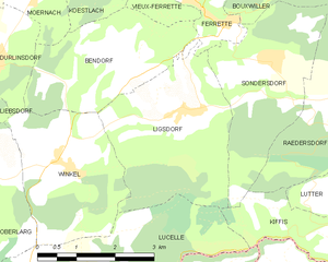
Ligsdorf
- commune in Haut-Rhin, France
Hiking in Ligsdorf
Ligsdorf is a charming area in the Grand Duchy of Luxembourg, nestled within the beautiful region of the Sûre valley. While it may not be as widely known as some other hiking destinations, it offers a selection of picturesque trails that showcase the natural beauty and tranquility of the Luxembourg countryside....
- Country:
- Postal Code: 68480
- Coordinates: 47° 28' 21" N, 7° 18' 19" E
- GPS tracks (wikiloc): [Link]
- Area: 10.03 sq km
- Population: 316

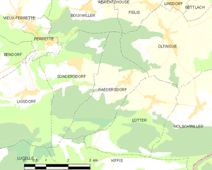
Raedersdorf
- commune in Haut-Rhin, France
Hiking in Raedersdorf
Raedersdorf is a small village located in the Alsace region of France, not far from the German border. It offers a serene environment perfect for hiking enthusiasts who want to explore the scenic beauty of the area. Here are some details and tips for hiking in and around Raedersdorf:...
- Country:
- Postal Code: 68480
- Coordinates: 47° 28' 30" N, 7° 22' 0" E
- GPS tracks (wikiloc): [Link]
- Area: 7.39 sq km
- Population: 506


Sondersdorf
- commune in Haut-Rhin, France
Hiking in Sondersdorf
Sondersdorf, a small town located in Bavaria, Germany, offers access to beautiful hiking trails and scenic landscapes typical of the region. The area is known for its rolling hills, lush forests, and picturesque farmland, making it an ideal location for hikers of all levels....
- Country:
- Postal Code: 68480
- Coordinates: 47° 28' 59" N, 7° 20' 7" E
- GPS tracks (wikiloc): [Link]
- Area: 8.44 sq km
- Population: 343

Wolschwiller
- commune in Haut-Rhin, France
Hiking in Wolschwiller
Wolschwiller is a charming village located in the Alsace region of France, near the border with Switzerland. The area is known for its beautiful natural scenery, making it a delightful destination for hikers. Here are some key points about hiking in and around Wolschwiller:...
- Country:
- Postal Code: 68480
- Coordinates: 47° 27' 41" N, 7° 24' 29" E
- GPS tracks (wikiloc): [Link]
- Area: 10.14 sq km
- Population: 469