
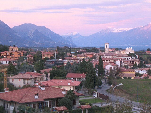
Manerba del Garda (Manerba del Garda)
.svg)
- Italian comune
 Hiking in Manerba del Garda
Manerba del Garda is a beautiful area located on the western shore of Lake Garda in northern Italy. The region is known for its stunning natural scenery, rich history, and a variety of hiking paths that cater to different skill levels. Here are some key highlights and tips for hiking in Manerba del Garda:
1.
- Sentiero del Ventr.: This is a scenic trail that offers panoramic views of Lake Garda and the surrounding mountains. It’s moderately challenging but well-marked.
- Parco della Rocca e del Sasso: This park features several trails that explore the natural environment and historical sites, including ruins of ancient fortifications and a 12th-century church.
- The Loop Trails: There are several shorter loop trails that are perfect for families or those looking for a leisurely hike. These trails often lead to picturesque views of the lake and surrounding hills.
2.
- The region is characterized by its diverse flora and fauna, with Mediterranean vegetation and several lookout points that provide fantastic views of the lake and surrounding landscape.
- The nearby cliffs and hills, including the Rocca di Manerba, provide excellent vantage points for photography and birdwatching.
3.
- While hiking, you can also explore various historical sites, such as the remains of ancient villages and medieval fortifications, which add cultural depth to your hiking experience.
4.
- The best times for hiking in Manerba del Garda are during the spring (April to June) and fall (September to October) when the weather is mild and the trails are less crowded. Summer can be quite hot, making early morning or late afternoon hikes more comfortable.
5.
- Always prepare adequately with plenty of water, snacks, a map or GPS for navigation, and appropriate clothing for changing weather conditions.
- It’s also advisable to inform someone about your plans before you head out, especially if you’re exploring more remote trails.
6.
- Manerba del Garda has several amenities for hikers, including restaurants, cafes, and shops where you can stock up on supplies or enjoy a meal after your hike.
7.
- Manerba is accessible by public transportation, and parking is available if you’re driving. Be aware of local parking regulations, especially in busy tourist seasons.
Whether you are an experienced hiker or a beginner looking for a scenic stroll, Manerba del Garda has something to offer everyone. Enjoy the breathtaking views and the diverse natural and historical experiences that await you!
- Country:

- Postal Code: 25080
- Local Dialing Code: 0365
- Licence Plate Code: BS
- Coordinates: 45° 32' 59" N, 10° 33' 5" E


- GPS tracks (wikiloc): [Link]
- AboveSeaLevel: 130 м m
- Area: 36.63 sq km
- Population: 5357
- Web site: http://www.comune.manerbadelgarda.bs.it/
- Wikipedia en: wiki(en)
- Wikipedia: wiki(it)
- Wikidata storage: Wikidata: Q105142
- Wikipedia Commons Category: [Link]
- Freebase ID: [/m/044w3p]
- GeoNames ID: Alt: [3174094]
- BnF ID: [15040546c]
- VIAF ID: Alt: [245852833]
- OSM relation ID: [45273]
- GND ID: Alt: [4733531-2]
- Library of Congress authority ID: Alt: [n2003116532]
- Quora topic ID: [Manerba-Del-Garda]
- UN/LOCODE: [ITMBR]
- ISTAT ID: 017102
- Italian cadastre code: E883
- LombardiaBeniCulturali toponym ID: 2000244
- LombardiaBeniCulturali institution ID: 2000244
Shares border with regions:

Moniga del Garda
- Italian comune
Hiking in Moniga del Garda
Moniga del Garda is a charming town located on the western shore of Lake Garda in Italy. It offers beautiful scenery, lovely views of the lake, and a pleasant Mediterranean climate, making it a great destination for hiking enthusiasts. Here are some details about hiking in the area:...
- Country:
- Postal Code: 25080
- Local Dialing Code: 0365
- Licence Plate Code: BS
- Coordinates: 45° 31' 37" N, 10° 32' 20" E
- GPS tracks (wikiloc): [Link]
- AboveSeaLevel: 125 м m
- Area: 14.65 sq km
- Population: 2575
- Web site: [Link]
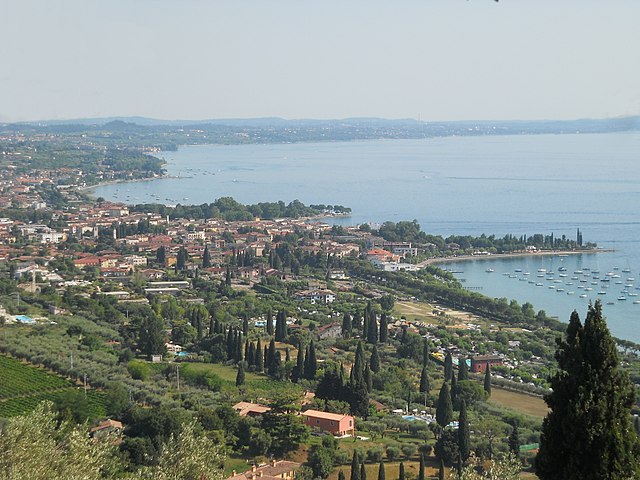
Polpenazze del Garda
- Italian comune
Hiking in Polpenazze del Garda
Polpenazze del Garda, located in the province of Brescia in northern Italy, offers a charming hiking experience with stunning views of Lake Garda and the surrounding countryside. This quaint town is part of the Valtènesi area, known for its vineyards, olive groves, and hilly landscapes, making it a perfect destination for both novice and experienced hikers....
- Country:
- Postal Code: 25080
- Local Dialing Code: 0365
- Licence Plate Code: BS
- Coordinates: 45° 32' 41" N, 10° 30' 51" E
- GPS tracks (wikiloc): [Link]
- AboveSeaLevel: 204 м m
- Area: 9.12 sq km
- Population: 2672
- Web site: [Link]

Puegnago sul Garda
- Italian comune
Hiking in Puegnago sul Garda
Puegnago sul Garda, located in the Lombardy region of Italy, is a charming village situated near the western shore of Lake Garda. It offers beautiful landscapes, rich flora and fauna, and a variety of hiking opportunities suited for different skill levels....
- Country:
- Postal Code: 25080
- Local Dialing Code: 0365
- Licence Plate Code: BS
- Coordinates: 45° 34' 0" N, 10° 30' 36" E
- GPS tracks (wikiloc): [Link]
- AboveSeaLevel: 224 м m
- Area: 10.97 sq km
- Population: 3444
- Web site: [Link]

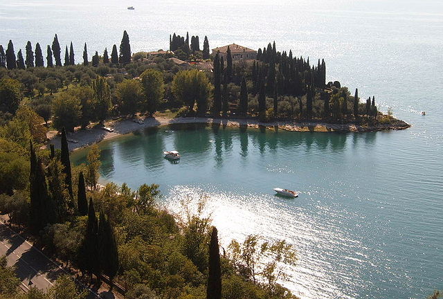
San Felice del Benaco
- Italian comune
Hiking in San Felice del Benaco
San Felice del Benaco is a picturesque town located on the western shores of Lake Garda in Italy. It offers a variety of hiking opportunities that are suitable for different skill levels, and the scenery is often breathtaking, with views of the lake, mountains, and lush landscapes....
- Country:
- Postal Code: 25010
- Local Dialing Code: 0365
- Licence Plate Code: BS
- Coordinates: 45° 35' 0" N, 10° 33' 0" E
- GPS tracks (wikiloc): [Link]
- AboveSeaLevel: 109 м m
- Area: 20.22 sq km
- Population: 3395
- Web site: [Link]

Soiano del Lago
- Italian comune
Hiking in Soiano del Lago
Soiano del Lago, located in the Lombardy region of Italy, near Lake Garda, offers a variety of hiking opportunities that showcase the area's stunning natural beauty and cultural heritage. The region is characterized by its rolling hills, olive groves, and panoramic views of the lake, making it a picturesque destination for hikers of all levels....
- Country:
- Postal Code: 25080
- Local Dialing Code: 0365
- Licence Plate Code: BS
- Coordinates: 45° 31' 40" N, 10° 30' 46" E
- GPS tracks (wikiloc): [Link]
- AboveSeaLevel: 196 м m
- Area: 5.77 sq km
- Population: 1919
- Web site: [Link]

Bardolino
- Italian comune
Hiking in Bardolino
Bardolino is a picturesque town located on the eastern shore of Lake Garda in Italy. The area is known for its beautiful landscapes, scenic views, and vineyard-covered hills, making it a great destination for hikers. Here are some highlights to consider when hiking in Bardolino:...
- Country:
- Postal Code: 37011
- Local Dialing Code: 045
- Licence Plate Code: VR
- Coordinates: 45° 33' 6" N, 10° 43' 17" E
- GPS tracks (wikiloc): [Link]
- AboveSeaLevel: 65 м m
- Area: 57.33 sq km
- Population: 7147
- Web site: [Link]

Garda
- Italian comune
Hiking in Garda
Hiking in the Garda region of Veneto is a fantastic way to explore the stunning landscapes and natural beauty that the area has to offer. Lake Garda, the largest lake in Italy, is surrounded by picturesque towns, rolling hills, and majestic mountains. Here are some highlights and tips for hiking in this beautiful region:...
- Country:
- Postal Code: 37016
- Local Dialing Code: 045
- Licence Plate Code: VR
- Coordinates: 45° 34' 21" N, 10° 40' 18" E
- GPS tracks (wikiloc): [Link]
- AboveSeaLevel: 67 м m
- Area: 14.37 sq km
- Population: 4117
- Web site: [Link]