Marainviller (Marainviller)

- commune in Meurthe-et-Moselle, France
- Country:

- Postal Code: 54300
- Coordinates: 48° 35' 22" N, 6° 36' 2" E


- GPS tracks (wikiloc): [Link]
- Area: 16.99 sq km
- Population: 659
- Wikipedia en: wiki(en)
- Wikipedia: wiki(fr)
- Wikidata storage: Wikidata: Q226809
- Wikipedia Commons Category: [Link]
- Freebase ID: [/m/03qdlfv]
- Freebase ID: [/m/03qdlfv]
- GeoNames ID: Alt: [6436736]
- GeoNames ID: Alt: [6436736]
- SIREN number: [215403502]
- SIREN number: [215403502]
- BnF ID: [15264419x]
- BnF ID: [15264419x]
- INSEE municipality code: 54350
- INSEE municipality code: 54350
Shares border with regions:


Laneuveville-aux-Bois
- commune in Meurthe-et-Moselle, France
- Country:
- Postal Code: 54370
- Coordinates: 48° 36' 41" N, 6° 39' 0" E
- GPS tracks (wikiloc): [Link]
- Area: 19.04 sq km
- Population: 314


Thiébauménil
- commune in Meurthe-et-Moselle, France
- Country:
- Postal Code: 54300
- Coordinates: 48° 34' 47" N, 6° 37' 22" E
- GPS tracks (wikiloc): [Link]
- Area: 3.87 sq km
- Population: 385


Moncel-lès-Lunéville
- commune in Meurthe-et-Moselle, France
- Country:
- Postal Code: 54300
- Coordinates: 48° 34' 26" N, 6° 31' 44" E
- GPS tracks (wikiloc): [Link]
- Area: 21.94 sq km
- Population: 634

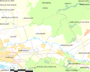
Croismare
- commune in Meurthe-et-Moselle, France
- Country:
- Postal Code: 54300
- Coordinates: 48° 35' 57" N, 6° 34' 14" E
- GPS tracks (wikiloc): [Link]
- Area: 15.7 sq km
- Population: 621