Mariendorf (Mariendorf)
- locality of Berlin, Germany
Mariendorf is a district in the borough of Tempelhof-Schöneberg in Berlin, Germany. While it may not be known for traditional hiking trails like you might find in more mountainous regions, there are still opportunities for outdoor activities and walks in and around the area.
Hiking and Walking Opportunities in Mariendorf:
-
Local Parks: The area features several parks where you can enjoy leisurely walks. Popular spots include:
- Mariendorfer Feld: This is a green space perfect for casual strolls.
- Volkspark Mariendorf: A larger park with walking paths, open fields, and a relaxed atmosphere.
-
Nearby Green Spaces: If you're willing to venture slightly farther, you can access various parks and nature areas within Berlin. Consider:
- Tempelhofer Feld: A former airport turned into a massive public park that offers ample walking, cycling, and outdoor recreational space.
- Grunewald Forest: Not too far away, this large forest provides numerous hiking trails and scenic routes.
-
Urban Walking Tours: Explore the history and architecture of Mariendorf with urban walking tours. You can appreciate the local culture, historical buildings, and community atmosphere.
-
Connect to Wider Trails: From Mariendorf, you can access the broader network of walking and biking paths throughout Berlin, linking to other districts and parks.
Tips for Hiking in Mariendorf:
- Comfortable Footwear: Since the area is more urban, wear comfortable shoes suitable for walking on pavements and park trails.
- Stay Hydrated: Bring water, especially if you're planning a longer walk.
- Local Weather: Check the weather forecast and dress appropriately.
- Start Early or Late in the Day: To avoid crowds and enjoy a more peaceful experience, consider starting your hike early in the morning or later in the evening.
While Mariendorf may not offer challenging hikes, it is still a pleasant area for walking, enjoying nature, and experiencing urban parks. If you're seeking larger hiking experiences, consider traveling to nearby forested or rural areas around Berlin.
- Country:

- Postal Code: 12109; 12107; 12105
- Coordinates: 52° 26' 24" N, 13° 23' 24" E


- GPS tracks (wikiloc): [Link]
- AboveSeaLevel: 49 м m
- Area: 9.38 sq km
- Population: 50956
- Wikipedia en: wiki(en)
- Wikipedia: wiki(de)
- Wikidata storage: Wikidata: Q602159
- Wikipedia Commons Gallery: [Link]
- Wikipedia Commons Category: [Link]
- Wikipedia Commons Maps Category: [Link]
- Freebase ID: [/m/0frmqx]
- GeoNames ID: Alt: [2873606]
- VIAF ID: Alt: [233787788]
- OSM relation ID: [162900]
- GND ID: Alt: [4253115-9]
- archINFORM location ID: [43328]
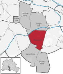
Shares border with regions:


Tempelhof
- locality of Berlin
Tempelhof, a district in Berlin, Germany, is known more for its urban atmosphere than for traditional hiking trails. However, it has unique outdoor spaces that can offer enjoyable walking and exploring experiences for those looking for a more urban hike....
- Country:

- Postal Code: 12279; 12099; 12109; 12105; 12103; 12101
- Coordinates: 52° 28' 0" N, 13° 23' 0" E


- GPS tracks (wikiloc): [Link]
- AboveSeaLevel: 47 м m
- Area: 12.2 sq km
- Population: 59728


Britz
- locality of Berlin
Britz is a neighborhood located in the borough of Neukölln in Berlin, Germany. It is not particularly known for hiking in the traditional sense, as it is more urban and residential in nature. However, there are some fantastic parks and green areas nearby that offer opportunities for leisurely walks and nature exploration....
- Country:

- Postal Code: 12359; 12347
- Coordinates: 52° 27' 0" N, 13° 26' 0" E


- GPS tracks (wikiloc): [Link]
- AboveSeaLevel: 44 м m
- Area: 12.4 sq km
- Population: 41613


Buckow
- locality of Berlin
Buckow is a charming district located in the borough of Neukölln in Berlin, Germany. While it may not be a traditional hiking hotspot, it does offer some lovely outdoor experiences, especially for those interested in walking, nature, and exploring the surrounding areas....
- Country:

- Postal Code: 12353; 12351; 12349
- Coordinates: 52° 25' 55" N, 13° 27' 42" E


- GPS tracks (wikiloc): [Link]
- AboveSeaLevel: 44 м m
- Area: 6.35 sq km
- Population: 39184


Lankwitz
- locality of Berlin
Lankwitz is a district in the southwestern part of Berlin, Germany. While it may not be known for traditional hiking in the way that larger nature reserves or mountain regions are, there are still opportunities for enjoyable walks and hikes in and around the area....
- Country:

- Postal Code: 12249; 12247
- Coordinates: 52° 26' 0" N, 13° 21' 0" E


- GPS tracks (wikiloc): [Link]
- AboveSeaLevel: 43 м m
- Area: 6.99 sq km
- Population: 41955


Marienfelde
- locality of Berlin, Germany
Marienfelde is a district located in the southwestern part of Berlin, Germany. While it may not be a traditional hiking destination with extensive trails like you might find in national parks, there are still some opportunities for walking and exploring the natural surroundings in and around the area....
- Country:

- Postal Code: 12249; 12279; 12277
- Coordinates: 52° 25' 0" N, 13° 22' 0" E


- GPS tracks (wikiloc): [Link]
- AboveSeaLevel: 44 м m
- Area: 9.15 sq km
- Population: 31372


Lichtenrade
- locality of Berlin, Germany
Lichtenrade, a district of Berlin, is more urban than it is rural, but you can still enjoy some outdoor activities in and around the area. If you're looking for hiking opportunities, here are a few suggestions:...
- Country:

- Postal Code: 12309; 12307; 12305
- Coordinates: 52° 24' 0" N, 13° 24' 0" E


- GPS tracks (wikiloc): [Link]
- AboveSeaLevel: 45 м m
- Area: 10.1 sq km
- Population: 49843

