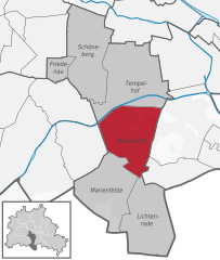
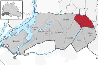
Lankwitz (Lankwitz)
- locality of Berlin
Lankwitz is a district in the southwestern part of Berlin, Germany. While it may not be known for traditional hiking in the way that larger nature reserves or mountain regions are, there are still opportunities for enjoyable walks and hikes in and around the area.
Local Parks and Green Spaces
-
Lankwitz Forest (Lankwitzer Wald): This urban forest offers a serene environment with paths that are suitable for leisurely walks and easy hikes. The forest is home to various species of trees and wildlife, making it ideal for nature enthusiasts.
-
Britzer Garten: Located nearby, this beautifully landscaped park features walking paths, meadows, and even a small lake. It's a great place for a more relaxed hiking experience, with well-maintained trails ideal for families.
-
Teltow Canal: The paths along the canal can be excellent for walking or biking. You can enjoy scenic views of the water and surrounding landscapes.
Hiking Trails
While Lankwitz itself may not have extensive hiking trails, you can start your hike in the district and connect to larger trails or green belts in Berlin or even venture into the nearby Brandenburg region for more substantial hiking options.
Preparation Tips
- Footwear: Wear comfortable walking shoes, as some paths may be uneven.
- Weather: Always check the weather before heading out, as conditions can change quickly.
- Hydration and Snacks: Bring water and snacks, especially if you plan on spending a few hours outdoors.
- Navigation: It might be helpful to have a map or a GPS device, especially if you're venturing out to other regions.
Public Transport
Lankwitz is accessible via public transport, making it easy to reach other natural areas around Berlin where you can enjoy more extensive hiking opportunities.
Overall, while Lankwitz may not be a hiking hotspot, it provides pleasant walking experiences and easy access to nearby trails and parks.
- Country:

- Postal Code: 12249; 12247
- Coordinates: 52° 26' 0" N, 13° 21' 0" E


- GPS tracks (wikiloc): [Link]
- AboveSeaLevel: 43 м m
- Area: 6.99 sq km
- Population: 41955
- Wikipedia en: wiki(en)
- Wikipedia: wiki(de)
- Wikidata storage: Wikidata: Q671474
- Wikipedia Commons Gallery: [Link]
- Wikipedia Commons Category: [Link]
- Wikipedia Commons Maps Category: [Link]
- Freebase ID: [/m/0bwg885]
- GeoNames ID: Alt: [2880498]
- VIAF ID: Alt: [138982521]
- OSM relation ID: [55736]
- GND ID: Alt: [4087325-0]
- archINFORM location ID: [43202]
- Library of Congress authority ID: Alt: [no2011192053]
- TGN ID: [1004946]
Shares border with regions:

Lichterfelde
- locality of Berlin, Germany
Lichterfelde is a district in the southwestern part of Berlin, known for its residential areas, parks, and greenery. While it may not be a traditional hiking destination like larger natural reserves or mountainous regions, there are still opportunities for enjoyable walking and hiking experiences in and around this area....
- Country:

- Postal Code: 14167; 12209; 12207; 12205; 12203
- Coordinates: 52° 26' 0" N, 13° 19' 0" E


- GPS tracks (wikiloc): [Link]
- AboveSeaLevel: 47 м m
- Area: 18.22 sq km
- Population: 81831

Mariendorf
- locality of Berlin, Germany
Mariendorf is a district in the borough of Tempelhof-Schöneberg in Berlin, Germany. While it may not be known for traditional hiking trails like you might find in more mountainous regions, there are still opportunities for outdoor activities and walks in and around the area....
- Country:

- Postal Code: 12109; 12107; 12105
- Coordinates: 52° 26' 24" N, 13° 23' 24" E


- GPS tracks (wikiloc): [Link]
- AboveSeaLevel: 49 м m
- Area: 9.38 sq km
- Population: 50956


Marienfelde
- locality of Berlin, Germany
Marienfelde is a district located in the southwestern part of Berlin, Germany. While it may not be a traditional hiking destination with extensive trails like you might find in national parks, there are still some opportunities for walking and exploring the natural surroundings in and around the area....
- Country:

- Postal Code: 12249; 12279; 12277
- Coordinates: 52° 25' 0" N, 13° 22' 0" E


- GPS tracks (wikiloc): [Link]
- AboveSeaLevel: 44 м m
- Area: 9.15 sq km
- Population: 31372


Steglitz
- locality of Berlin
Steglitz is a district located in Berlin, Germany, and it offers several opportunities for outdoor activities, including hiking. While Steglitz itself might not have extensive hiking trails like some of the more rural areas surrounding Berlin, there are still some pleasant parks and natural areas where you can enjoy walking and light hiking. Here are a few options:...
- Country:

- Postal Code: 12169; 12167; 12165; 12163; 12161; 12157
- Coordinates: 52° 28' 0" N, 13° 20' 0" E


- GPS tracks (wikiloc): [Link]
- AboveSeaLevel: 51 м m
- Area: 6.79 sq km
- Population: 73463

