canton of Séderon (canton de Séderon)
- canton of France (until March 2015)
The Canton of Séderon, located in the southeastern region of France, is a part of the Drôme department and is known for its stunning natural landscapes, diverse flora and fauna, and picturesque villages. This area is situated near the Parc Naturel Régional des Baronnies Provençales, which offers a wide range of hiking opportunities for all skill levels.
Hiking Highlights in the Canton of Séderon:
-
Scenic Trails: The region features numerous marked trails that lead through beautiful landscapes, including lavender fields, vineyards, rocky outcrops, and forested hillsides. The trails often provide breathtaking views of the surrounding mountains and valleys.
-
Variety of Routes: Hikers can find trails ranging from easy walks suitable for families to more challenging treks for experienced hikers. Popular routes often include circular paths that allow hikers to experience the full beauty of the countryside.
-
Local Flora and Fauna: As you hike, keep an eye out for the diverse wildlife, including various bird species, deer, and even the occasional wild boar. The area is also rich in plant life, with many species unique to the region.
-
Historical and Cultural Sites: Along many trails, you’ll encounter charming villages, ancient ruins, and historical churches. This makes for a culturally enriching hiking experience, as you can explore the local heritage and architecture.
-
Tips for Hiking:
- Best Time to Go: The ideal seasons for hiking in the Canton of Séderon are spring and fall, when the weather is mild, and the landscapes are particularly vibrant.
- Preparation: Always check weather conditions before heading out, wear appropriate footwear, and carry enough water and snacks. It's also advisable to carry a map or GPS device, as some trails may not be well-marked.
- Respect Nature: Stay on marked paths to minimize your impact on the environment, and follow local guidelines for wildlife safety.
-
Local Resources: Consider stopping by local tourist information centers for maps, guides, and recommendations on the best routes and lookout points.
Hiking in the Canton of Séderon can be a memorable experience due to its stunning scenery, a mix of natural and cultural attractions, and the tranquility the French countryside offers. Enjoy your adventure!
- Country:

- Capital: Séderon
- Coordinates: 44° 13' 42" N, 5° 32' 5" E


- GPS tracks (wikiloc): [Link]
- Wikipedia en: wiki(en)
- Wikipedia: wiki(fr)
- Wikidata storage: Wikidata: Q647859
- Freebase ID: [/m/0gx167x]
- INSEE canton code: [2627]
Includes regions:


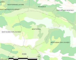
Montguers
- commune in Drôme, France
Montguers is a picturesque site in the French Pyrenees, known for its stunning landscapes and rich history. This beautiful area is especially popular among hiking enthusiasts due to its diverse terrains, well-marked trails, and breathtaking views. Here are some key points to consider if you're planning a hike in Montguers:...
- Country:

- Postal Code: 26170
- Coordinates: 44° 17' 13" N, 5° 27' 31" E


- GPS tracks (wikiloc): [Link]
- Area: 11.06 sq km
- Population: 42


Ferrassières
- commune in Drôme, France
Ferrassières, a picturesque village located in the Vaucluse department of Provence, France, offers a fantastic hiking experience amidst stunning landscapes, including lavender fields, pine forests, and the rugged beauty of the Mont Ventoux region....
- Country:

- Postal Code: 26570
- Coordinates: 44° 8' 8" N, 5° 28' 42" E


- GPS tracks (wikiloc): [Link]
- Area: 29.27 sq km
- Population: 116


Montfroc
- commune in Drôme, France
Montfroc, located in the Provence-Alpes-Côte d'Azur region of France, offers beautiful hiking opportunities amidst stunning natural landscapes. Here are some highlights and tips for hiking in and around Montfroc:...
- Country:

- Postal Code: 26560
- Coordinates: 44° 10' 29" N, 5° 38' 20" E


- GPS tracks (wikiloc): [Link]
- Area: 14.76 sq km
- Population: 77


Reilhanette
- commune in Drôme, France
Reilhanette, a charming village located in the heart of the Drôme region in southeastern France, offers a beautiful setting for hiking enthusiasts. The area is known for its stunning natural landscapes, including rolling hills, forests, and panoramic views of the surrounding mountains....
- Country:

- Postal Code: 26570
- Coordinates: 44° 10' 8" N, 5° 25' 12" E


- GPS tracks (wikiloc): [Link]
- Area: 14.78 sq km
- Population: 145


Séderon
- commune in Drôme, France
Séderon is a picturesque village located in the Drôme region of southeastern France, known for its stunning landscapes and hiking opportunities. The surrounding area offers a variety of trails that cater to different skill levels and interests, making it an ideal destination for both casual walkers and experienced hikers....
- Country:

- Postal Code: 26560
- Coordinates: 44° 12' 16" N, 5° 32' 14" E


- GPS tracks (wikiloc): [Link]
- Area: 20.3 sq km
- Population: 272


Villefranche-le-Château
- commune in Drôme, France
 Hiking in Villefranche-le-Château
Villefranche-le-Château, located in the beautiful region of France, offers a variety of hiking opportunities amidst picturesque landscapes. The surrounding areas are characterized by rolling hills, dense forests, and charming rural settings, making it a great destination for outdoor enthusiasts....
- Country:

- Postal Code: 26560
- Coordinates: 44° 13' 16" N, 5° 31' 21" E


- GPS tracks (wikiloc): [Link]
- Area: 7.42 sq km
- Population: 24


Villebois-les-Pins
- commune in Drôme, France
Villebois-les-Pins is a charming village in the Auvergne-Rhône-Alpes region of France. Nestled within a picturesque natural landscape, it offers various opportunities for hiking enthusiasts to explore the surrounding countryside. Here are some highlights for hiking in this area:...
- Country:

- Postal Code: 05700
- Coordinates: 44° 19' 1" N, 5° 36' 36" E


- GPS tracks (wikiloc): [Link]
- Area: 10.81 sq km
- Population: 21


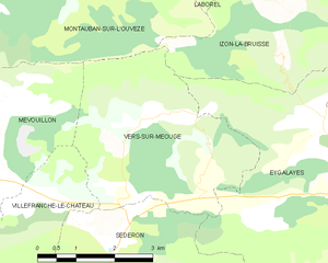
Vers-sur-Méouge
- commune in Drôme, France
Vers-sur-Méouge is a charming village located in the Drôme department in southeastern France, known for its natural beauty and outdoor activities, particularly hiking. The surrounding region features stunning landscapes, including the picturesque Méouge River, limestone cliffs, and the scenic backdrop of the Baronnies Provençales Natural Regional Park....
- Country:

- Postal Code: 26560
- Coordinates: 44° 13' 51" N, 5° 34' 14" E


- GPS tracks (wikiloc): [Link]
- Area: 13.81 sq km
- Population: 47


Barret-de-Lioure
- commune in Drôme, France
Barret-de-Lioure is a picturesque village located in the Drôme department of southeastern France. It is surrounded by stunning natural landscapes that provide excellent opportunities for hiking and outdoor activities. Here are some key points to consider if you're planning a hiking trip in or around Barret-de-Lioure:...
- Country:

- Postal Code: 26570
- Coordinates: 44° 11' 10" N, 5° 29' 37" E


- GPS tracks (wikiloc): [Link]
- Area: 34.64 sq km
- Population: 86


Izon-la-Bruisse
- commune in Drôme, France
Izon-la-Bruisse is a beautiful destination located in the French Alps, known for its stunning landscapes, diverse flora and fauna, and well-marked hiking trails. Here are some highlights and tips for hiking in this region:...
- Country:

- Postal Code: 26560
- Coordinates: 44° 15' 20" N, 5° 35' 36" E


- GPS tracks (wikiloc): [Link]
- Area: 14.65 sq km
- Population: 9


Montauban-sur-l'Ouvèze
- commune in Drôme, France
 Hiking in Montauban-sur-l'Ouvèze
Montauban-sur-l'Ouvèze is a charming village located in the Drôme department in southeastern France, nestled in the picturesque region of the Vercors. The area is known for its stunning natural landscapes, making it a great destination for hiking enthusiasts....
- Country:

- Postal Code: 26170
- Coordinates: 44° 16' 28" N, 5° 30' 8" E


- GPS tracks (wikiloc): [Link]
- Area: 32.29 sq km
- Population: 107


Mévouillon
- commune in Drôme, France
Mévouillon is a small village located in the Drôme department of southeastern France, nestled in the picturesque landscapes of the Provençal countryside. This region is known for its beautiful hiking trails that offer both seasoned hikers and casual walkers an opportunity to explore its natural beauty....
- Country:

- Postal Code: 26560
- Coordinates: 44° 14' 30" N, 5° 27' 52" E


- GPS tracks (wikiloc): [Link]
- Area: 29.09 sq km
- Population: 246


Ballons
- commune in Drôme, France
Hiking in the Ballons des Vosges Regional Nature Park, located in northeastern France, offers a diverse range of trails and stunning landscapes. The park is characterized by its rolling hills, mountainous terrain, and dense forests, making it a fantastic destination for both novice and experienced hikers....
- Country:

- Postal Code: 26560
- Coordinates: 44° 15' 21" N, 5° 38' 39" E


- GPS tracks (wikiloc): [Link]
- Area: 17.23 sq km
- Population: 83


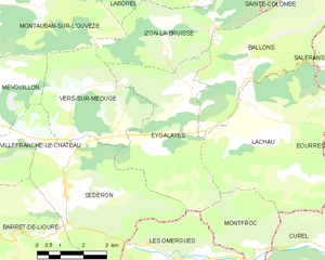
Eygalayes
- commune in Drôme, France
Eygaliers is a picturesque village in the Drôme department of southeastern France, nestled in the beautiful landscape of the Vercors Regional Natural Park. It offers a variety of hiking opportunities that cater to all levels of experience. Here’s a general overview of hiking in the Eygaliers area:...
- Country:

- Postal Code: 26560
- Coordinates: 44° 14' 21" N, 5° 36' 28" E


- GPS tracks (wikiloc): [Link]
- Area: 17.97 sq km
- Population: 76
- Web site: [Link]


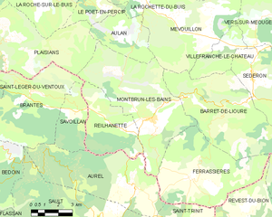
Montbrun-les-Bains
- commune in Drôme, France
Montbrun-les-Bains is a charming village located in the Drôme department of southeastern France, nestled in the foothills of the Mont Ventoux. This picturesque area is known for its stunning landscapes, thermal springs, and rich history, making it a great destination for hiking enthusiasts....
- Country:

- Postal Code: 26570
- Coordinates: 44° 10' 32" N, 5° 26' 35" E


- GPS tracks (wikiloc): [Link]
- Area: 33.26 sq km
- Population: 433
- Web site: [Link]


Laborel
- commune in Drôme, France
Laborel is a small and picturesque village located in the Drôme department of southeastern France. It's nestled in the charming landscape of the Vercors Regional Natural Park, which offers a range of hiking opportunities for both beginners and experienced hikers....
- Country:

- Postal Code: 26560
- Coordinates: 44° 17' 32" N, 5° 35' 45" E


- GPS tracks (wikiloc): [Link]
- Area: 23.91 sq km
- Population: 106


Aulan
- commune in Drôme, France
Aulan, located in the heart of the Rhône-Alpes region in France, offers a range of hiking opportunities that cater to various skill levels. The natural beauty of the area is characterized by its rolling hills, lush forests, and stunning mountain views, making it a charming destination for outdoor enthusiasts....
- Country:

- Postal Code: 26570
- Coordinates: 44° 13' 19" N, 5° 25' 42" E


- GPS tracks (wikiloc): [Link]
- Area: 10.55 sq km
- Population: 11


Lachau
- commune in Drôme, France
Lachau is a picturesque region located in southeastern France, known for its stunning landscapes, diverse flora and fauna, and well-maintained hiking trails. Here are some key points to consider if you're planning to hike in Lachau:...
- Country:

- Postal Code: 26560
- Coordinates: 44° 13' 56" N, 5° 38' 16" E


- GPS tracks (wikiloc): [Link]
- Area: 25.78 sq km
- Population: 222