Gros-de-Vaud District (Bezirk Gros-de-Vaud)
- district of the canton of Vaud, Switzerland
 Hiking in Gros-de-Vaud District
Gros-de-Vaud District, located in the canton of Vaud in Switzerland, offers a wonderful hiking experience with its picturesque landscapes, charming villages, and diverse terrain. Here are some highlights of hiking in this beautiful region:
Scenic Trails
- Lavaud Trail: This trail is known for its stunning views of the Jura mountains and lush vineyards. It’s relatively easy and suitable for families.
- Vully Region: Located at the edge of Lake Murten, the Vully offers a variety of trails that showcase panoramic views of the lake and surrounding countryside. The area is also known for its wine-producing vineyards.
- Les Monts de Chardonne: This area features trails that go through wooded areas and pastoral landscapes, ideal for those looking for a tranquil hike away from the crowds.
Unique Features
- Flora and Fauna: Gros-de-Vaud is rich in biodiversity. Hikers can often spot various wildlife and enjoy the unique flora that characterizes the region.
- Cultural Heritage: Along the trails, you may encounter historical sites, picturesque villages, and charming farms that add cultural depth to your hiking experience.
- Seasonal Beauty: Each season brings a different beauty to the area. Summer offers vibrant greens and blooming flowers, while autumn showcases stunning fall foliage.
Accessibility
Many of the trails are well-marked and accessible for varying levels of hikers, from beginners to experienced trekkers. Public transportation options are available, making it easy to reach trailheads.
Local Amenities
In addition to hiking, the Gros-de-Vaud District has a range of local amenities, including cozy mountain huts and restaurants where hikers can enjoy a meal or a local wine after a hike.
Tips for Hiking
- Check Weather: Always check the weather conditions before heading out, as they can change rapidly in the region.
- Appropriate Gear: Wear sturdy hiking boots and bring plenty of water and snacks, as some trails may be longer than expected.
- Respect Nature: Stay on marked paths and take your litter with you to preserve the natural beauty of the area.
Whether you're a casual walker or a seasoned hiker, Gros-de-Vaud District has something to offer everyone. Enjoy your hikes in this stunning region!
- Country:

- Capital: Echallens
- Licence Plate Code: VD
- Coordinates: 46° 37' 59" N, 6° 37' 59" E


- GPS tracks (wikiloc): [Link]
- AboveSeaLevel: 636 м m
- Area: 232.22 sq km
- Wikipedia en: wiki(en)
- Wikipedia: wiki(de)
- Wikidata storage: Wikidata: Q681215
- Wikipedia Commons Category: [Link]
- Freebase ID: [/m/06_wpwh]
- GeoNames ID: Alt: [7285003]
- archINFORM location ID: [42803]
- HDS ID: [43648]
Includes regions:

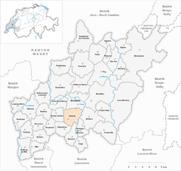
Assens
- municipality in Switzerland
Assens is a charming location in Switzerland, surrounded by beautiful landscapes and numerous hiking opportunities. While it might not be as widely known as some of the larger Swiss hiking destinations like the Alps or the Bernese Oberland, the area offers a range of trails suited for different experience levels....
- Country:

- Postal Code: 1042
- Local Dialing Code: 021
- Licence Plate Code: VD
- Coordinates: 46° 37' 4" N, 6° 37' 39" E


- GPS tracks (wikiloc): [Link]
- AboveSeaLevel: 637 м m
- Area: 5.33 sq km
- Population: 1069
- Web site: [Link]


Bercher
- municipality in Switzerland
Bercher is a picturesque location in Switzerland, nestled in the idyllic region of Vaud, near the shores of Lake Geneva. It's a great destination for hiking enthusiasts, offering a variety of trails that showcase the stunning alpine landscape, rolling hills, and beautiful views of the surrounding countryside....
- Country:

- Local Dialing Code: 021
- Licence Plate Code: VD
- Coordinates: 46° 41' 30" N, 6° 42' 22" E


- GPS tracks (wikiloc): [Link]
- AboveSeaLevel: 633 м m
- Area: 4.27 sq km
- Population: 1217
- Web site: [Link]


Bettens
- municipality in Switzerland
Bettens isn’t widely recognized as a significant hiking destination, so it may refer to a small village or locality in Switzerland. However, if you’re looking for hiking opportunities in the surrounding region, there are plenty of trails and beautiful landscapes to explore in the nearby areas of Vaud or other parts of Switzerland....
- Country:

- Local Dialing Code: 021
- Licence Plate Code: VD
- Coordinates: 46° 38' 0" N, 6° 35' 0" E


- GPS tracks (wikiloc): [Link]
- AboveSeaLevel: 584 м m
- Area: 3.74 sq km
- Population: 571
- Web site: [Link]


Bioley-Orjulaz
- municipality in Switzerland
Bioley-Orjulaz is a charming village located in the Canton of Vaud, Switzerland, situated on the slopes of the Jura Mountains. It's a fantastic location for hiking, offering various trails that cater to different skill levels and interests....
- Country:

- Local Dialing Code: 021
- Licence Plate Code: VD
- Coordinates: 46° 37' 0" N, 6° 36' 0" E


- GPS tracks (wikiloc): [Link]
- AboveSeaLevel: 603 м m
- Area: 3.12 sq km
- Population: 491


Bottens
- municipality in Switzerland
Bottens, located in the Vaud region of Switzerland, is a quaint village that serves as a lovely hub for hiking enthusiasts. The surrounding landscape is characterized by rolling hills, scenic views, and a mix of forests and farmland, making it a great destination for various hiking experiences....
- Country:

- Local Dialing Code: 021
- Licence Plate Code: VD
- Coordinates: 46° 36' 54" N, 6° 39' 43" E


- GPS tracks (wikiloc): [Link]
- AboveSeaLevel: 730 м m
- Area: 6.79 sq km
- Population: 1262
- Web site: [Link]

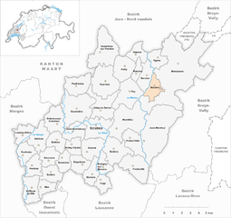
Boulens
- municipality in Switzerland
Boulens, located in the canton of Vaud in Switzerland, is a charming area with beautiful landscapes and opportunities for hiking. The region offers various trails that cater to different skill levels, from easy walks to more challenging hikes....
- Country:

- Postal Code: 1063
- Local Dialing Code: 021
- Licence Plate Code: VD
- Coordinates: 46° 41' 0" N, 6° 43' 0" E


- GPS tracks (wikiloc): [Link]
- AboveSeaLevel: 718 м m
- Area: 3.42 sq km
- Population: 378
- Web site: [Link]


Bournens
- municipality in Switzerland
Bournens, a small municipality located in the Lausanne district of Switzerland, is surrounded by picturesque landscapes, making it a charming spot for hiking enthusiasts. Though not as widely known as some of the larger hiking areas in Switzerland, it offers a few hidden gems for those looking to explore the natural beauty of the region....
- Country:

- Local Dialing Code: 021
- Licence Plate Code: VD
- Coordinates: 46° 36' 0" N, 6° 34' 0" E


- GPS tracks (wikiloc): [Link]
- AboveSeaLevel: 562 м m
- Area: 3.91 sq km
- Population: 417
- Web site: [Link]


Boussens
- municipality in Switzerland
Boussens, located in the scenic region of Switzerland, is an excellent destination for hiking enthusiasts. While it's a small village, its proximity to the beautiful landscapes of the region opens up a variety of hiking opportunities. Here are some highlights to consider if you're planning a hike in and around Boussens:...
- Country:

- Local Dialing Code: 021
- Licence Plate Code: VD
- Coordinates: 46° 36' 12" N, 6° 35' 9" E


- GPS tracks (wikiloc): [Link]
- AboveSeaLevel: 587 м m
- Area: 3.14 sq km
- Population: 982
- Web site: [Link]
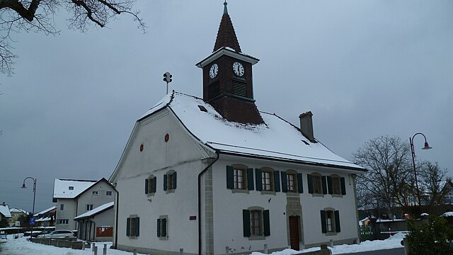

Bretigny-sur-Morrens
- municipality in Switzerland
 Hiking in Bretigny-sur-Morrens
Bretigny-sur-Morrens, located in the Vaud region of Switzerland, offers a beautiful setting for hiking enthusiasts. The area is characterized by picturesque landscapes, rolling hills, and stunning views of the surrounding mountains, making it an attractive destination for outdoor activities....
- Country:

- Local Dialing Code: 021
- Licence Plate Code: VD
- Coordinates: 46° 36' 0" N, 6° 38' 0" E


- GPS tracks (wikiloc): [Link]
- AboveSeaLevel: 721 м m
- Area: 2.88 sq km
- Population: 823
- Web site: [Link]


Montanaire
- municipality in Switzerland
It seems like you might be referring to "Montana," a state in the northwestern United States known for its stunning natural landscapes, including mountains, forests, and rivers. If you meant something else by "Montanaire," please clarify!...
- Country:

- Postal Code: 1063, 1064, 1409, 1410, 1515
- Local Dialing Code: 021
- Licence Plate Code: VD
- Coordinates: 46° 40' 0" N, 6° 44' 0" E


- GPS tracks (wikiloc): [Link]
- AboveSeaLevel: 768 м m
- Area: 33.48 sq km
- Population: 2596
- Web site: [Link]


Saint-Barthélemy
- municipality in Switzerland
Saint-Barthélemy, located in the Valais region of Switzerland, is a picturesque destination that offers stunning hiking opportunities. Nestled in the Alps, this small mountain village is surrounded by breathtaking scenery, including dramatic peaks, lush valleys, and pristine nature, making it an ideal spot for hikers of all skill levels....
- Country:

- Postal Code: 1040
- Local Dialing Code: 021
- Licence Plate Code: VD
- Coordinates: 46° 38' 0" N, 6° 36' 0" E


- GPS tracks (wikiloc): [Link]
- AboveSeaLevel: 593 м m
- Area: 4.11 sq km
- Population: 771
- Web site: [Link]


Villars-le-Terroir
- municipality in Switzerland
Villars-le-Terroir, located in Switzerland's Vaud region, is a charming village that offers a range of hiking opportunities amidst stunning landscapes. Here are some highlights about hiking in this area:...
- Country:

- Postal Code: 1040
- Local Dialing Code: 021
- Licence Plate Code: VD
- Coordinates: 46° 39' 0" N, 6° 38' 0" E


- GPS tracks (wikiloc): [Link]
- AboveSeaLevel: 647 м m
- Area: 7.06 sq km
- Population: 1151
- Web site: [Link]
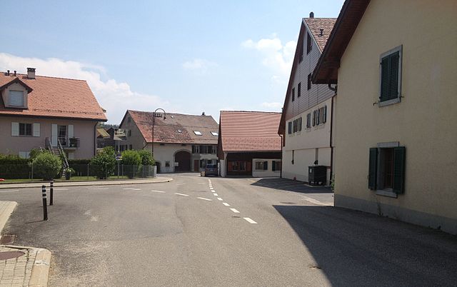

Froideville
- municipality in Switzerland
Froideville is a picturesque village in the canton of Vaud, Switzerland, known for its beautiful landscapes and proximity to the larger city of Lausanne. While it is a smaller and lesser-known destination for hiking, there are several options for outdoor enthusiasts looking to explore its natural beauty....
- Country:

- Postal Code: 1055
- Local Dialing Code: 021
- Licence Plate Code: VD
- Coordinates: 46° 35' 53" N, 6° 41' 30" E


- GPS tracks (wikiloc): [Link]
- AboveSeaLevel: 834 м m
- Area: 7.12 sq km
- Population: 2557
- Web site: [Link]


Essertines-sur-Yverdon
- municipality in Switzerland
 Hiking in Essertines-sur-Yverdon
Essertines-sur-Yverdon is a charming commune located in the canton of Vaud in Switzerland. It offers picturesque landscapes, making it a lovely destination for hiking enthusiasts. The area is characterized by rolling hills, lush forests, and scenic views of the surrounding countryside, which provide a great backdrop for outdoor activities....
- Country:

- Postal Code: 1417
- Local Dialing Code: 024
- Licence Plate Code: VD
- Coordinates: 46° 43' 0" N, 6° 38' 0" E


- GPS tracks (wikiloc): [Link]
- AboveSeaLevel: 600 м m
- Area: 9.78 sq km
- Population: 981
- Web site: [Link]
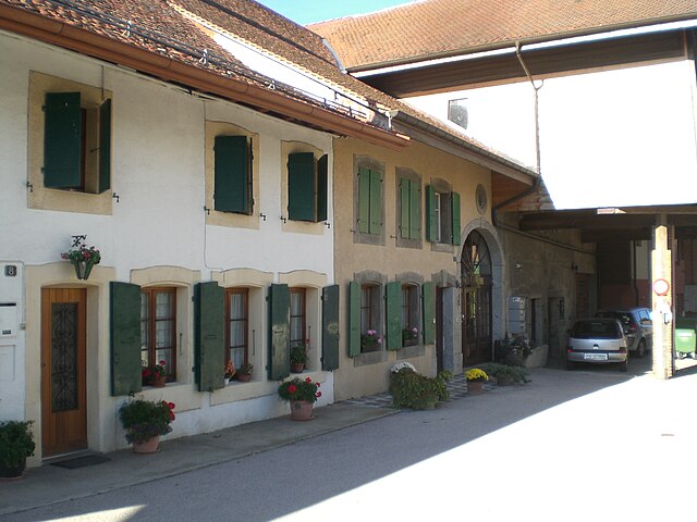

Etagnières
- municipality in Switzerland
Étagnières, located in the canton of Vaud in Switzerland, offers picturesque landscapes and a variety of hiking opportunities. The region is known for its charming countryside, rolling hills, and proximity to the Swiss Plateau, making it a delightful destination for nature lovers and hiking enthusiasts....
- Country:

- Postal Code: 1037
- Local Dialing Code: 021
- Licence Plate Code: VD
- Coordinates: 46° 36' 0" N, 6° 37' 0" E


- GPS tracks (wikiloc): [Link]
- AboveSeaLevel: 628 м m
- Area: 3.80 sq km
- Population: 1117
- Web site: [Link]


Cugy
- municipality in Switzerland
Cugy is a charming village located in the Canton of Vaud in Switzerland, nestled between rolling hills and picturesque landscapes. Hiking in this area offers a variety of trails that cater to different skill levels, making it an excellent destination for both casual walkers and seasoned hikers....
- Country:

- Postal Code: 1053
- Local Dialing Code: 021
- Licence Plate Code: VD
- Coordinates: 46° 34' 53" N, 6° 38' 37" E


- GPS tracks (wikiloc): [Link]
- AboveSeaLevel: 708 м m
- Area: 2.95 sq km
- Population: 2735
- Web site: [Link]

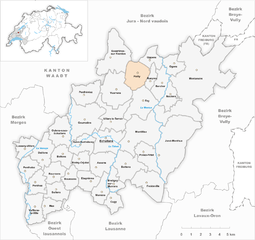
Pailly
- municipality in Switzerland
Pailly is a charming village in the Italian Alps, known for its stunning landscapes and outdoor activities, making it a great destination for hiking enthusiasts. The area boasts a variety of hiking trails that cater to different skill levels, from gentle strolls to challenging mountain hikes....
- Country:

- Postal Code: 1416
- Local Dialing Code: 021
- Licence Plate Code: VD
- Coordinates: 46° 42' 0" N, 6° 41' 0" E


- GPS tracks (wikiloc): [Link]
- AboveSeaLevel: 642 м m
- Area: 5.77 sq km
- Population: 543
- Web site: [Link]


Daillens
- municipality in Switzerland
Daillens is a municipality located in the Canton of Vaud, Switzerland. As part of the Swiss landscape, it offers picturesque views and a mix of hiking opportunities that cater to various experience levels. Here are some insights about hiking in and around Daillens:...
- Country:

- Postal Code: 1306
- Local Dialing Code: 021
- Licence Plate Code: VD
- Coordinates: 46° 37' 43" N, 6° 32' 58" E


- GPS tracks (wikiloc): [Link]
- AboveSeaLevel: 543 м m
- Area: 5.52 sq km
- Population: 999
- Web site: [Link]


Ogens
- municipality in Switzerland
Ogens, located in Switzerland, offers stunning landscapes and various hiking opportunities. While it may be less well-known than some other Swiss hiking destinations, it provides a unique experience with its trails featuring beautiful views of the Alps, lakes, and charming villages....
- Country:

- Postal Code: 1045
- Local Dialing Code: 021
- Licence Plate Code: VD
- Coordinates: 46° 43' 0" N, 6° 43' 0" E


- GPS tracks (wikiloc): [Link]
- AboveSeaLevel: 629 м m
- Area: 3.4 sq km
- Population: 304
- Web site: [Link]


Vuarrens
- municipality in Switzerland
Vuarrens, located in the picturesque Canton of Vaud in Switzerland, offers a variety of hiking opportunities for outdoor enthusiasts. The region is characterized by its stunning landscapes, charming villages, and well-marked trails that cater to different skill levels....
- Country:

- Postal Code: 1418
- Local Dialing Code: 021
- Licence Plate Code: VD
- Coordinates: 46° 41' 0" N, 6° 39' 0" E


- GPS tracks (wikiloc): [Link]
- AboveSeaLevel: 677 м m
- Area: 8.99 sq km
- Population: 1003
- Web site: [Link]

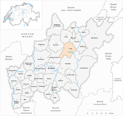
Fey
- municipality in Switzerland
Fey, Switzerland, is a lovely area often associated with breathtaking landscapes and hiking opportunities, though it may not be as widely recognized as other regions in Switzerland like Zermatt or Interlaken. When planning a hiking trip to Fey, here are some general tips and highlights for an enjoyable experience:...
- Country:

- Postal Code: 1044
- Local Dialing Code: 021
- Licence Plate Code: VD
- Coordinates: 46° 40' 22" N, 6° 40' 48" E


- GPS tracks (wikiloc): [Link]
- AboveSeaLevel: 654 м m
- Area: 7.34 sq km
- Population: 703
- Web site: [Link]
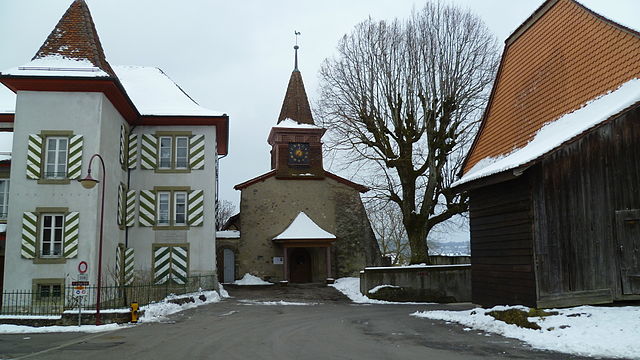

Morrens
- municipality in Switzerland
Morrens is a charming municipality located in the canton of Vaud in Switzerland, nestled near the beautiful Lake Geneva. It is surrounded by picturesque landscapes, and hiking enthusiasts will find a variety of trails in and around the area, offering opportunities to enjoy the stunning views of the Swiss Alps and the tranquil surroundings of the lake....
- Country:

- Postal Code: 1054
- Local Dialing Code: 021
- Licence Plate Code: VD
- Coordinates: 46° 35' 0" N, 6° 38' 0" E


- GPS tracks (wikiloc): [Link]
- AboveSeaLevel: 702 м m
- Area: 3.68 sq km
- Population: 1090
- Web site: [Link]


Sullens
- municipality in Switzerland
Sullens is a small village located in Switzerland, near the shores of Lake Geneva in the Canton of Vaud. While it may not be as well-known as some larger hiking destinations in the Swiss Alps, the area around Sullens offers a variety of hiking opportunities that allow you to explore the beautiful landscapes of the region....
- Country:

- Postal Code: 1036
- Local Dialing Code: 021
- Licence Plate Code: VD
- Coordinates: 46° 36' 0" N, 6° 34' 0" E


- GPS tracks (wikiloc): [Link]
- AboveSeaLevel: 591 м m
- Area: 3.84 sq km
- Population: 1004
- Web site: [Link]


Vufflens-la-Ville
- municipality in Switzerland
Vufflens-la-Ville, a small municipality located in the canton of Vaud, Switzerland, offers beautiful landscapes and a tranquil atmosphere for hiking enthusiasts. While there may not be extensive hiking trails directly in Vufflens-la-Ville itself, the area is surrounded by scenic regions with various hiking opportunities. Here are some highlights:...
- Country:

- Postal Code: 1302
- Local Dialing Code: 021
- Licence Plate Code: VD
- Coordinates: 46° 35' 0" N, 6° 32' 0" E


- GPS tracks (wikiloc): [Link]
- AboveSeaLevel: 478 м m
- Area: 5.29 sq km
- Population: 1284
- Web site: [Link]


Poliez-Pittet
- municipality in Switzerland
Poliez-Pittet is a charming village located in the canton of Vaud in Switzerland, surrounded by beautiful natural landscapes that offer great hiking opportunities. Here are some details about hiking in and around Poliez-Pittet:...
- Country:

- Postal Code: 1041
- Local Dialing Code: 021
- Licence Plate Code: VD
- Coordinates: 46° 38' 0" N, 6° 41' 0" E


- GPS tracks (wikiloc): [Link]
- AboveSeaLevel: 743 м m
- Area: 5.00 sq km
- Population: 850
- Web site: [Link]

Lussery-Villars
- municipality in Switzerland
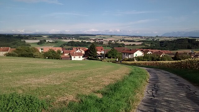
Lussery-Villars is a charming village located in the Vaud region of Switzerland, and it offers a variety of hiking opportunities with beautiful scenery. Nestled in the foothills of the Swiss Alps, this area is characterized by stunning landscapes, lush forests, and panoramic views of the Alps and Lake Geneva....
- Country:

- Postal Code: 1307
- Local Dialing Code: 021
- Licence Plate Code: VD
- Coordinates: 46° 38' 0" N, 6° 32' 0" E


- GPS tracks (wikiloc): [Link]
- AboveSeaLevel: 494 м m
- Area: 3.65 sq km
- Population: 459
- Web site: [Link]

Rueyres
- municipality in Switzerland
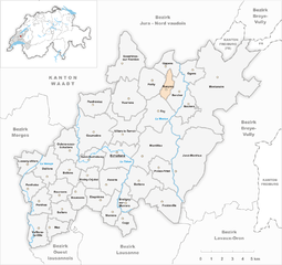
Rueyres, located in Switzerland, is a picturesque destination for hiking enthusiasts. Nestled in the Swiss countryside, it offers a variety of trails that cater to different skill levels, from leisurely walks to challenging hikes....
- Country:

- Postal Code: 1414
- Local Dialing Code: 021
- Licence Plate Code: VD
- Coordinates: 46° 41' 38" N, 6° 41' 37" E


- GPS tracks (wikiloc): [Link]
- AboveSeaLevel: 619 м m
- Area: 2 sq km
- Population: 256
- Web site: [Link]


Penthéréaz
- municipality in Switzerland
Penthéréaz is a beautiful area in the Canton of Vaud, Switzerland, known for its picturesque landscapes and extensive hiking opportunities. Here are some highlights for hiking in Penthéréaz:...
- Country:

- Postal Code: 1375
- Local Dialing Code: 021
- Licence Plate Code: VD
- Coordinates: 46° 41' 0" N, 6° 36' 0" E


- GPS tracks (wikiloc): [Link]
- AboveSeaLevel: 624 м m
- Area: 5.68 sq km
- Population: 418
- Web site: [Link]


Oulens-sous-Echallens
- municipality in Switzerland
 Hiking in Oulens-sous-Echallens
Oulens-sous-Échallens is a charming region located in the canton of Vaud, Switzerland. Surrounded by picturesque landscapes, it offers various hiking opportunities for both beginners and seasoned hikers. Here are some details about hiking in this area:...
- Country:

- Postal Code: 1377
- Local Dialing Code: 021
- Licence Plate Code: VD
- Coordinates: 46° 39' 0" N, 6° 35' 0" E


- GPS tracks (wikiloc): [Link]
- AboveSeaLevel: 588 м m
- Area: 5.87 sq km
- Population: 578
- Web site: [Link]
Penthaz
- municipality in Switzerland
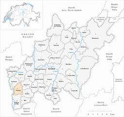
Penthaz is a charming village located in the Vaud region of Switzerland, near Lausanne, and is surrounded by beautiful landscapes that are perfect for hiking enthusiasts. The region offers a variety of trails suitable for different skill levels, allowing you to explore both the natural beauty and cultural heritage of the area....
- Country:

- Postal Code: 1303
- Local Dialing Code: 021
- Licence Plate Code: VD
- Coordinates: 46° 36' 0" N, 6° 32' 0" E


- GPS tracks (wikiloc): [Link]
- AboveSeaLevel: 482 м m
- Area: 3.84 sq km
- Population: 1725
- Web site: [Link]


Mex
- municipality in Switzerland
Vaud, a beautiful canton in Switzerland, offers a wide range of hiking opportunities that showcase the region’s stunning natural landscapes, including lakes, mountains, and charming villages. Here are some highlights for hiking in the area:...
- Country:

- Postal Code: 1031
- Local Dialing Code: 021
- Licence Plate Code: VD
- Coordinates: 46° 34' 39" N, 6° 33' 33" E


- GPS tracks (wikiloc): [Link]
- AboveSeaLevel: 569 м m
- Area: 2.90 sq km
- Population: 720
- Web site: [Link]


Penthalaz
- municipality in Switzerland
Penthalaz is a small commune located in the canton of Vaud in Switzerland, known for its picturesque landscapes and proximity to nature. While it may not be as renowned as some of the larger Swiss hiking destinations, it offers several opportunities for outdoor enthusiasts to enjoy hiking amidst the beautiful scenery of the region....
- Country:

- Postal Code: 1305
- Local Dialing Code: 021
- Licence Plate Code: VD
- Coordinates: 46° 36' 46" N, 6° 31' 45" E


- GPS tracks (wikiloc): [Link]
- AboveSeaLevel: 483 м m
- Area: 3.87 sq km
- Population: 3276
- Web site: [Link]


Oppens
- municipality in Switzerland
It seems there may be a small typo or misunderstanding regarding "Oppens." If you meant "Oppens" in Switzerland, it's a lesser-known area but can still offer beautiful scenery and outdoor activities....
- Country:

- Postal Code: 1413
- Local Dialing Code: 021
- Licence Plate Code: VD
- Coordinates: 46° 42' 55" N, 6° 41' 42" E


- GPS tracks (wikiloc): [Link]
- AboveSeaLevel: 536 м m
- Area: 3.6 sq km
- Population: 194
- Web site: [Link]


Jorat-Menthue
- municipality in Switzerland
Jorat-Menthue is a picturesque region located in Switzerland, known for its stunning landscapes, diverse trails, and tranquil surroundings. Hiking in this area can be an enriching experience for both beginner and experienced hikers, offering a mix of nature, culture, and panoramic views....
- Country:

- Postal Code: 1041, 1058, 1059, 1061, 1062
- Licence Plate Code: VD
- Coordinates: 46° 39' 0" N, 6° 43' 0" E


- GPS tracks (wikiloc): [Link]
- AboveSeaLevel: 813 м m
- Area: 17.65 sq km
- Population: 1529
- Web site: [Link]


Echallens
- municipality in Switzerland
Échallens is a charming town located in the canton of Vaud in Switzerland, known for its picturesque landscapes and proximity to the Swiss Alps. The region offers a variety of hiking opportunities that cater to different levels of experience. Here are some highlights for hiking in Échallens and its surroundings:...
- Country:

- Postal Code: 1040
- Local Dialing Code: 021
- Licence Plate Code: VD
- Coordinates: 46° 38' 0" N, 6° 38' 0" E


- GPS tracks (wikiloc): [Link]
- AboveSeaLevel: 619 м m
- Area: 6.66 sq km
- Population: 5732
- Web site: [Link]


Montilliez
- municipality in Switzerland
Montilliez, located in the scenic region of Switzerland, offers a variety of hiking opportunities for outdoor enthusiasts. The area is known for its stunning landscapes, lush forests, and picturesque views of the surrounding mountains....
- Country:

- Postal Code: 1041, 1043
- Licence Plate Code: VD
- Coordinates: 46° 39' 0" N, 6° 40' 0" E


- GPS tracks (wikiloc): [Link]
- AboveSeaLevel: 695 м m
- Area: 11.94 sq km
- Population: 1731
- Web site: [Link]

Goumoëns
- municipality in Switzerland
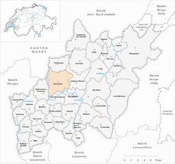
Goumoëns, located in the Vaud region of Switzerland, offers a variety of hiking opportunities that showcase the stunning landscapes of the Swiss countryside. This picturesque area is characterized by rolling hills, lush forests, and panoramic views of the surrounding Alps. Here are a few key points about hiking in Goumoëns:...
- Country:

- Postal Code: 1376
- Local Dialing Code: 021
- Licence Plate Code: VD
- Coordinates: 46° 39' 0" N, 6° 36' 0" E


- GPS tracks (wikiloc): [Link]
- AboveSeaLevel: 618 м m
- Area: 10.70 sq km
- Population: 1110
- Web site: [Link]
Shares border with regions:


Broye-Vully District
- district of the canton of Vaud, Switzerland
 Hiking in Broye-Vully District
The Broye-Vully District, located in the canton of Vaud in Switzerland, is a fantastic destination for hiking enthusiasts. This region offers a variety of trails suitable for different skill levels, catering to both casual walkers and more experienced hikers....
- Country:

- Capital: Payerne
- Licence Plate Code: VD
- Coordinates: 46° 49' 0" N, 6° 56' 0" E


- GPS tracks (wikiloc): [Link]
- AboveSeaLevel: 471 м m
- Area: 264.98 sq km

Morges District
- district of the canton of Vaud, Switzerland
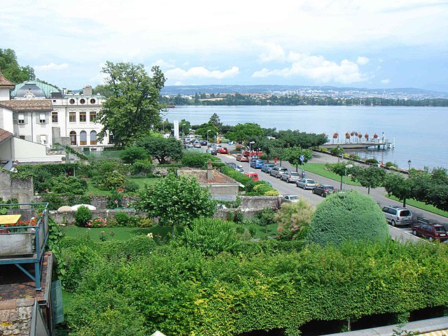
Morges District, located on the shores of Lake Geneva in Switzerland, offers a variety of scenic hiking opportunities that cater to different skill levels. The region boasts beautiful landscapes, vineyards, and charming villages, making it an excellent destination for hikers....
- Country:

- Capital: Morges
- Licence Plate Code: VD
- Coordinates: 46° 30' 0" N, 6° 30' 0" E


- GPS tracks (wikiloc): [Link]
- AboveSeaLevel: 492 м m
- Area: 372.99 sq km


Lausanne District
- district of the canton of Vaud, Switzerland
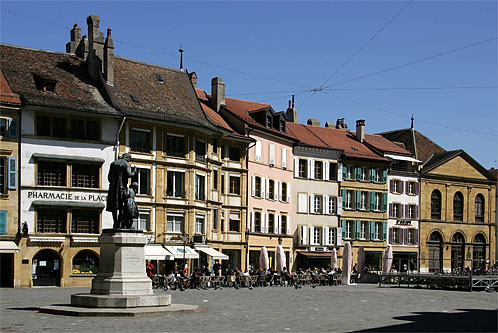
Hiking in the Lausanne District, located in the picturesque region of Switzerland, offers a blend of stunning views, varied terrain, and a chance to explore the beautiful natural landscape of the Swiss Alps and Lake Geneva. Here are some highlights and tips for hiking in this area:...
- Country:

- Capital: Lausanne
- Licence Plate Code: VD
- Coordinates: 46° 31' 16" N, 6° 38' 28" E


- GPS tracks (wikiloc): [Link]
- AboveSeaLevel: 501 м m
- Area: 65.15 sq km

Jura-Nord vaudois District
- district of the canton of Vaud, Switzerland
 Hiking in Jura-Nord vaudois District
Hiking in the Jura-Nord Vaudois District, located in the Jura Mountains of Switzerland, offers stunning landscapes, diverse flora and fauna, and a range of trails that cater to all skill levels. Here are some highlights:...
- Country:

- Capital: Yverdon-les-Bains
- Licence Plate Code: VD
- Coordinates: 46° 46' 0" N, 6° 38' 0" E


- GPS tracks (wikiloc): [Link]
- AboveSeaLevel: 654 м m
- Area: 702.61 sq km


Lavaux-Oron District
- district of the canton of Vaud, Switzerland
 Hiking in Lavaux-Oron District
The Lavaux-Oron District, located in Switzerland, is renowned for its stunning landscapes, picturesque vineyards, and breathtaking views of Lake Geneva and the surrounding Alps. Here’s what you need to know about hiking in this beautiful area:...
- Country:

- Licence Plate Code: VD
- Coordinates: 46° 29' 0" N, 6° 44' 0" E


- GPS tracks (wikiloc): [Link]
- AboveSeaLevel: 683 м m
- Area: 134.57 sq km


Ouest Lausannois District
- district of the canton of Vaud, Switzerland
 Hiking in Ouest Lausannois District
The Ouest Lausannois District, located in the canton of Vaud in Switzerland, is a scenic area that offers various hiking opportunities amidst beautiful landscapes, featuring vineyards, rolling hills, and views of Lake Geneva. Here are some highlights and tips for hiking in this region:...
- Country:

- Licence Plate Code: VD
- Coordinates: 46° 32' 19" N, 6° 35' 3" E


- GPS tracks (wikiloc): [Link]
- AboveSeaLevel: 413 м m
- Area: 26.32 sq km
