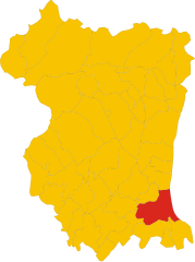
Morsano al Tagliamento (Morsano al Tagliamento)
.svg)
- Italian comune
 Hiking in Morsano al Tagliamento
Morsano al Tagliamento is a picturesque village located in the Friuli Venezia Giulia region of northeastern Italy. The area surrounding Morsano al Tagliamento is characterized by its gentle rolling hills, lush farmlands, and scenic landscapes, making it a delightful spot for hiking enthusiasts.
Hiking Options:
-
Local Trails: There are various trails that weave through the countryside, offering hikers the chance to explore the natural beauty and enjoy views of the Tagliamento River. These trails vary in difficulty, catering to both beginners and more experienced hikers.
-
Nature Reserves: The nearby natural areas provide opportunities for longer hikes. The Tagliamento Valley is known for its biodiversity, making it a great spot for nature lovers to witness local flora and fauna.
-
Cultural Hikes: Morsano al Tagliamento has several historical sites worth hiking to, including churches and local monuments. Combining nature with a touch of culture can enrich your hiking experience.
Tips for Hiking in Morsano al Tagliamento:
- Check Weather Conditions: The weather can change, so it's important to check forecasts before heading out. Spring and early autumn are particularly pleasant for hiking.
- Stay Hydrated: Always carry enough water, especially if you plan to hike during the warmer months.
- Wear Proper Footwear: Good hiking shoes or boots with good grip are essential, as some trails may be uneven or muddy.
- Local Maps or Apps: While many trails are marked, having a local map or GPS hiking app can be useful for navigating.
- Respect Nature: Follow Leave No Trace principles by taking your trash with you and staying on designated trails.
Accessibility:
Morsano al Tagliamento can be easily reached by car or public transportation from larger cities like Udine or Pordenone. This makes it a convenient base for those looking to explore the surrounding Alps or the Adriatic coast.
Conclusion:
Hiking in Morsano al Tagliamento offers a unique blend of stunning natural landscapes and rich cultural experiences. Whether you’re looking for a leisurely stroll or a more challenging hike, the area has something to offer for every enthusiast. Enjoy your adventure!
- Country:

- Postal Code: 33075
- Local Dialing Code: 0434
- Licence Plate Code: PN
- Coordinates: 45° 52' 23" N, 12° 57' 12" E


- GPS tracks (wikiloc): [Link]
- AboveSeaLevel: 14 м m
- Area: 32.54 sq km
- Population: 2788
- Web site: http://www.comune.morsanoaltagliamento.pn.it/
- Wikipedia en: wiki(en)
- Wikipedia: wiki(it)
- Wikidata storage: Wikidata: Q11502
- Wikipedia Commons Category: [Link]
- Freebase ID: [/m/0gqzfg]
- GeoNames ID: Alt: [6536407]
- VIAF ID: Alt: [264383021]
- OSM relation ID: [79186]
- Library of Congress authority ID: Alt: [nr90023654]
- UN/LOCODE: [ITZOA]
- ISTAT ID: 093028
- Italian cadastre code: F750
Shares border with regions:


San Michele al Tagliamento
- Italian comune
Hiking in San Michele al Tagliamento
San Michele al Tagliamento is a charming town located in the northeastern part of Italy, surrounded by beautiful natural landscapes and offering various opportunities for hiking and outdoor activities. It’s situated in the Veneto region, close to the Adriatic Sea, which means you can enjoy a diverse hiking experience that includes both coastal and inland trails....
- Country:
- Postal Code: 30028
- Local Dialing Code: 0431
- Licence Plate Code: VE
- Coordinates: 45° 45' 49" N, 12° 59' 43" E
- GPS tracks (wikiloc): [Link]
- AboveSeaLevel: 7 м m
- Area: 114.39 sq km
- Population: 11822
- Web site: [Link]
Teglio Veneto
- Italian comune
Hiking in Teglio Veneto
Teglio Veneto is a charming town located in the Veneto region of Italy, known for its beautiful landscapes, rich culture, and outdoor activities, including hiking. Here are some key points you may want to consider when hiking in this area:...
- Country:
- Postal Code: 30025
- Local Dialing Code: 0421
- Licence Plate Code: VE
- Coordinates: 45° 49' 0" N, 12° 53' 0" E
- GPS tracks (wikiloc): [Link]
- AboveSeaLevel: 9 м m
- Area: 11.44 sq km
- Population: 2336
- Web site: [Link]
Fossalta di Portogruaro
- Italian comune
Hiking in Fossalta di Portogruaro
Fossalta di Portogruaro, located in the Veneto region of Italy, offers a unique hiking experience characterized by its picturesque landscapes, lush countryside, and tranquil surroundings. While it may not be as famed for hiking as some other Italian regions like the Dolomites, it still provides opportunities for outdoor enthusiasts to explore its natural beauty....
- Country:
- Postal Code: 30025
- Local Dialing Code: 0421
- Licence Plate Code: VE
- Coordinates: 45° 47' 0" N, 12° 55' 0" E
- GPS tracks (wikiloc): [Link]
- AboveSeaLevel: 9 м m
- Area: 31.1 sq km
- Population: 6190
- Web site: [Link]


Cordovado
- Italian comune
Hiking in Cordovado
Cordovado is a charming village located in the Friuli Venezia Giulia region of Italy, surrounded by beautiful landscapes and historical sites that make it a great destination for hiking enthusiasts. The area offers a mix of gentle hills, rolling countryside, and stunning mountain views, making it suitable for hikers of various skill levels....
- Country:
- Postal Code: 33075
- Local Dialing Code: 0434
- Licence Plate Code: PN
- Coordinates: 45° 51' 0" N, 12° 53' 0" E
- GPS tracks (wikiloc): [Link]
- AboveSeaLevel: 15 м m
- Area: 12.02 sq km
- Population: 2736
- Web site: [Link]

San Vito al Tagliamento
- Italian comune
Hiking in San Vito al Tagliamento
San Vito al Tagliamento, located in the Friuli Venezia Giulia region of northeastern Italy, is a charming town surrounded by picturesque landscapes, making it a great spot for hiking enthusiasts. The area features a mixture of rolling hills, woodlands, and agricultural fields, providing a variety of trails for different skill levels....
- Country:
- Postal Code: 33078
- Local Dialing Code: 0434
- Licence Plate Code: PN
- Coordinates: 45° 54' 55" N, 12° 51' 20" E
- GPS tracks (wikiloc): [Link]
- AboveSeaLevel: 30 м m
- Area: 60.88 sq km
- Population: 15063
- Web site: [Link]


Sesto al Reghena
- Italian comune
Hiking in Sesto al Reghena
Sesto al Reghena, a charming town in the Friuli Venezia Giulia region of Italy, is not only rich in history and culture but also offers some beautiful hiking opportunities. Nestled in the picturesque countryside, it serves as a great starting point for various hiking trails that allow you to explore the surrounding natural beauty....
- Country:
- Postal Code: 33079
- Local Dialing Code: 0434
- Licence Plate Code: PN
- Coordinates: 45° 51' 0" N, 12° 49' 0" E
- GPS tracks (wikiloc): [Link]
- AboveSeaLevel: 13 м m
- Area: 40.68 sq km
- Population: 6367
- Web site: [Link]
Camino al Tagliamento
- Italian comune
Hiking in Camino al Tagliamento
The Camino al Tagliamento, also known as the "Way of the Tagliamento," is a scenic hiking route in the Friuli Venezia Giulia region of northeastern Italy. This trail follows the Tagliamento River, one of the last wild rivers in Europe, and offers hikers a chance to experience stunning natural landscapes, diverse wildlife, and picturesque villages along the way....
- Country:
- Postal Code: 33030
- Local Dialing Code: 0432
- Licence Plate Code: UD
- Coordinates: 45° 55' 39" N, 12° 56' 41" E
- GPS tracks (wikiloc): [Link]
- AboveSeaLevel: 34 м m
- Area: 22.32 sq km
- Population: 1614
- Web site: [Link]

Varmo
- Italian comune
Hiking in Varmo
Varmo, located in the Friuli Venezia Giulia region of northeastern Italy, is not widely known as a hiking destination compared to other areas in Italy, but it offers some beautiful landscapes and trails that can be enjoyed by hikers. The region is characterized by its stunning natural scenery, including rolling hills, rivers, and nearby mountains....
- Country:
- Postal Code: 33030
- Local Dialing Code: 0432
- Licence Plate Code: UD
- Coordinates: 45° 53' 0" N, 12° 59' 0" E
- GPS tracks (wikiloc): [Link]
- AboveSeaLevel: 18 м m
- Area: 34.92 sq km
- Population: 2725
- Web site: [Link]