Varmo (Varmo)
.svg)
- Italian comune
 Hiking in Varmo
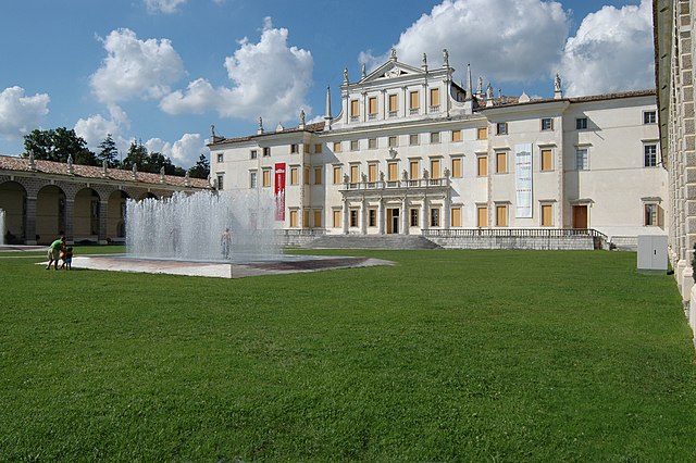
Varmo, located in the Friuli Venezia Giulia region of northeastern Italy, is not widely known as a hiking destination compared to other areas in Italy, but it offers some beautiful landscapes and trails that can be enjoyed by hikers. The region is characterized by its stunning natural scenery, including rolling hills, rivers, and nearby mountains.
Hiking Opportunities in Varmo
-
Nature Trails: Varmo is surrounded by agricultural fields and rivers, making it a great place for leisurely walks and nature trails. The paths often offer picturesque views of the Paludo di Varmo, a natural reserve known for its biodiversity.
-
Nearby Hills and Mountains: While Varmo itself may have limited trails, it's a short drive to the foothills of the Julian Alps and other mountainous areas in Friuli Venezia Giulia. You can find various hiking routes in the nearby Carnic Alps and other mountain ranges.
-
Local Flora and Fauna: As you hike in this region, keep an eye out for local wildlife and plant species. The area can be rich in biodiversity, offering a unique opportunity for nature lovers and those interested in botany and birdwatching.
-
Cultural Sites: Some hikes in the area may lead you to historical and cultural landmarks, such as ancient churches and traditional villages, adding a cultural aspect to your hiking experience.
Tips for Hiking in Varmo
- Stay Hydrated: Always carry sufficient water, especially if you're planning longer hikes.
- Wear Appropriate Footwear: Good hiking boots or shoes are essential, particularly if you venture into more rugged terrain.
- Check Weather Conditions: Weather can change quickly, so it's essential to check the forecast and dress in layers.
- Local Guidelines and Maps: Obtain maps and local guidelines, as well-marked trails can be less common in this region.
Conclusion
Hiking in Varmo is a great way to experience the natural beauty of northeastern Italy while enjoying the tranquility of lesser-known trails. Combine your hikes with visits to the local villages and cultural sites to enhance your experience. Whether you seek leisurely walks or more challenging hikes, the Varmo area provides opportunities for all levels of hikers. Always be respectful of nature and follow local guidelines to preserve this beautiful environment for future visitors.
- Country:

- Postal Code: 33030
- Local Dialing Code: 0432
- Licence Plate Code: UD
- Coordinates: 45° 53' 0" N, 12° 59' 0" E


- GPS tracks (wikiloc): [Link]
- AboveSeaLevel: 18 м m
- Area: 34.92 sq km
- Population: 2725
- Web site: http://www.comune.varmo.ud.it
- Wikipedia en: wiki(en)
- Wikipedia: wiki(it)
- Wikidata storage: Wikidata: Q53389
- Wikipedia Commons Category: [Link]
- Freebase ID: [/m/0gkbrh]
- GeoNames ID: Alt: [6539699]
- VIAF ID: Alt: [159522489]
- OSM relation ID: [79208]
- MusicBrainz area ID: [1e395d66-a180-4e5d-9acb-968322838c20]
- ISTAT ID: 030130
- Italian cadastre code: L686
Shares border with regions:
Morsano al Tagliamento
- Italian comune
Hiking in Morsano al Tagliamento
Morsano al Tagliamento is a picturesque village located in the Friuli Venezia Giulia region of northeastern Italy. The area surrounding Morsano al Tagliamento is characterized by its gentle rolling hills, lush farmlands, and scenic landscapes, making it a delightful spot for hiking enthusiasts....
- Country:
- Postal Code: 33075
- Local Dialing Code: 0434
- Licence Plate Code: PN
- Coordinates: 45° 52' 23" N, 12° 57' 12" E
- GPS tracks (wikiloc): [Link]
- AboveSeaLevel: 14 м m
- Area: 32.54 sq km
- Population: 2788
- Web site: [Link]


San Michele al Tagliamento
- Italian comune
Hiking in San Michele al Tagliamento
San Michele al Tagliamento is a charming town located in the northeastern part of Italy, surrounded by beautiful natural landscapes and offering various opportunities for hiking and outdoor activities. It’s situated in the Veneto region, close to the Adriatic Sea, which means you can enjoy a diverse hiking experience that includes both coastal and inland trails....
- Country:
- Postal Code: 30028
- Local Dialing Code: 0431
- Licence Plate Code: VE
- Coordinates: 45° 45' 49" N, 12° 59' 43" E
- GPS tracks (wikiloc): [Link]
- AboveSeaLevel: 7 м m
- Area: 114.39 sq km
- Population: 11822
- Web site: [Link]


Bertiolo
- Italian comune
Hiking in Bertiolo
Bertiolo is a small town located in the Friuli Venezia Giulia region of northeastern Italy. While it might not be as famous as some of the larger towns or cities in Italy, it offers access to beautiful natural landscapes and hiking opportunities....
- Country:
- Postal Code: 33032
- Local Dialing Code: 0432
- Licence Plate Code: UD
- Coordinates: 45° 56' 42" N, 13° 3' 19" E
- GPS tracks (wikiloc): [Link]
- AboveSeaLevel: 33 м m
- Area: 26.07 sq km
- Population: 2423
- Web site: [Link]
Camino al Tagliamento
- Italian comune
Hiking in Camino al Tagliamento
The Camino al Tagliamento, also known as the "Way of the Tagliamento," is a scenic hiking route in the Friuli Venezia Giulia region of northeastern Italy. This trail follows the Tagliamento River, one of the last wild rivers in Europe, and offers hikers a chance to experience stunning natural landscapes, diverse wildlife, and picturesque villages along the way....
- Country:
- Postal Code: 33030
- Local Dialing Code: 0432
- Licence Plate Code: UD
- Coordinates: 45° 55' 39" N, 12° 56' 41" E
- GPS tracks (wikiloc): [Link]
- AboveSeaLevel: 34 м m
- Area: 22.32 sq km
- Population: 1614
- Web site: [Link]

Codroipo
- Italian comune
Hiking in Codroipo
Codroipo, located in the Friuli Venezia Giulia region of northeastern Italy, offers a unique experience for hikers. The area is characterized by a mix of flat plains and gentle hills, making it suitable for hikers of all skill levels. While Codroipo itself may not be a well-known hiking destination, it's surrounded by beautiful landscapes and trails that can appeal to nature lovers....
- Country:
- Postal Code: 33033
- Local Dialing Code: 0432
- Licence Plate Code: UD
- Coordinates: 45° 57' 41" N, 12° 58' 39" E
- GPS tracks (wikiloc): [Link]
- AboveSeaLevel: 43 м m
- Area: 75.22 sq km
- Population: 16165
- Web site: [Link]
Ronchis
- Italian comune
Hiking in Ronchis
Ronchis is a small village located in the Friuli Venezia Giulia region of northeastern Italy. While it may not be a prominent hiking destination in itself, the surrounding area offers several opportunities for hiking and outdoor activities, especially in the nearby natural parks and hills....
- Country:
- Postal Code: 33050
- Local Dialing Code: 0431
- Licence Plate Code: UD
- Coordinates: 45° 49' 0" N, 13° 7' 0" E
- GPS tracks (wikiloc): [Link]
- AboveSeaLevel: 15 м m
- Area: 18.4 sq km
- Population: 2013
- Web site: [Link]