Moussy (Moussy)

- commune in Nièvre, France
- Country:

- Postal Code: 58700
- Coordinates: 47° 11' 32" N, 3° 27' 13" E


- GPS tracks (wikiloc): [Link]
- Area: 11.97 sq km
- Population: 107
- Wikipedia en: wiki(en)
- Wikipedia: wiki(fr)
- Wikidata storage: Wikidata: Q570575
- Wikipedia Commons Category: [Link]
- Freebase ID: [/m/03qg01g]
- GeoNames ID: Alt: [6424437]
- SIREN number: [215801846]
- BnF ID: [15266449b]
- INSEE municipality code: 58184
Shares border with regions:


Saint-Révérien
- commune in Nièvre, France
- Country:
- Postal Code: 58420
- Coordinates: 47° 12' 37" N, 3° 30' 0" E
- GPS tracks (wikiloc): [Link]
- Area: 18.48 sq km
- Population: 166
- Web site: [Link]
Saint-Franchy
- commune in Nièvre, France
- Country:
- Postal Code: 58330
- Coordinates: 47° 8' 22" N, 3° 27' 40" E
- GPS tracks (wikiloc): [Link]
- Area: 18.63 sq km
- Population: 74

Oulon
- commune in Nièvre, France
- Country:
- Postal Code: 58700
- Coordinates: 47° 11' 57" N, 3° 23' 53" E
- GPS tracks (wikiloc): [Link]
- Area: 10.99 sq km
- Population: 67

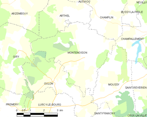
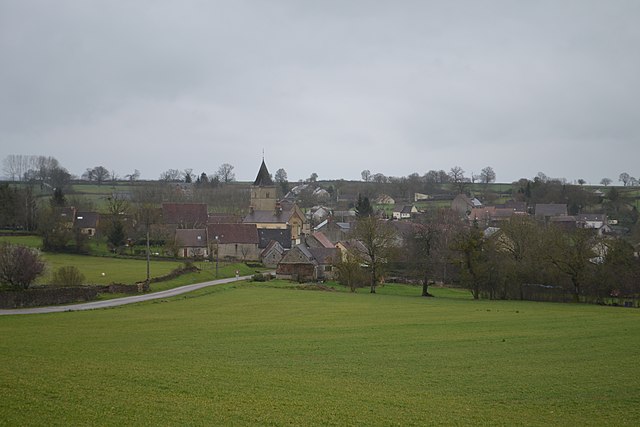
Montenoison
- commune in Nièvre, France
- Country:
- Postal Code: 58700
- Coordinates: 47° 12' 56" N, 3° 25' 37" E
- GPS tracks (wikiloc): [Link]
- Area: 16.73 sq km
- Population: 123


Crux-la-Ville
- commune in Nièvre, France
- Country:
- Postal Code: 58330
- Coordinates: 47° 9' 40" N, 3° 31' 16" E
- GPS tracks (wikiloc): [Link]
- Area: 45.56 sq km
- Population: 414
- Web site: [Link]

Champallement
- commune in Nièvre, France
- Country:
- Postal Code: 58420
- Coordinates: 47° 13' 56" N, 3° 29' 20" E
- GPS tracks (wikiloc): [Link]
- Area: 8.07 sq km
- Population: 50