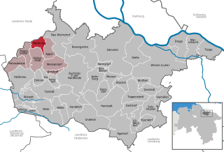
Neu Wulmstorf (Neu Wulmstorf)

- German municipality in Lower Saxony
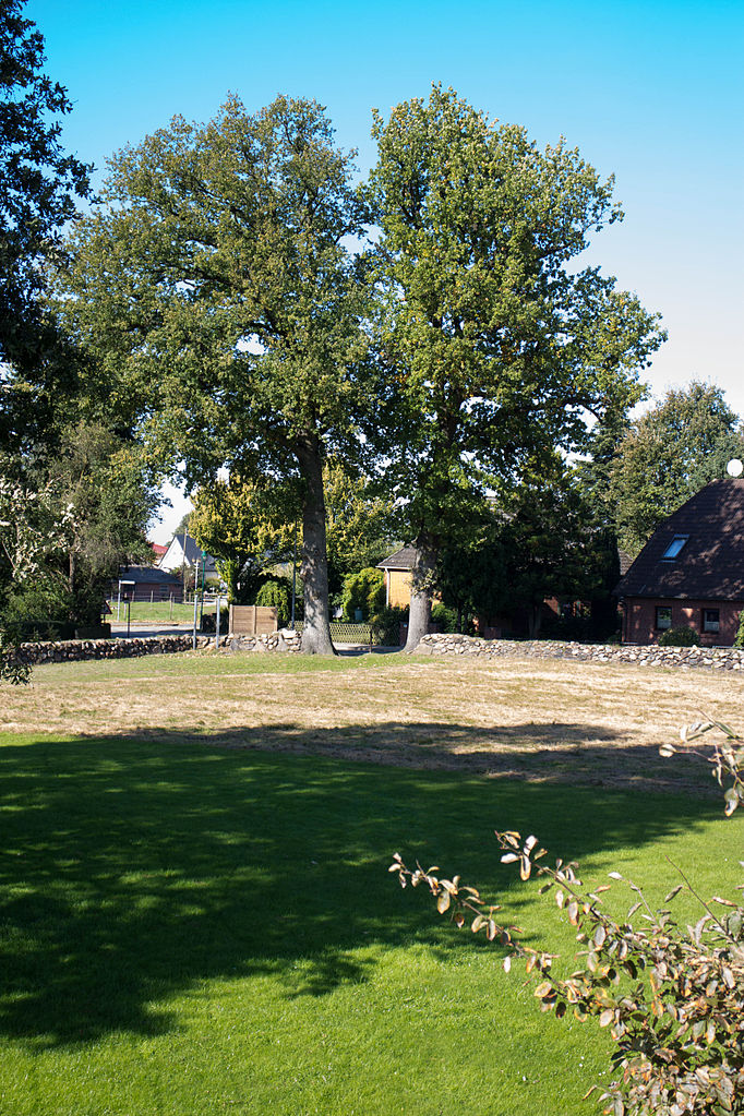
 Hiking in Neu Wulmstorf
Neu Wulmstorf is located in Lower Saxony, Germany, and while it may not be a major hiking destination like some national parks, it does offer some pleasant outdoor experiences for those looking to enjoy nature and hiking.
-
Scenic Trails: There are several local trails and paths surrounding Neu Wulmstorf that lead through woodlands, farmlands, and along the Elbe River. These trails can provide a nice respite for day hikers wanting to enjoy the natural beauty of the area.
-
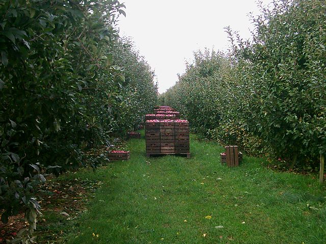
Nearby Parks: The region around Neu Wulmstorf includes some green spaces and parks. For instance, you can explore natural reserves or parks in nearby areas, such as the Harburg Hills to the north or the Lüneburg Heath area a bit further away, which features diverse ecosystems and beautiful landscapes.
-
Accessibility: Neu Wulmstorf is easily accessible from Hamburg, making it a convenient spot for locals and visitors. The area has a range of trails suitable for all skill levels, including family-friendly paths.
-
Wildlife Observation: The region is home to various wildlife, making it an excellent place for nature enthusiasts. Hikers can often spot birds, deer, and various plant species along the trails.
-
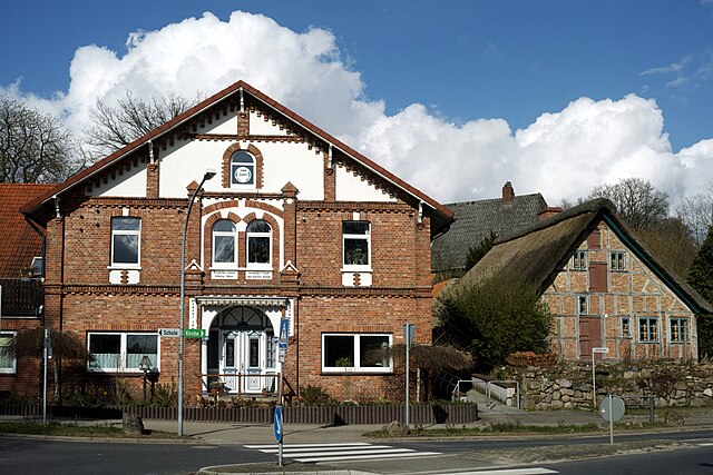
Local Amenities: After a hike, you can enjoy local cafes or restaurants in Neu Wulmstorf to rest and refresh.
If you're planning to hike in Neu Wulmstorf, make sure to check local maps for specific trails, as well as the weather forecast, to ensure a safe and enjoyable experience. Always remember to wear suitable hiking gear and pack enough water and snacks for your adventure!
- Country:

- Postal Code: 21629
- Local Dialing Code: 04168; 040
- Licence Plate Code: WL
- Coordinates: 53° 25' 22" N, 9° 47' 23" E


- GPS tracks (wikiloc): [Link]
- AboveSeaLevel: 49 м m
- Area: 56.16 sq km
- Population: 21159
- Web site: https://www.neu-wulmstorf.de/
- Wikipedia en: wiki(en)
- Wikipedia: wiki(de)
- Wikidata storage: Wikidata: Q508054
- Wikipedia Commons Category: [Link]
- Freebase ID: [/m/0c726k]
- Freebase ID: [/m/0c726k]
- GeoNames ID: Alt: [6552645]
- GeoNames ID: Alt: [6552645]
- VIAF ID: Alt: [159465672]
- VIAF ID: Alt: [159465672]
- OSM relation ID: [109821]
- OSM relation ID: [109821]
- GND ID: Alt: [4041701-3]
- GND ID: Alt: [4041701-3]
- Library of Congress authority ID: Alt: [n82039202]
- Library of Congress authority ID: Alt: [n82039202]
- MusicBrainz area ID: [adeef2fa-d4fa-4069-bd2b-18723a85b44b]
- MusicBrainz area ID: [adeef2fa-d4fa-4069-bd2b-18723a85b44b]
- Twitter username: Alt: [Wulmstorf]
- Twitter username: Alt: [Wulmstorf]
- German municipality key: 03353026
- German municipality key: 03353026
Includes regions:


Elstorf
- Village in the municipality Neu Wulmstorf
Hiking in Elstorf
Elstorf is a small village located in Lower Saxony, Germany, near the city of Hamburg. While it may not be widely known as a hiking destination, the surrounding areas offer some enjoyable outdoor experiences for hikers. Here are some aspects to consider when hiking near Elstorf:...
- Country:
- Postal Code: 21629
- Local Dialing Code: 04168
- Coordinates: 53° 25' 30" N, 9° 47' 16" E
- GPS tracks (wikiloc): [Link]
- Population: 3072


Rade
- District of the municipality of Neu Wulmstorf
Hiking in Rade
Rade and Neu Wulmstorf, located in Lower Saxony, Germany, offer a variety of hiking opportunities that cater to different skill levels. Here are some insights about hiking in that area:...
- Country:
- Postal Code: 21629
- Local Dialing Code: 04168
- Coordinates: 53° 23' 14" N, 9° 47' 36" E
- GPS tracks (wikiloc): [Link]
- Population: 763

Schwiederstorf
- Village in the municipality Neu Wulmstorf
Hiking in Schwiederstorf
Schwiederstorf, located in Germany, offers scenic hiking opportunities that allow you to explore the natural beauty of the region. While it may not be as well-known as some other hiking destinations, it presents a peaceful environment with picturesque landscapes, forests, and meadows....
- Country:
- Postal Code: 21629
- Local Dialing Code: 04168
- Coordinates: 53° 25' 19" N, 9° 47' 51" E
- GPS tracks (wikiloc): [Link]
- Population: 922

Rübke
- Village in the municipality Neu Wulmstorf
Hiking in Rübke
Rübke is a small village in Lower Saxony, Germany, located near the city of Buxtehude. While it may not be a well-known hiking destination, the surrounding areas offer some picturesque trails and opportunities to enjoy the natural landscape....
- Country:
- Postal Code: 21376
- Local Dialing Code: 040
- Coordinates: 53° 30' 0" N, 9° 46' 0" E
- GPS tracks (wikiloc): [Link]
- Population: 583
Shares border with regions:


Hamburg
- city in Germany, city state and federal state
Hiking in Hamburg
Hiking in and around Hamburg offers a unique blend of urban landscapes and natural scenery. While Hamburg is primarily known for its rich maritime history and vibrant city life, nearby areas provide some excellent opportunities for hiking enthusiasts....
- Country:
- Postal Code: 22041–22769; 20095–21149
- Local Dialing Code: 04721; 040
- Licence Plate Code: HH
- Coordinates: 53° 33' 0" N, 10° 0' 0" E
- GPS tracks (wikiloc): [Link]
- AboveSeaLevel: 6 м m
- Area: 755.30 sq km
- Population: 1834244
- Web site: [Link]

Ovelgönne
- human settlement in Germany
Hiking in Ovelgönne
Ovelgönne, a district in Buxtehude, is located in Lower Saxony, Germany. This area is not specifically known for extensive hiking trails, but it offers a charming landscape that can be enjoyed through various walking and hiking routes....
- Country:
- Postal Code: 21614
- Local Dialing Code: 04161
- Coordinates: 53° 27' 1" N, 9° 45' 13" E
- GPS tracks (wikiloc): [Link]
- AboveSeaLevel: 17 м m


Buxtehude
- German town
Hiking in Buxtehude
Buxtehude, located in Lower Saxony, Germany, is known for its beautiful landscapes and charming surroundings, making it a great destination for hiking enthusiasts. The area is characterized by its lush woodlands, scenic rivers, and picturesque countryside....
- Country:
- Postal Code: 21614
- Local Dialing Code: 04161
- Licence Plate Code: STD
- Coordinates: 53° 28' 37" N, 9° 42' 4" E
- GPS tracks (wikiloc): [Link]
- AboveSeaLevel: 5 м m
- Area: 76.49 sq km
- Population: 40033
- Web site: [Link]


Buchholz in der Nordheide
- town in the district of Harburg, in Lower Saxony, Germany
Hiking in Buchholz in der Nordheide
Buchholz in der Nordheide, located in Lower Saxony, Germany, is surrounded by picturesque landscapes that offer excellent opportunities for hiking. While it may not be as well-known as some of Germany's larger hiking destinations, it has several trails and natural areas that can be quite appealing for outdoor enthusiasts....
- Country:
- Postal Code: 21244
- Local Dialing Code: 04181
- Licence Plate Code: WL
- Coordinates: 53° 19' 43" N, 9° 51' 43" E
- GPS tracks (wikiloc): [Link]
- AboveSeaLevel: 55 м m
- Area: 74.62 sq km
- Population: 38689
- Web site: [Link]


Wenzendorf
- municipality of Germany
Hiking in Wenzendorf
Wenzendorf, a small village located in Lower Saxony, Germany, offers a serene environment for hiking enthusiasts. While the village itself may not be a well-known hiking destination, its surrounding landscapes and trails provide plenty of opportunities for those looking to explore nature....
- Country:
- Postal Code: 21279
- Local Dialing Code: 04165
- Licence Plate Code: WL
- Coordinates: 53° 21' 0" N, 9° 46' 0" E
- GPS tracks (wikiloc): [Link]
- AboveSeaLevel: 64 м m
- Area: 21.47 sq km
- Population: 1434
- Web site: [Link]


Rosengarten
- rural municipality in the district of Harburg, Lower Saxony, Germany
Hiking in Rosengarten
Rosengarten, located in Lower Saxony, Germany, offers hikers a beautiful landscape characterized by its rolling hills, dense forests, and scenic views. The area is part of the Lüneburg Heath, known for its unique heathland ecosystems and diverse flora and fauna....
- Country:
- Postal Code: 21224
- Local Dialing Code: 04108; 04105; 040
- Licence Plate Code: WL
- Coordinates: 53° 23' 0" N, 9° 54' 0" E
- GPS tracks (wikiloc): [Link]
- AboveSeaLevel: 85 м m
- Area: 63.67 sq km
- Population: 14031
- Web site: [Link]


Jork
- Municipality in Lower Saxony
Hiking in Jork
Jork, a small town in Lower Saxony, Germany, may not be widely known as a hiking destination, but it offers some scenic routes and nearby natural areas for outdoor enthusiasts. Here are some highlights related to hiking in and around Jork:...
- Country:
- Postal Code: 21635
- Local Dialing Code: 04162
- Licence Plate Code: STD
- Coordinates: 53° 31' 55" N, 9° 40' 51" E
- GPS tracks (wikiloc): [Link]
- AboveSeaLevel: 3 м m
- Area: 62.26 sq km
- Population: 12050
- Web site: [Link]
Moisburg
- municipality of Germany
Hiking in Moisburg
Moisburg, located in Lower Saxony, Germany, is a small town that offers a quaint atmosphere and access to beautiful natural scenery. While Moisburg itself may not be widely recognized as a major hiking destination, its surroundings provide opportunities for outdoor activities, including hiking....
- Country:
- Postal Code: 21647
- Local Dialing Code: 04165
- Licence Plate Code: WL
- Coordinates: 53° 23' 59" N, 9° 41' 59" E
- GPS tracks (wikiloc): [Link]
- AboveSeaLevel: 15 м m
- Area: 11.25 sq km
- Population: 1936
- Web site: [Link]


Appel
- municipality of Germany
Hiking in Appel
Appel, Germany, is a small village located in the Lower Saxony region, known for its picturesque landscapes and proximity to the Lüneburg Heath (Lüneburger Heide), a beautiful area popular for hiking and nature activities. Although Appel itself may not be a major hiking destination, it serves as an excellent base for exploring the surrounding natural beauty....
- Country:
- Postal Code: 21279
- Local Dialing Code: 04165
- Licence Plate Code: WL
- Coordinates: 53° 23' 35" N, 9° 44' 50" E
- GPS tracks (wikiloc): [Link]
- AboveSeaLevel: 40 м m
- Area: 15.42 sq km
- Population: 1962
- Web site: [Link]