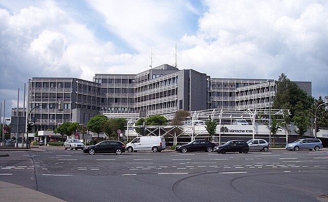
Olpe (Kreis Olpe)

- district in North Rhine-Westphalia, Germany
 Hiking in Olpe
Olpe is a picturesque district located in the North Rhine-Westphalia region of Germany, known for its scenic landscapes, charming villages, and outdoor recreational opportunities, making it a great destination for hiking enthusiasts. Here are some key highlights about hiking in Olpe:
Trails and Areas:
-
Biggesee and Listersee: The area around these two lakes offers various trails with stunning views of the water, forests, and surrounding mountains. The lakes are popular for their recreational facilities, and many trails provide the opportunity to walk along the shoreline or venture into the nearby woodlands.
-
Sauerland Region: Olpe is part of the Sauerland, a hilly area with extensive hiking paths. The Sauerland Höhenflug is a renowned long-distance hiking trail that runs through the region, offering breathtaking vistas and a mix of woodlands, meadows, and valleys.
-
Nature Park Homert: Located near Olpe, this nature park provides numerous marked hiking routes that showcase the diverse flora and fauna. Trails vary in difficulty, catering to both beginners and seasoned hikers.
Trail Features:
-
Scenic Views: Most trails feature elevated sections that provide panoramic views of the surrounding countryside, including forests, hills, and lakes.
-
Wildlife: Hikers may encounter various wildlife, making this area a great spot for nature observation.
-
Cultural Landmarks: Many trails pass by historical sites and charming villages, offering a glimpse into the local culture and history.
Practical Tips:
-
Trail Markings: Familiarize yourself with the color-coded trail markings to ensure you stay on course. Maps and apps are available to help navigate the routes.
-
Weather: Be prepared for changing weather conditions, as they can vary significantly in mountainous areas. Dress in layers and be equipped for rain if needed.
-
Safety: Carry sufficient water, snacks, and a first-aid kit. It’s also advisable to let someone know your hiking plans and estimated return time.
-
Accessibility: While many trails are well-marked and maintained, some may be steep or rugged, so choose routes that suit your fitness level.
Conclusion:
Hiking in Olpe offers a wonderful mix of nature and culture, with the added bonus of beautiful landscapes and the peaceful environment of the Sauerland region. Whether you’re looking for a leisurely stroll or a more challenging hike, you’ll find a variety of options to enjoy the natural beauty of this area. Make sure to plan ahead, stay safe, and enjoy the great outdoors!
- Country:

- Licence Plate Code: OE
- Coordinates: 51° 4' 48" N, 8° 0' 0" E


- GPS tracks (wikiloc): [Link]
- AboveSeaLevel: 334 м m
- Web site: http://www.kreis-olpe.de/
- Wikipedia en: wiki(en)
- Wikipedia: wiki(de)
- Wikidata storage: Wikidata: Q5953
- Wikipedia Commons Gallery: [Link]
- Wikipedia Commons Category: [Link]
- Wikipedia Commons Maps Category: [Link]
- Freebase ID: [/m/0192pc]
- GeoNames ID: Alt: [3221122]
- VIAF ID: Alt: [143200858]
- OSM relation ID: [1891506]
- GND ID: Alt: [4043500-3]
- archINFORM location ID: [11043]
- Library of Congress authority ID: Alt: [n91005121]
- TGN ID: [7076828]
- National Library of Israel ID: [001028048]
- NUTS code: [DEA59]
- GNS Unique Feature ID: 115809
- German district key: 05966
Shares border with regions:

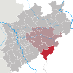
Märkischer Kreis
- district in central North Rhine-Westphalia, Germany
Hiking in Märkischer Kreis
Märkischer Kreis, located in North Rhine-Westphalia, Germany, is a beautiful region for hiking enthusiasts. It offers a blend of natural landscapes, charming small towns, and cultural heritage. Here are some highlights and things to know about hiking in this area:...
- Country:
- Capital: Lüdenscheid
- Licence Plate Code: MK
- Coordinates: 51° 13' 30" N, 7° 36' 52" E
- GPS tracks (wikiloc): [Link]
- AboveSeaLevel: 186 м m
- Area: 1058.95 sq km
- Population: 416171
- Web site: [Link]
Hochsauerlandkreis
- district in North Rhine-Westphalia, Germany
Hiking in Hochsauerlandkreis
Hochsauerlandkreis, located in North Rhine-Westphalia, Germany, is known for its stunning natural landscapes and well-marked hiking trails. The area is characterized by rolling hills, dense forests, and picturesque villages, making it a great destination for hikers of all experience levels....
- Country:
- Licence Plate Code: HSK
- Coordinates: 51° 17' 57" N, 8° 20' 33" E
- GPS tracks (wikiloc): [Link]
- AboveSeaLevel: 577 м m
- Area: 1958.78 sq km
- Population: 268851
- Web site: [Link]

Siegen-Wittgenstein
- district in North Rhine-Westphalia, Germany
Hiking in Siegen-Wittgenstein
Siegen-Wittgenstein is a beautiful region located in North Rhine-Westphalia, Germany, characterized by its lush landscapes, rolling hills, and dense forests. This area is perfect for hiking enthusiasts, offering a variety of trails suitable for all skill levels....
- Country:
- Licence Plate Code: BLB; SI
- Coordinates: 50° 55' 12" N, 8° 10' 12" E
- GPS tracks (wikiloc): [Link]
- AboveSeaLevel: 616 м m
- Area: 1132.89 sq km
- Population: 275909
- Web site: [Link]