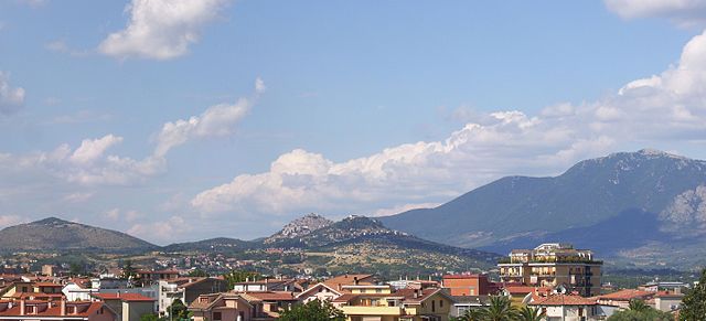
Palombara Sabina (Palombara Sabina)
.svg)
- Italian comune
 Hiking in Palombara Sabina
Palombara Sabina, located in the Lazio region of Italy, is a charming town known for its picturesque landscapes and a variety of hiking opportunities. Nestled in the Sabine Hills, it offers a mix of natural beauty, historical sites, and beautiful trails that are perfect for both beginner and experienced hikers.
Hiking Trails
-
Sorgenti del Fiume Verde Trail: This trail takes you alongside the Green River springs. It’s a scenic walk that allows you to enjoy the peaceful sounds of nature while exploring the local flora and fauna.
-
Monte Gennaro Trail: A bit more challenging, this trail leads to Monte Gennaro, offering breathtaking views of the surrounding countryside. The ascent can be demanding, but the panoramic vistas make it worthwhile.
-
Via Francigena: Portions of this historic pilgrimage route run through the area. It provides a unique opportunity to hike along a path rich in history, where you can appreciate both the landscape and the historical significance of the route.
-
Local Nature Reserves: Nearby nature reserves, such as the Monte Soratte Natural Reserve, also provide great options for hiking. These areas are characterized by varied terrain and an abundance of wildlife.
Preparations
- Timing: The best times for hiking in Palombara Sabina are during the spring (April to June) and fall (September to October) when the weather is mild and the landscapes are vibrant.
- Gear: Ensure you wear appropriate hiking attire, sturdy boots, and carry enough water and snacks. A map or GPS device can be very helpful as trails can occasionally be unmarked.
- Respect Nature: Remember to follow the Leave No Trace principles, respecting the local environment and wildlife.
Additional Attractions
Apart from hiking, Palombara Sabina has cultural and historical sites worth exploring, such as its medieval castle and charming old town. After a day of hiking, you can enjoy local cuisine in one of the town’s restaurants, featuring traditional Sabine dishes.
Conclusion
Overall, hiking in Palombara Sabina offers a fantastic blend of nature, history, and culture. Whether you’re in for a casual day hike or an adventurous trek, the area has plenty to offer for outdoor enthusiasts. Always check local trail conditions and guidelines before heading out!
- Country:

- Postal Code: 00018
- Local Dialing Code: 0774
- Licence Plate Code: ROMA
- Coordinates: 42° 4' 0" N, 12° 46' 0" E


- GPS tracks (wikiloc): [Link]
- AboveSeaLevel: 372 м m
- Area: 75.8 sq km
- Population: 13200
- Web site: http://www.perledipalombara.it/
- Wikipedia en: wiki(en)
- Wikipedia: wiki(it)
- Wikidata storage: Wikidata: Q243143
- Wikipedia Commons Category: [Link]
- Freebase ID: [/m/0f8r9z]
- GeoNames ID: Alt: [6536958]
- VIAF ID: Alt: [151712649]
- OSM relation ID: [41740]
- MusicBrainz area ID: [d119e93d-5eef-4877-92bf-270e07c230c9]
- WOEID: [719884]
- UN/LOCODE: [ITPBP]
- ISTAT ID: 058075
- Italian cadastre code: G293
Shares border with regions:
Monteflavio
- Italian comune
Hiking in Monteflavio
Monteflavio is a charming village located in the Province of Rome, Italy, nestled in the beautiful Sabine Hills. The area around Monteflavio offers several opportunities for hiking, characterized by its lush landscapes, historic sites, and panoramic views....
- Country:
- Postal Code: 00010
- Local Dialing Code: 0774
- Licence Plate Code: RM
- Coordinates: 42° 6' 30" N, 12° 49' 51" E
- GPS tracks (wikiloc): [Link]
- AboveSeaLevel: 800 м m
- Area: 16.84 sq km
- Population: 1285
- Web site: [Link]

Guidonia Montecelio
- Italian comune
Hiking in Guidonia Montecelio
Guidonia Montecelio, located in the Lazio region of Italy, is a great destination for hiking enthusiasts. The area is characterized by a mix of natural landscapes, historical sites, and striking views, making it appealing for outdoor activities. Here are some key points about hiking in Guidonia Montecelio:...
- Country:
- Postal Code: 00012
- Local Dialing Code: 0774
- Licence Plate Code: ROMA
- Coordinates: 41° 59' 49" N, 12° 43' 34" E
- GPS tracks (wikiloc): [Link]
- AboveSeaLevel: 105 м m
- Area: 79.06 sq km
- Population: 89288
- Web site: [Link]


Mentana
- Italian comune
Hiking in Mentana
Mentana is a charming town located in the Lazio region of Italy, not far from Rome. It offers various hiking opportunities, thanks to its picturesque landscapes and proximity to natural reserves and scenic hills....
- Country:
- Postal Code: 00013
- Local Dialing Code: 06
- Licence Plate Code: RM
- Coordinates: 42° 2' 1" N, 12° 38' 40" E
- GPS tracks (wikiloc): [Link]
- AboveSeaLevel: 150 м m
- Area: 24.27 sq km
- Population: 23126
- Web site: [Link]


Montelibretti
- Italian comune
Hiking in Montelibretti
Montelibretti is a charming area located in the province of Rome, Italy. Known for its scenic landscapes and historical sites, it offers a unique hiking experience for nature enthusiasts and history buffs alike. Here are some key points about hiking in Montelibretti:...
- Country:
- Postal Code: 00010
- Local Dialing Code: 0774
- Licence Plate Code: ROMA
- Coordinates: 42° 8' 0" N, 12° 44' 0" E
- GPS tracks (wikiloc): [Link]
- AboveSeaLevel: 232 м m
- Area: 45.43 sq km
- Population: 5326
- Web site: [Link]


Monterotondo
- Italian comune
Hiking in Monterotondo
Monterotondo, located near Rome, Italy, offers a blend of natural beauty and cultural heritage, making it a great location for hiking enthusiasts. The area is characterized by scenic landscapes, ancient ruins, and charming countryside....
- Country:
- Postal Code: 00015; 00015, 00016 (Scalo)
- Local Dialing Code: 06
- Licence Plate Code: ROMA
- Coordinates: 42° 3' 0" N, 12° 37' 0" E
- GPS tracks (wikiloc): [Link]
- AboveSeaLevel: 165 м m
- Area: 40.94 sq km
- Population: 41144
- Web site: [Link]
Moricone
- Italian comune
Hiking in Moricone
Moricone, a picturesque village located in the Lazio region of Italy, is surrounded by beautiful landscapes and offers various hiking opportunities. The surrounding areas are characterized by lush woods, rolling hills, and scenic trails. Here are some key points to consider if you're planning a hiking trip to Moricone:...
- Country:
- Postal Code: 00010
- Local Dialing Code: 0774
- Licence Plate Code: RM
- Coordinates: 42° 7' 0" N, 12° 46' 20" E
- GPS tracks (wikiloc): [Link]
- AboveSeaLevel: 296 м m
- Area: 19.59 sq km
- Population: 2559
- Web site: [Link]


San Polo dei Cavalieri
- Italian comune
Hiking in San Polo dei Cavalieri
San Polo dei Cavalieri, located in the Lazio region of Italy, offers a delightful hiking experience amidst beautiful landscapes and rich history. The area is characterized by its picturesque countryside, rolling hills, and lush forests, making it a great destination for hiking enthusiasts of all levels....
- Country:
- Postal Code: 00010
- Local Dialing Code: 0774
- Licence Plate Code: RM
- Coordinates: 42° 1' 0" N, 12° 50' 0" E
- GPS tracks (wikiloc): [Link]
- AboveSeaLevel: 651 м m
- Area: 42.53 sq km
- Population: 2919
- Web site: [Link]


Sant'Angelo Romano
- Italian comune
Hiking in Sant'Angelo Romano
Sant'Angelo Romano is a charming village located in the Sabine Hills, about 40 kilometers northeast of Rome, Italy. It’s an excellent destination for hiking enthusiasts looking for scenic trails and a mix of natural beauty and cultural heritage....
- Country:
- Postal Code: 00010
- Local Dialing Code: 0774
- Licence Plate Code: RM
- Coordinates: 42° 2' 5" N, 12° 42' 48" E
- GPS tracks (wikiloc): [Link]
- AboveSeaLevel: 400 м m
- Area: 21.36 sq km
- Population: 4987
- Web site: [Link]