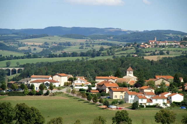
Pradines (Pradines)

- commune in Loire, France
- Country:

- Postal Code: 42630
- Coordinates: 45° 59' 54" N, 4° 10' 35" E


- GPS tracks (wikiloc): [Link]
- Area: 11.6 sq km
- Population: 785
- Wikipedia en: wiki(en)
- Wikipedia: wiki(fr)
- Wikidata storage: Wikidata: Q1339630
- Wikipedia Commons Category: [Link]
- Freebase ID: [/m/03qd3hk]
- Freebase ID: [/m/03qd3hk]
- GeoNames ID: Alt: [6434228]
- GeoNames ID: Alt: [6434228]
- SIREN number: [214201782]
- SIREN number: [214201782]
- BnF ID: [15259746n]
- BnF ID: [15259746n]
- INSEE municipality code: 42178
- INSEE municipality code: 42178
Shares border with regions:


Régny
- commune in Loire, France
- Country:
- Postal Code: 42630
- Coordinates: 45° 59' 27" N, 4° 12' 53" E
- GPS tracks (wikiloc): [Link]
- Area: 13.8 sq km
- Population: 1543
Notre-Dame-de-Boisset
- commune in Loire, France
- Country:
- Postal Code: 42120
- Coordinates: 45° 59' 39" N, 4° 7' 45" E
- GPS tracks (wikiloc): [Link]
- Area: 9.1 sq km
- Population: 566
- Web site: [Link]


Montagny
- commune in Loire, France
- Country:
- Postal Code: 42840
- Coordinates: 46° 1' 58" N, 4° 14' 9" E
- GPS tracks (wikiloc): [Link]
- AboveSeaLevel: 490 м m
- Area: 25.57 sq km
- Population: 1071
- Web site: [Link]

Neaux
- commune in Loire, France
- Country:
- Postal Code: 42470
- Coordinates: 45° 57' 44" N, 4° 10' 48" E
- GPS tracks (wikiloc): [Link]
- Area: 17.36 sq km
- Population: 488

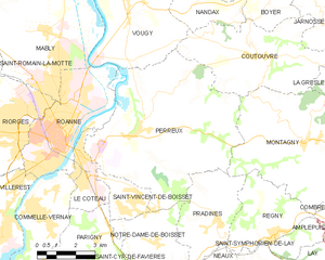
Perreux
- commune in Loire, France
- Country:
- Postal Code: 42120
- Coordinates: 46° 2' 17" N, 4° 7' 20" E
- GPS tracks (wikiloc): [Link]
- Area: 41.35 sq km
- Population: 2141
- Web site: [Link]