Pfofeld (Pfofeld)
- municipality of Germany
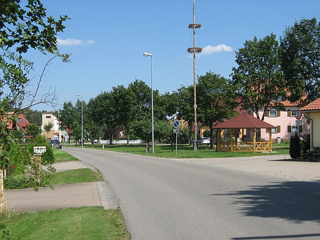
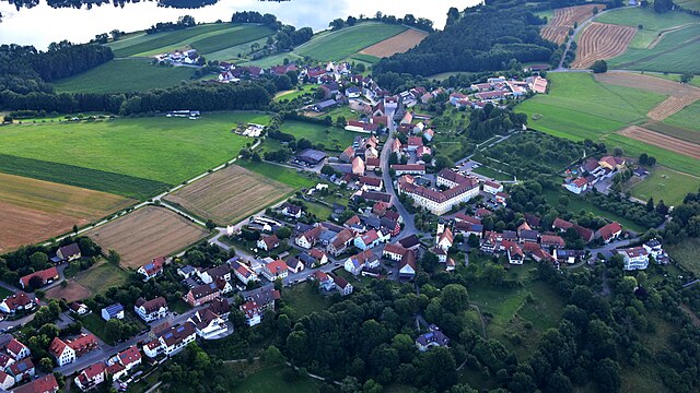
Pfofeld is a small village located in Bavaria, Germany, near the beautiful Altmühltal Natural Park. Although it might not be as well-known as some larger hiking destinations, it offers a range of trails suitable for various skill levels amid stunning natural scenery.
Hiking Highlights in Pfofeld:
-
Scenic Trails: The area around Pfofeld is characterized by diverse landscapes, including rolling hills, forests, and meadows. This variety provides hikers with a chance to experience different environments and lovely views.
-
Nature Trails: Many trails in and around Pfofeld are part of the Altmühltal Natural Park. These trails often feature well-marked paths and information boards about the local flora and fauna, making them perfect for nature enthusiasts.
-
Difficulty Levels: Hikes in the region cater to all skill levels, from easy walks suitable for families and beginners to more challenging routes for experienced hikers.
-
Historic Sites: While hiking in this area, you may encounter various historical sites, such as ancient castles, ruins, and traditional Bavarian villages that add cultural significance to your excursions.
-
Wildlife Watching: The natural park is home to diverse wildlife including birds, deer, and various other species, making it a great spot for nature photographers and wildlife enthusiasts.
-
Nearby Attractions: If you wish to extend your hike, the Altmühl River runs through the region and offers additional walking paths as well as opportunities for kayaking and cycling.
Practical Tips:
-
Maps and Guides: It’s advisable to have a hiking map or guidebook, as some trails might not be as well-marked as in more tourist-heavy locations.
-
Best Season: Spring and early autumn are great times for hiking in this area due to mild temperatures and beautiful scenery.
-
Gear: Wear appropriate hiking boots and carry enough water, snacks, and a first-aid kit, especially if you plan to hike longer trails.
-
Respect Nature: As with any hiking area, follow Leave No Trace principles to help preserve the environment.
If you're considering a hiking trip to Pfofeld, you can enjoy a lovely experience among natural beauty and history!
- Country:

- Postal Code: 91738
- Local Dialing Code: 09834
- Licence Plate Code: WUG
- Coordinates: 49° 7' 0" N, 10° 50' 0" E


- GPS tracks (wikiloc): [Link]
- AboveSeaLevel: 446 м m
- Area: 23.88 sq km
- Population: 1528
- Web site: http://www.pfofeld.de
- Wikipedia en: wiki(en)
- Wikipedia: wiki(de)
- Wikidata storage: Wikidata: Q525945
- Wikipedia Commons Category: [Link]
- Freebase ID: [/m/02q94c9]
- GeoNames ID: Alt: [2853984]
- VIAF ID: Alt: [244713919]
- OSM relation ID: [1015105]
- GND ID: Alt: [4363472-2]
- MusicBrainz area ID: [0815f868-d911-418a-bca6-5a3fa0a523d3]
- TGN ID: [7119581]
- Historical Gazetteer (GOV) ID: [PFOELDJN59JC]
- Bavarikon ID: [ODB_A00000215]
- German municipality key: 09577159
Includes regions:

Furthmühle
- human settlement in Germany
Furthmühle, located near Pfofeld in Bavaria, Germany, is an attractive destination for hikers looking to explore scenic landscapes and enjoy outdoor activities. This area is characterized by its beautiful natural surroundings, which include forests, rolling hills, and picturesque views....
- Country:

- Postal Code: 91738
- Local Dialing Code: 09834
- Coordinates: 49° 7' 35" N, 10° 51' 16" E


- GPS tracks (wikiloc): [Link]
- AboveSeaLevel: 415 м m

Sorghof
- human settlement in Germany
Sorghof, located near Pfofeld in Bavaria, Germany, offers a scenic hiking experience characterized by lush landscapes, rolling hills, and access to the beautiful waters of the nearby Altmühlsee (Altmühl Lake). Here are some features and tips for hiking in the area:...
- Country:

- Postal Code: 91738
- Local Dialing Code: 09834
- Coordinates: 49° 6' 59" N, 10° 52' 19" E


- GPS tracks (wikiloc): [Link]

Langlau
- human settlement in Germany
Langlau is a picturesque area located in Germany, often celebrated for its scenic landscapes and outdoor activities, including hiking. It is nestled near natural parks and offers a range of trails suitable for various skill levels, making it a popular destination for both casual hikers and seasoned outdoor enthusiasts....
- Country:

- Postal Code: 91738
- Local Dialing Code: 09834
- Coordinates: 49° 7' 17" N, 10° 51' 42" E


- GPS tracks (wikiloc): [Link]

Rehenbühl
- human settlement in Germany
Rehenbühl is not widely recognized as a specific hiking destination, and information may vary depending on its exact location, which could refer to a specific area or region within a country. However, if Rehenbühl is part of a larger hiking area or park, I can provide general advice about hiking in mountainous or nature-rich areas....
- Country:

- Postal Code: 91738
- Local Dialing Code: 09834
- Coordinates: 49° 7' 9" N, 10° 50' 57" E


- GPS tracks (wikiloc): [Link]

Hühnermühle
- human settlement in Germany
Hühnermühle, located in Germany, is a delightful spot for hiking enthusiasts. Nestled in scenic countryside, it offers a variety of trails that cater to all skill levels, from leisurely walks to more challenging hikes....
- Country:

- Postal Code: 91738
- Local Dialing Code: 09834
- Coordinates: 49° 7' 44" N, 10° 51' 14" E


- GPS tracks (wikiloc): [Link]
- AboveSeaLevel: 413 м m

Neuherberg
- human settlement in Germany
Neuherberg, located in the municipality of Pfofeld in Bavaria, Germany, is a beautiful area well-suited for hiking enthusiasts. Nestled near the shores of the Altmühlsee and surrounded by scenic countryside, Neuherberg offers a variety of trails and natural landscapes for hikers of all skill levels....
- Country:

- Postal Code: 91738
- Local Dialing Code: 09834
- Coordinates: 49° 7' 47" N, 10° 51' 15" E


- GPS tracks (wikiloc): [Link]
- AboveSeaLevel: 414 м m
Neumühle
- human settlement in Germany
Neumühle, located in the Thannhausen area of Germany, is an excellent starting point for various hiking adventures. The region is known for its picturesque landscapes, with rolling hills, forests, and streams that provide a tranquil hiking experience....
- Country:

- Coordinates: 49° 8' 7" N, 10° 53' 16" E


- GPS tracks (wikiloc): [Link]
Scheermühle
- human settlement in Germany
Scheermühle, located near Thannhausen in Germany, is an excellent destination for hiking enthusiasts. Nestled in a beautiful natural landscape, it offers a variety of trails that cater to different skill levels, making it suitable for both casual walkers and experienced hikers....
- Country:

- Coordinates: 49° 8' 2" N, 10° 52' 44" E


- GPS tracks (wikiloc): [Link]
Thannhausen
Thannhausen, located in the Pfofeld municipality in the district of Ansbach, Bavaria, is a charming area that offers some lovely hiking opportunities. The region is characterized by its scenic landscapes, including rolling hills, forests, and open fields, making it ideal for outdoor enthusiasts....
- Country:

- Postal Code: 91738
- Local Dialing Code: 09834
- Coordinates: 49° 6' 31" N, 10° 53' 15" E


- GPS tracks (wikiloc): [Link]
- AboveSeaLevel: 434 м m

Gundelshalm
- Village in Germany
Gundelshalm, located in the region of Upper Austria, is known for its picturesque landscapes and natural beauty, making it a great destination for hiking enthusiasts. While specific trails might vary based on recent developments, here are some general highlights and tips for hiking in the area:...
- Country:

- Postal Code: 91738
- Local Dialing Code: 09834
- Coordinates: 49° 6' 39" N, 10° 49' 16" E


- GPS tracks (wikiloc): [Link]
- AboveSeaLevel: 434 м m
- Population: 73
Beutelmühle
- human settlement in Germany
Beutelmühle is a picturesque location in Germany, often celebrated for its beautiful landscapes and opportunities for hiking. Nestled in the countryside, it's part of the larger region that boasts scenic trails, wildlife, and natural beauty....
- Country:

- Coordinates: 49° 7' 55" N, 10° 52' 31" E


- GPS tracks (wikiloc): [Link]
Shares border with regions:


Pleinfeld
- municipality in Germany
Pleinfeld, located in the state of Bavaria, Germany, is a charming destination for hiking enthusiasts. Nestled near the beautiful Franconian Lake District, it offers a range of hiking trails that cater to various skill levels and preferences. Here are some highlights and tips for hiking in Pleinfeld:...
- Country:

- Postal Code: 91785
- Local Dialing Code: 09177; 09144
- Licence Plate Code: WUG
- Coordinates: 49° 6' 0" N, 10° 58' 0" E


- GPS tracks (wikiloc): [Link]
- AboveSeaLevel: 382 м m
- Area: 71.35 sq km
- Population: 7443
- Web site: [Link]


Absberg
- human settlement in Germany
Absberg is a charming village located in Bavaria, Germany, known for its proximity to beautiful natural landscapes, including the scenic Altmühl Valley. Hiking in and around Absberg offers a range of trails suitable for various skill levels, making it an excellent destination for both novice hikers and experienced outdoor enthusiasts....
- Country:

- Postal Code: 91720
- Local Dialing Code: 09175
- Licence Plate Code: WUG
- Coordinates: 49° 9' 0" N, 10° 53' 0" E


- GPS tracks (wikiloc): [Link]
- AboveSeaLevel: 476 м m
- Area: 18.98 sq km
- Population: 1179
- Web site: [Link]


Gunzenhausen
- town in Bavaria, Germany
Gunzenhausen is a charming town located in Bavaria, Germany, and serves as a gateway to some beautiful hiking opportunities, particularly around the Franconian Lake District (Fränkisches Seenland). Here’s what you can expect when hiking in and around Gunzenhausen:...
- Country:

- Postal Code: 91710
- Local Dialing Code: 09836; 09831
- Coordinates: 49° 6' 53" N, 10° 45' 15" E


- GPS tracks (wikiloc): [Link]
- AboveSeaLevel: 416 м m
- Area: 82.72 sq km
- Population: 16562
- Web site: [Link]


Theilenhofen
- municipality of Germany
Theilenhofen, located in Bavaria, Germany, offers beautiful scenic landscapes that are perfect for hiking enthusiasts. The region features a mix of natural beauty, charming villages, and a rich cultural heritage, making it a great destination for outdoor activities....
- Country:

- Postal Code: 91741
- Local Dialing Code: 09834
- Licence Plate Code: WUG
- Coordinates: 49° 5' 0" N, 10° 51' 0" E


- GPS tracks (wikiloc): [Link]
- AboveSeaLevel: 494 м m
- Area: 20.32 sq km
- Population: 1129
- Web site: [Link]


Haundorf
- municipality of Germany
Haundorf, a quaint village located in the Bavarian region of Germany, offers a variety of hiking opportunities for outdoor enthusiasts. Here are some details to consider if you're planning a hike in the area:...
- Country:

- Postal Code: 91729
- Local Dialing Code: 09837
- Licence Plate Code: WUG
- Coordinates: 49° 11' 0" N, 10° 46' 0" E


- GPS tracks (wikiloc): [Link]
- AboveSeaLevel: 445 м m
- Area: 51.34 sq km
- Population: 1909
- Web site: [Link]

