Haundorf (Haundorf)
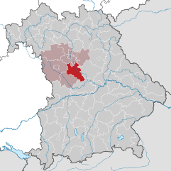
- municipality of Germany
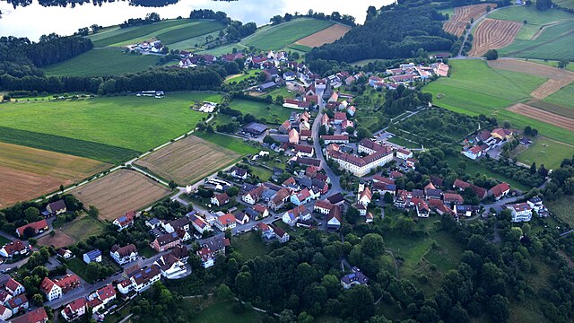
Haundorf, a quaint village located in the Bavarian region of Germany, offers a variety of hiking opportunities for outdoor enthusiasts. Here are some details to consider if you're planning a hike in the area:
Trails and Routes
-
Scenic Trails: Haundorf is surrounded by beautiful landscapes, including rolling hills, forests, and lakes. Trails often provide views of the surrounding countryside and natural features.
-
Marked Paths: The area generally has well-marked hiking trails of varying difficulties. You can find routes that cater to casual walkers as well as more challenging paths for experienced hikers.
-
Nature Trails: Many trails focus on the rich biodiversity of the region, allowing hikers to immerse themselves in nature and possibly spot local wildlife.
Features
-
Natural Beauty: The landscape around Haundorf features picturesque views of rural Bavaria, with meadows, woodlands, and water bodies that enhance the hiking experience.
-
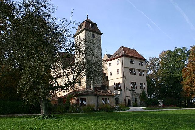
Cultural Sites: Hiking in the area may also lead you to historical sites or local landmarks, adding a cultural dimension to your outdoor adventure.
Tips for Hiking in Haundorf
-
Consider the Weather: Be prepared for changing weather conditions, especially in the shoulder seasons of spring and autumn.
-
Gear Up: Wear appropriate hiking footwear and consider bringing trekking poles if you're traversing more rugged terrain.
-
Stay Hydrated: Always carry enough water, especially on warmer days, and plan for breaks along the way.
-
Local Information: Check with local tourist centers or hiking clubs for updated trail maps and any potential closures or advisories.
Nearby Attractions
- If you have extra time, consider exploring nearby natural parks or lakes, such as the Altmühlsee, which is not far from Haundorf, providing additional opportunities for hiking and outdoor activities.
Haundorf's combination of natural beauty and tranquil rural atmosphere makes it a wonderful destination for hikers of all levels. Enjoy your adventure in this charming area of Bavaria!
- Country:

- Postal Code: 91729
- Local Dialing Code: 09837
- Licence Plate Code: WUG
- Coordinates: 49° 11' 0" N, 10° 46' 0" E


- GPS tracks (wikiloc): [Link]
- AboveSeaLevel: 445 м m
- Area: 51.34 sq km
- Population: 1909
- Web site: http://www.haundorf.de
- Wikipedia en: wiki(en)
- Wikipedia: wiki(de)
- Wikidata storage: Wikidata: Q525879
- Wikipedia Commons Category: [Link]
- Freebase ID: [/m/02q9453]
- GeoNames ID: Alt: [2909087]
- VIAF ID: Alt: [972145424657686831429]
- OSM relation ID: [1015098]
- GND ID: Alt: [4285294-8]
- TGN ID: [7167361]
- Historical Gazetteer (GOV) ID: [HAUOR1JN59JE]
- Bavarikon ID: [ODB_A00009264]
- German municipality key: 09577138
Includes regions:
Eichenberg
- human settlement in Germany
Eichenberg, located in Haundorf, Germany, offers a beautiful setting for hiking enthusiasts. This region is characterized by its picturesque landscapes, rolling hills, and wooded areas that provide a variety of trails for all skill levels....
- Country:

- Postal Code: 91729
- Local Dialing Code: 09837
- Coordinates: 49° 10' 0" N, 10° 46' 49" E


- GPS tracks (wikiloc): [Link]
- AboveSeaLevel: 472 м m
Geislohe
- human settlement in Germany
Geislohe, located near Haundorf in Bavaria, Germany, offers scenic hiking opportunities that cater to various skill levels. This picturesque area, with its lush landscapes, offers a mix of forests, meadows, and hills, making it ideal for outdoor enthusiasts....
- Country:

- Postal Code: 91729
- Local Dialing Code: 09837
- Coordinates: 49° 8' 43" N, 10° 47' 5" E


- GPS tracks (wikiloc): [Link]
- AboveSeaLevel: 450 м m
Brand
- human settlement in Germany
Brand, located near Haundorf in Bavaria, Germany, is an excellent destination for hiking enthusiasts. The area offers beautiful landscapes, diverse trails, and the chance to experience the natural beauty of the Franconian Switzerland region. Here's what you can expect when hiking in and around Brand:...
- Country:

- Postal Code: 91729
- Local Dialing Code: 09837
- Coordinates: 49° 9' 18" N, 10° 47' 36" E


- GPS tracks (wikiloc): [Link]
Geiselsberg
- human settlement in Germany
Geiselsberg, located near Haundorf, is a charming destination for hiking enthusiasts. The region offers a variety of scenic trails that wind through lush landscapes, forests, and picturesque views, making it ideal for both casual walkers and more experienced hikers....
- Country:

- Postal Code: 91729
- Local Dialing Code: 09837
- Coordinates: 49° 8' 47" N, 10° 50' 38" E


- GPS tracks (wikiloc): [Link]

Röthenhof
- human settlement in Germany
Röthenhof, while not one of the most famous hiking areas, offers a unique experience for outdoor enthusiasts looking to explore less crowded trails. Often nestled in a picturesque landscape, hiking in and around Röthenhof allows hikers to enjoy a mix of natural beauty, serene surroundings, and cultural elements....
- Country:

- Postal Code: 91729
- Local Dialing Code: 09837
- Coordinates: 49° 8' 13" N, 10° 50' 59" E


- GPS tracks (wikiloc): [Link]
- AboveSeaLevel: 417 м m
Seitersdorf
- human settlement in Germany
Seitersdorf, located in the area surrounding the Vienna Woods in Austria, offers a variety of hiking opportunities for all skill levels. The region is characterized by its beautiful landscapes, dense forests, rolling hills, and scenic views. Here are some key points about hiking in Seitersdorf:...
- Country:

- Postal Code: 91729
- Local Dialing Code: 09837
- Coordinates: 49° 10' 29" N, 10° 48' 16" E


- GPS tracks (wikiloc): [Link]
- AboveSeaLevel: 445 м m
Aue
- human settlement in Germany
Aue, also known as Haundorf, is a charming area located in Bavaria, Germany, offering a great backdrop for hiking enthusiasts. The region is characterized by picturesque landscapes, rolling hills, and lush forests, making it ideal for various hiking trails suitable for different skill levels....
- Country:

- Postal Code: 91729
- Local Dialing Code: 09837
- Coordinates: 49° 10' 32" N, 10° 46' 26" E


- GPS tracks (wikiloc): [Link]
Unterhöhberg
- human settlement in Germany
Unterhöhberg, located in the picturesque landscape of Germany, is a great destination for hiking enthusiasts. The region offers a variety of trails that cater to different skill levels, from easy walks suitable for families to more challenging hikes for seasoned adventurers....
- Country:

- Postal Code: 91729
- Local Dialing Code: 09837
- Coordinates: 49° 11' 39" N, 10° 48' 12" E


- GPS tracks (wikiloc): [Link]
- AboveSeaLevel: 510 м m
Dematshof
- human settlement in Germany
Dematshof may not be a well-known hiking destination based on my current knowledge up until October 2023. However, there might be local trails or scenic areas depending on where Dematshof is located. If it's a smaller, less-publicized area, I recommend checking local tourism websites, hiking forums, or social media groups for detailed trail information, maps, and difficulty levels....
- Country:

- Postal Code: 91729
- Local Dialing Code: 09837
- Coordinates: 49° 10' 41" N, 10° 45' 35" E


- GPS tracks (wikiloc): [Link]
- AboveSeaLevel: 448 м m
Lindenbühl
- human settlement in Germany
Lindenbühl is a scenic area that offers a variety of hiking opportunities for enthusiasts of all levels. Located in Switzerland, it's known for its picturesque landscapes, lush greenery, and beautiful trails that weave through forests and meadows, showcasing the natural beauty of the region....
- Country:

- Postal Code: 91729
- Local Dialing Code: 09837
- Coordinates: 49° 11' 2" N, 10° 45' 1" E


- GPS tracks (wikiloc): [Link]
- AboveSeaLevel: 430 м m
Stixenhof
- human settlement in Germany
Stixenhof, located in Haundorf, is a charming area in Bavaria, Germany, that offers a variety of hiking opportunities. While it might not be as widely known as some larger hiking destinations, it provides scenic landscapes and a more tranquil hiking experience. Here are some features you might enjoy while hiking in this area:...
- Country:

- Postal Code: 91729
- Local Dialing Code: 09837
- Coordinates: 49° 10' 17" N, 10° 48' 18" E


- GPS tracks (wikiloc): [Link]
- AboveSeaLevel: 460 м m

Gutzenmühle
- human settlement in Germany
Gutzenmühle, located in the beautiful region of Bavaria, Germany, is a charming area suitable for hiking enthusiasts. Nestled in the lush landscapes of the Upper Franconia, it offers a variety of trails that cater to different skill levels, making it an ideal spot for both beginners and experienced hikers....
- Country:

- Postal Code: 91729
- Local Dialing Code: 09837
- Coordinates: 49° 10' 42" N, 10° 49' 18" E


- GPS tracks (wikiloc): [Link]
- AboveSeaLevel: 410 м m
Straßenhaus
- human settlement in Germany
Hiking in Straßenhaus, particularly in the Haundorf area, offers a beautiful experience for outdoor enthusiasts. This region is located in the Rhineland-Palatinate state of Germany and is known for its picturesque landscapes, woodlands, and charming rural scenery. Here are some highlights and tips for hiking in this area:...
- Country:

- Postal Code: 91729
- Local Dialing Code: 09837
- Coordinates: 49° 10' 34" N, 10° 49' 9" E


- GPS tracks (wikiloc): [Link]
- AboveSeaLevel: 417 м m
Straßenwirthshaus
- human settlement in Germany
It seems there might be a slight confusion with the name "Straßenwirthshaus," as it's not widely recognized as a specific hiking destination or area. It's possible you might be referring to a location with a similar name or perhaps a particular hiking route or accommodation in a region....
- Country:

- Postal Code: 91729
- Local Dialing Code: 09837
- Coordinates: 49° 10' 32" N, 10° 49' 9" E


- GPS tracks (wikiloc): [Link]
- AboveSeaLevel: 415 м m

Obererlbach
- human settlement in Germany
Obererlbach is a lesser-known area compared to more popular hiking destinations, but it offers charming trails that allow hikers to experience the beauty of nature. Located in Bavaria, Germany, it provides a peaceful setting ideal for both casual and experienced hikers....
- Country:

- Postal Code: 91729
- Local Dialing Code: 09837
- Coordinates: 49° 11' 7" N, 10° 49' 43" E


- GPS tracks (wikiloc): [Link]
- AboveSeaLevel: 400 м m
- Population: 473
Thierhof
- human settlement in Germany
Thierhof could refer to a local area or trail not widely recognized in major hiking resources. However, I can provide some general tips and ideas for hiking in lesser-known or less popular locations, as well as what to look for when exploring such areas....
- Country:

- Postal Code: 91729
- Local Dialing Code: 09837
- Coordinates: 49° 11' 10" N, 10° 49' 6" E


- GPS tracks (wikiloc): [Link]
- AboveSeaLevel: 430 м m
Leidingendorf
- human settlement in Germany
Leidingendorf, located in Germany, is a scenic area that offers opportunities for hiking amidst beautiful landscapes. While specific trails and conditions can vary, here are some general tips and information to enhance your hiking experience in and around Leidingendorf:...
- Country:

- Postal Code: 91729
- Local Dialing Code: 09837
- Coordinates: 49° 10' 55" N, 10° 46' 26" E


- GPS tracks (wikiloc): [Link]
- AboveSeaLevel: 465 м m
Neuhof
- human settlement in Germany
Neuhof, located in Haundorf, Germany, offers a picturesque setting for hikers. The region is characterized by its rolling hills, lush forests, and beautiful meadows, making it a great destination for nature lovers....
- Country:

- Postal Code: 91729
- Local Dialing Code: 09837
- Coordinates: 49° 10' 48" N, 10° 49' 21" E


- GPS tracks (wikiloc): [Link]
- AboveSeaLevel: 420 м m
Oberhöhberg
- human settlement in Germany
Oberhöhberg is a picturesque area that offers various hiking opportunities, set in the beautiful landscapes typical of southern Germany. Located near the Black Forest, this region is known for its stunning scenery, diverse flora and fauna, and well-marked trails. Here are some highlights and tips for hiking in Oberhöhberg:...
- Country:

- Postal Code: 91729
- Local Dialing Code: 09837
- Coordinates: 49° 11' 35" N, 10° 47' 30" E


- GPS tracks (wikiloc): [Link]
- AboveSeaLevel: 530 м m

Gräfensteinberg
- human settlement in Germany
Gräfensteinberg is a picturesque region located near the town of Annweiler am Trifels in Germany, particularly known for its beautiful landscapes and historical significance. When hiking in this area, here are some highlights and tips to consider:...
- Country:

- Postal Code: 91729
- Local Dialing Code: 09837
- Coordinates: 49° 9' 6" N, 10° 48' 37" E


- GPS tracks (wikiloc): [Link]
- AboveSeaLevel: 502 м m
Brombach
- human settlement in Germany
Hiking in the Brombach region, particularly around Haundorf in Bavaria, Germany, offers a serene and picturesque experience for nature lovers and outdoor enthusiasts. The area is known for its scenic landscapes, including rolling hills, lush forests, and proximity to the Brombachsee (Brombach Lake), which enhances the natural beauty of the region....
- Country:

- Postal Code: 91729
- Local Dialing Code: 09837
- Coordinates: 49° 8' 28" N, 10° 48' 37" E


- GPS tracks (wikiloc): [Link]
- AboveSeaLevel: 439 м m
Shares border with regions:


Roth
- district in Bavaria, Germany
Roth district, located in Bavaria, Germany, offers a variety of beautiful landscapes and hiking opportunities that appeal to both novice and experienced hikers. The area is characterized by rolling hills, forests, and picturesque views. Here are some highlights and tips for hiking in Roth:...
- Country:

- Capital: Roth
- Licence Plate Code: RH; HIP
- Coordinates: 49° 15' 0" N, 11° 4' 48" E


- GPS tracks (wikiloc): [Link]
- AboveSeaLevel: 355 м m
- Area: 895.00 sq km
- Population: 103944
- Web site: [Link]


Ansbach
- district in Bavaria, Germany
Ansbach district, located in the region of Bavaria, Germany, offers a variety of hiking opportunities suitable for different skill levels. The region is characterized by its picturesque landscapes, including rolling hills, forests, and historical sites, making it a great destination for outdoor enthusiasts....
- Country:

- Capital: Ansbach
- Licence Plate Code: ROT; FEU; DKB; AN
- Coordinates: 49° 19' 48" N, 10° 30' 0" E


- GPS tracks (wikiloc): [Link]
- AboveSeaLevel: 426 м m
- Area: 1972.00 sq km
- Population: 157632
- Web site: [Link]


Muhr am See
- municipality of Germany
Muhr am See, located in Bavaria, Germany, is a picturesque destination that offers a variety of outdoor activities, including hiking. The area is characterized by its beautiful landscapes, tranquil lakes, and lush forests, making it an ideal place for nature enthusiasts....
- Country:

- Postal Code: 91735
- Local Dialing Code: 09831
- Licence Plate Code: WUG
- Coordinates: 49° 9' 16" N, 10° 43' 6" E


- GPS tracks (wikiloc): [Link]
- AboveSeaLevel: 422 м m
- Area: 10.95 sq km
- Population: 2223
- Web site: [Link]


Spalt
- municipality of Germany
Spalt is a charming town located in Bavaria, Germany, known for its picturesque landscapes and rich cultural heritage. It is a great base for hiking enthusiasts, offering various trails that cater to different skill levels. Here are some highlights about hiking in and around Spalt:...
- Country:

- Postal Code: 91174
- Local Dialing Code: 09175
- Licence Plate Code: RH
- Coordinates: 49° 10' 26" N, 10° 55' 39" E


- GPS tracks (wikiloc): [Link]
- AboveSeaLevel: 309 м m
- Area: 55.67 sq km
- Population: 4937
- Web site: [Link]


Absberg
- human settlement in Germany
Absberg is a charming village located in Bavaria, Germany, known for its proximity to beautiful natural landscapes, including the scenic Altmühl Valley. Hiking in and around Absberg offers a range of trails suitable for various skill levels, making it an excellent destination for both novice hikers and experienced outdoor enthusiasts....
- Country:

- Postal Code: 91720
- Local Dialing Code: 09175
- Licence Plate Code: WUG
- Coordinates: 49° 9' 0" N, 10° 53' 0" E


- GPS tracks (wikiloc): [Link]
- AboveSeaLevel: 476 м m
- Area: 18.98 sq km
- Population: 1179
- Web site: [Link]


Wolframs-Eschenbach
- town in Germany
Wolframs-Eschenbach, a picturesque town in Bavaria, Germany, is surrounded by beautiful landscapes that make it an excellent destination for hiking enthusiasts. The region offers a variety of trails that cater to different skill levels, from leisurely walks to more challenging hikes....
- Country:

- Postal Code: 91639
- Local Dialing Code: 09875
- Licence Plate Code: AN • DKB • FEU • ROT
- Coordinates: 49° 14' 0" N, 10° 44' 0" E


- GPS tracks (wikiloc): [Link]
- AboveSeaLevel: 442 м m
- Area: 25.47 sq km
- Population: 2086
- Web site: [Link]


Gunzenhausen
- town in Bavaria, Germany
Gunzenhausen is a charming town located in Bavaria, Germany, and serves as a gateway to some beautiful hiking opportunities, particularly around the Franconian Lake District (Fränkisches Seenland). Here’s what you can expect when hiking in and around Gunzenhausen:...
- Country:

- Postal Code: 91710
- Local Dialing Code: 09836; 09831
- Coordinates: 49° 6' 53" N, 10° 45' 15" E


- GPS tracks (wikiloc): [Link]
- AboveSeaLevel: 416 м m
- Area: 82.72 sq km
- Population: 16562
- Web site: [Link]


Merkendorf
- town in Germany
Merkendorf is a charming town located in Bavaria, Germany, known for its beautiful countryside and scenic trails. Here are some highlights and tips for hiking in and around Merkendorf:...
- Country:

- Postal Code: 91732
- Local Dialing Code: 09826
- Licence Plate Code: AN
- Coordinates: 49° 12' 0" N, 10° 41' 0" E


- GPS tracks (wikiloc): [Link]
- AboveSeaLevel: 438 м m
- Area: 26.08 sq km
- Population: 2174
- Web site: [Link]


Pfofeld
- municipality of Germany
Pfofeld is a small village located in Bavaria, Germany, near the beautiful Altmühltal Natural Park. Although it might not be as well-known as some larger hiking destinations, it offers a range of trails suitable for various skill levels amid stunning natural scenery....
- Country:

- Postal Code: 91738
- Local Dialing Code: 09834
- Licence Plate Code: WUG
- Coordinates: 49° 7' 0" N, 10° 50' 0" E


- GPS tracks (wikiloc): [Link]
- AboveSeaLevel: 446 м m
- Area: 23.88 sq km
- Population: 1528
- Web site: [Link]

