Weißenburg-Gunzenhausen (Landkreis Weißenburg-Gunzenhausen)
- district of Bavaria, Germany
 Hiking in Weißenburg-Gunzenhausen
Weißenburg-Gunzenhausen, located in Bavaria, Germany, is a great destination for hiking enthusiasts. This region is known for its beautiful landscapes, including hills, lakes, and forests, making it perfect for various outdoor activities.
Hiking Trails
-
Altmühl Valley Nature Park: This is one of the main highlights for hikers in the region. The park features a network of well-marked trails that showcase the stunning scenery of the Altmühl River and its surrounding limestone hills. The trails vary in difficulty, making it accessible for hikers of all levels.
-
Limes Trail: This trail follows the ancient Roman border, the Limes, and offers a fascinating combination of history and nature. Hikers can enjoy views of historical sites while walking through lush landscapes.
-
Weißer Burgweg: This circular trail is around 13 kilometers long and takes you through the charming countryside around Weißenburg. It’s a great way to experience the local flora and fauna as well as some picturesque villages.
-
Gunzenhausen Region: Another beautiful area for hiking, Gunzenhausen has various trails that lead to scenic lakes such as the Großer Brombachsee and the smaller lakes around it. These areas are ideal for both hiking and enjoying water-related activities if you choose to take a break.
Tips for Hiking in Weißenburg-Gunzenhausen
-
Best Time to Visit: Spring and early autumn are ideal for hiking due to mild temperatures and fewer insects. Summer can be warmer, while winter hiking can be delightful if you're prepared for cold weather.
-
Maps and Guides: Consider picking up a local hiking map or guide at tourist information centers or online. Many trails are well-marked, but having a map can help you explore more off-the-beaten-path routes.
-
Safety: Always wear appropriate hiking boots and bring plenty of water, especially on longer hikes. It’s also wise to carry a small first-aid kit and check the weather before you set out.
-
Respect Nature: Stay on marked trails to protect the local ecosystem, and be mindful of wildlife. Take your trash with you to keep the area clean.
Overall, hiking in Weißenburg-Gunzenhausen offers a perfect blend of nature, history, and the opportunity to enjoy the outdoors!
- Country:

- Capital: Weißenburg in Bayern
- Licence Plate Code: WUG; GUN
- Coordinates: 49° 4' 48" N, 10° 49' 48" E


- GPS tracks (wikiloc): [Link]
- AboveSeaLevel: 452 м m
- Area: 970.83 sq km
- Population: 92331
- Web site: https://www.landkreis-wug.de/
- Wikipedia en: wiki(en)
- Wikipedia: wiki(de)
- Wikidata storage: Wikidata: Q10453
- Wikipedia Commons Category: [Link]
- Wikipedia Commons Maps Category: [Link]
- Freebase ID: [/m/02hz4c]
- GeoNames ID: Alt: [3220797]
- VIAF ID: Alt: [141372468]
- OSM relation ID: [62390]
- GND ID: Alt: [4065246-4]
- archINFORM location ID: [12128]
- Library of Congress authority ID: Alt: [n85122754]
- TGN ID: [7077321]
- Bavarikon ID: [ODB_A00000196]
- DMOZ ID: Alt: [Regional/Europa/Deutschland/Bayern/Landkreise/Weißenburg-Gunzenhausen/]
- NUTS code: [DE25C]
- NUKAT (WarsawU) authorities ID: Alt: [n2011020252]
- German district key: 09577
Includes regions:


Pleinfeld
- municipality in Germany
Pleinfeld, located in the state of Bavaria, Germany, is a charming destination for hiking enthusiasts. Nestled near the beautiful Franconian Lake District, it offers a range of hiking trails that cater to various skill levels and preferences. Here are some highlights and tips for hiking in Pleinfeld:...
- Country:

- Postal Code: 91785
- Local Dialing Code: 09177; 09144
- Licence Plate Code: WUG
- Coordinates: 49° 6' 0" N, 10° 58' 0" E


- GPS tracks (wikiloc): [Link]
- AboveSeaLevel: 382 м m
- Area: 71.35 sq km
- Population: 7443
- Web site: [Link]


Treuchtlingen
- town in Germany
Treuchtlingen is a lovely town located in the Franconia region of Bavaria, Germany, and offers a variety of opportunities for hiking enthusiasts. Nestled in the picturesque terrain of the Jura Mountains, the area is characterized by its scenic landscapes, rich flora and fauna, and numerous marked hiking trails....
- Country:

- Postal Code: 91757
- Local Dialing Code: 09142
- Coordinates: 48° 57' 19" N, 10° 54' 34" E


- GPS tracks (wikiloc): [Link]
- AboveSeaLevel: 412 м m
- Area: 103 sq km
- Population: 12781
- Web site: [Link]
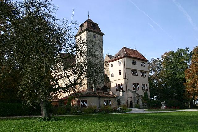

Muhr am See
- municipality of Germany
Muhr am See, located in Bavaria, Germany, is a picturesque destination that offers a variety of outdoor activities, including hiking. The area is characterized by its beautiful landscapes, tranquil lakes, and lush forests, making it an ideal place for nature enthusiasts....
- Country:

- Postal Code: 91735
- Local Dialing Code: 09831
- Licence Plate Code: WUG
- Coordinates: 49° 9' 16" N, 10° 43' 6" E


- GPS tracks (wikiloc): [Link]
- AboveSeaLevel: 422 м m
- Area: 10.95 sq km
- Population: 2223
- Web site: [Link]
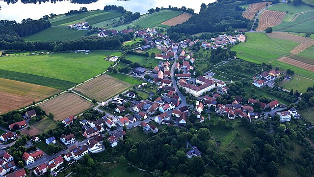

Absberg
- human settlement in Germany
Absberg is a charming village located in Bavaria, Germany, known for its proximity to beautiful natural landscapes, including the scenic Altmühl Valley. Hiking in and around Absberg offers a range of trails suitable for various skill levels, making it an excellent destination for both novice hikers and experienced outdoor enthusiasts....
- Country:

- Postal Code: 91720
- Local Dialing Code: 09175
- Licence Plate Code: WUG
- Coordinates: 49° 9' 0" N, 10° 53' 0" E


- GPS tracks (wikiloc): [Link]
- AboveSeaLevel: 476 м m
- Area: 18.98 sq km
- Population: 1179
- Web site: [Link]


Polsingen
- human settlement in Germany
Polsingen is a charming area located in the region of Bavaria, Germany. While it may not be one of the most popular hiking destinations compared to some of the larger national parks, it does offer a variety of scenic trails and opportunities for outdoor activities, making it suitable for hikers of different skill levels....
- Country:

- Postal Code: 91805
- Local Dialing Code: 09093
- Licence Plate Code: WUG
- Coordinates: 48° 56' 0" N, 10° 43' 0" E


- GPS tracks (wikiloc): [Link]
- AboveSeaLevel: 443 м m
- Area: 33.87 sq km
- Population: 1864
- Web site: [Link]


Weißenburg in Bayern
- town in Bavaria, Germany
 Hiking in Weißenburg in Bayern
Weißenburg in Bayern, located in the picturesque region of Bavaria, Germany, offers a wonderful variety of hiking opportunities for outdoor enthusiasts. Here are some key points about hiking in this area:...
- Country:

- Postal Code: 91781
- Local Dialing Code: 09141
- Licence Plate Code: WUG
- Coordinates: 49° 1' 50" N, 10° 58' 19" E


- GPS tracks (wikiloc): [Link]
- AboveSeaLevel: 422 м m
- Area: 97.55 sq km
- Population: 17976
- Web site: [Link]


Gunzenhausen
- town in Bavaria, Germany
Gunzenhausen is a charming town located in Bavaria, Germany, and serves as a gateway to some beautiful hiking opportunities, particularly around the Franconian Lake District (Fränkisches Seenland). Here’s what you can expect when hiking in and around Gunzenhausen:...
- Country:

- Postal Code: 91710
- Local Dialing Code: 09836; 09831
- Coordinates: 49° 6' 53" N, 10° 45' 15" E


- GPS tracks (wikiloc): [Link]
- AboveSeaLevel: 416 м m
- Area: 82.72 sq km
- Population: 16562
- Web site: [Link]


Pappenheim
- human settlement in Germany
Pappenheim, located in the picturesque region of Bavaria, Germany, offers a variety of hiking opportunities that cater to different skill levels. The area is known for its beautiful landscapes, rich history, and well-marked trails....
- Country:

- Postal Code: 91788
- Local Dialing Code: 09143
- Licence Plate Code: WUG
- Coordinates: 48° 56' 5" N, 10° 58' 28" E


- GPS tracks (wikiloc): [Link]
- AboveSeaLevel: 405 м m
- Area: 64.32 sq km
- Population: 4049
- Web site: [Link]
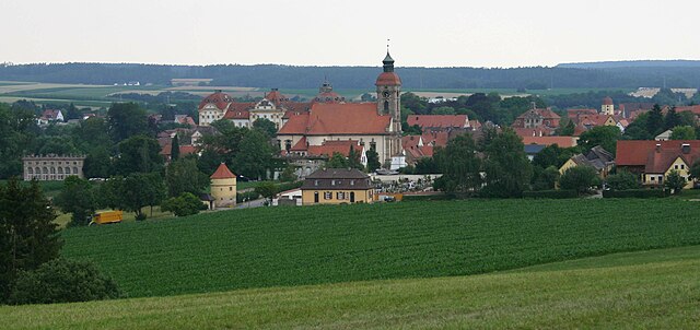

Ellingen
- human settlement in Germany
Ellingen is a picturesque village located in Bavaria, Germany, known for its beautiful landscapes and historical charm. Hiking in and around Ellingen offers a delightful experience for nature lovers and outdoor enthusiasts. Here are some highlights you can expect when hiking in this area:...
- Country:

- Postal Code: 91792
- Local Dialing Code: 09141
- Licence Plate Code: WUG
- Coordinates: 49° 3' 39" N, 10° 58' 4" E


- GPS tracks (wikiloc): [Link]
- AboveSeaLevel: 395 м m
- Area: 31.25 sq km
- Population: 3638
- Web site: [Link]


Theilenhofen
- municipality of Germany
Theilenhofen, located in Bavaria, Germany, offers beautiful scenic landscapes that are perfect for hiking enthusiasts. The region features a mix of natural beauty, charming villages, and a rich cultural heritage, making it a great destination for outdoor activities....
- Country:

- Postal Code: 91741
- Local Dialing Code: 09834
- Licence Plate Code: WUG
- Coordinates: 49° 5' 0" N, 10° 51' 0" E


- GPS tracks (wikiloc): [Link]
- AboveSeaLevel: 494 м m
- Area: 20.32 sq km
- Population: 1129
- Web site: [Link]


Höttingen
- municipality of Germany
Höttingen is a small village in Bavaria, Germany, situated near the Altmühl River and surrounded by picturesque landscapes that make it an appealing place for hiking and outdoor activities. While it might not be as widely known as larger towns, it offers some beautiful trails and scenery typical of the region....
- Country:

- Postal Code: 91798
- Local Dialing Code: 09141
- Licence Plate Code: WUG
- Coordinates: 49° 4' 0" N, 11° 1' 0" E


- GPS tracks (wikiloc): [Link]
- AboveSeaLevel: 430 м m
- Area: 19.26 sq km
- Population: 1148
- Web site: [Link]


Haundorf
- municipality of Germany
Haundorf, a quaint village located in the Bavarian region of Germany, offers a variety of hiking opportunities for outdoor enthusiasts. Here are some details to consider if you're planning a hike in the area:...
- Country:

- Postal Code: 91729
- Local Dialing Code: 09837
- Licence Plate Code: WUG
- Coordinates: 49° 11' 0" N, 10° 46' 0" E


- GPS tracks (wikiloc): [Link]
- AboveSeaLevel: 445 м m
- Area: 51.34 sq km
- Population: 1909
- Web site: [Link]


Westheim
- municipality of Germany
Westheim, located in Germany, is an area that typically offers a variety of outdoor activities including hiking. While it may not be as extensively covered as some of the more famous hiking regions in Germany, it possesses its own unique charm and natural beauty. Here are some aspects to consider if you're planning a hiking trip around Westheim:...
- Country:

- Postal Code: 91747
- Local Dialing Code: 09082
- Licence Plate Code: WUG
- Coordinates: 49° 0' 0" N, 10° 40' 0" E


- GPS tracks (wikiloc): [Link]
- AboveSeaLevel: 439 м m
- Area: 28.32 sq km
- Population: 1141
- Web site: [Link]


Meinheim
- municipality of Germany
Meinheim is a municipality located in the Middle Franconia region of Bavaria, Germany. While it may not be as widely known for hiking as larger national parks or mountainous areas, the region around Meinheim offers a number of picturesque trails that can provide a delightful experience for hikers....
- Country:

- Postal Code: 91802
- Local Dialing Code: 09146
- Licence Plate Code: WUG
- Coordinates: 49° 2' 0" N, 10° 49' 0" E


- GPS tracks (wikiloc): [Link]
- AboveSeaLevel: 433 м m
- Area: 16.36 sq km
- Population: 842
- Web site: [Link]


Burgsalach
- municipality of Germany
Burgsalach is a picturesque area located in Germany, often noted for its beautiful landscapes and hiking opportunities, especially surrounded by nature reserves and scenic trails. While I don't have specific updated trail information, here are some general insights and tips for hiking in that region:...
- Country:

- Postal Code: 91790
- Local Dialing Code: 09147
- Licence Plate Code: WUG
- Coordinates: 49° 2' 0" N, 11° 6' 0" E


- GPS tracks (wikiloc): [Link]
- AboveSeaLevel: 583 м m
- Area: 19.31 sq km
- Population: 1143
- Web site: [Link]


Pfofeld
- municipality of Germany
Pfofeld is a small village located in Bavaria, Germany, near the beautiful Altmühltal Natural Park. Although it might not be as well-known as some larger hiking destinations, it offers a range of trails suitable for various skill levels amid stunning natural scenery....
- Country:

- Postal Code: 91738
- Local Dialing Code: 09834
- Licence Plate Code: WUG
- Coordinates: 49° 7' 0" N, 10° 50' 0" E


- GPS tracks (wikiloc): [Link]
- AboveSeaLevel: 446 м m
- Area: 23.88 sq km
- Population: 1528
- Web site: [Link]


Nennslingen
- human settlement in Germany
Nennslingen is a small picturesque village in Bavaria, Germany, surrounded by beautiful nature that offers great hiking opportunities. The region is characterized by its rolling hills, lush forests, and well-marked trails that cater to various skill levels....
- Country:

- Postal Code: 91790
- Local Dialing Code: 09147
- Licence Plate Code: WUG
- Coordinates: 49° 3' 0" N, 11° 8' 0" E


- GPS tracks (wikiloc): [Link]
- AboveSeaLevel: 523 м m
- Area: 21.97 sq km
- Population: 1385
- Web site: [Link]


Markt Berolzheim
- human settlement in Germany
Markt Berolzheim, located in Bavaria, Germany, is a picturesque village that offers a range of outdoor activities, including hiking. The region is characterized by its beautiful landscapes, rolling hills, and scenic trails, making it an appealing destination for nature enthusiasts....
- Country:

- Postal Code: 91801
- Local Dialing Code: 09146
- Licence Plate Code: WUG
- Coordinates: 49° 1' 0" N, 10° 51' 0" E


- GPS tracks (wikiloc): [Link]
- AboveSeaLevel: 424 м m
- Area: 14.52 sq km
- Population: 1280
- Web site: [Link]


Ettenstatt
- municipality of Germany
Ettenstatt is a charming village located in the Altmühl Valley in Bavaria, Germany. This region is well-known for its beautiful landscapes, rich history, and diverse outdoor activities, including hiking....
- Country:

- Postal Code: 91796
- Local Dialing Code: 09148
- Licence Plate Code: WUG
- Coordinates: 49° 4' 59" N, 11° 3' 0" E


- GPS tracks (wikiloc): [Link]
- AboveSeaLevel: 440 м m
- Area: 15.84 sq km
- Population: 846
- Web site: [Link]

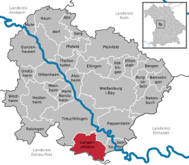
Langenaltheim
- municipality in Germany
Langenaltheim is a small village located in Bavaria, Germany, and is surrounded by beautiful natural landscapes, making it a great spot for hiking enthusiasts. The region features rolling hills, forests, and picturesque views of the surrounding countryside....
- Country:

- Postal Code: 91788; 91799
- Local Dialing Code: 09145
- Licence Plate Code: WUG
- Coordinates: 48° 54' 0" N, 10° 56' 0" E


- GPS tracks (wikiloc): [Link]
- AboveSeaLevel: 555 м m
- Area: 39.05 sq km
- Population: 2258
- Web site: [Link]
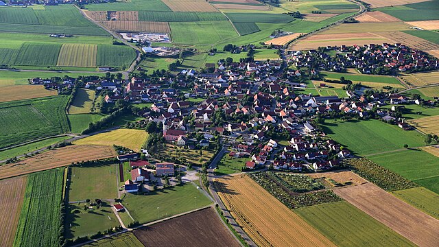

Gnotzheim
- human settlement in Germany
Gnotzheim is a small village in Bavaria, Germany, surrounded by picturesque landscapes that make it a wonderful spot for hiking enthusiasts. The region features a variety of trails that cater to different skill levels, from gentle walks suitable for families to more challenging hikes for experienced trekkers....
- Country:

- Postal Code: 91728
- Local Dialing Code: 09833
- Licence Plate Code: WUG
- Coordinates: 49° 4' 0" N, 10° 43' 0" E


- GPS tracks (wikiloc): [Link]
- AboveSeaLevel: 473 м m
- Area: 12.48 sq km
- Population: 834
- Web site: [Link]


Heidenheim
- town in the Weißenburg-Gunzenhausen district, Bavaria, Germany
Heidenheim, located in the heart of Bavaria, Germany, is a fantastic destination for hiking enthusiasts. The region offers a mix of scenic landscapes, including rolling hills, forests, and beautiful vistas that are perfect for various skill levels....
- Country:

- Postal Code: 91719
- Local Dialing Code: 09833
- Coordinates: 49° 1' 0" N, 10° 45' 0" E


- GPS tracks (wikiloc): [Link]
- AboveSeaLevel: 529 м m
- Area: 52.29 sq km
- Population: 2595
- Web site: [Link]


Bergen
- municipality in the Weißenburg-Gunzenhausen district, in Bavaria, Germany
Bergen, located in the Middle Franconia region of Germany, offers a variety of hiking opportunities for all levels of experience. The picturesque landscape is characterized by rolling hills, wooded areas, and charming rural vistas, making it an ideal spot for hiking enthusiasts....
- Country:

- Postal Code: 91790
- Local Dialing Code: 09148; 09147
- Licence Plate Code: WUG
- Coordinates: 49° 5' 0" N, 11° 7' 0" E


- GPS tracks (wikiloc): [Link]
- AboveSeaLevel: 540 м m
- Area: 19.91 sq km
- Population: 1082
- Web site: [Link]


Raitenbuch
- municipality of Germany
Raitenbuch is a picturesque village located in Bavaria, Germany, near the borders of the scenic Allgäu region. Hiking in and around Raitenbuch offers a range of trails, suitable for various skill levels, showcasing the natural beauty of the Bavarian countryside, including rolling hills, lush forests, and stunning views of the Alps....
- Country:

- Postal Code: 91790
- Local Dialing Code: 09147
- Licence Plate Code: WUG
- Coordinates: 49° 0' 53" N, 11° 7' 35" E


- GPS tracks (wikiloc): [Link]
- AboveSeaLevel: 559 м m
- Area: 38.2 sq km
- Population: 1206
- Web site: [Link]


Dittenheim
- municipality of Germany
Dittenheim is a charming village located in Bavaria, Germany, known for its picturesque landscapes and outdoor recreational opportunities. Hiking in and around Dittenheim can be a delightful experience, offering various trails and natural attractions....
- Country:

- Postal Code: 91723
- Local Dialing Code: 09834
- Licence Plate Code: WUG
- Coordinates: 49° 3' 0" N, 10° 48' 0" E


- GPS tracks (wikiloc): [Link]
- AboveSeaLevel: 437 м m
- Area: 29.34 sq km
- Population: 1643
- Web site: [Link]


Alesheim
- municipality of Germany
Alesheim, located in Bavaria, Germany, is surrounded by picturesque landscapes that are perfect for hiking enthusiasts. While it may not be as widely known as some of the larger national parks in Germany, it offers several beautiful trails and a chance to experience the serene nature of the region. Here are some notable aspects of hiking in the area:...
- Country:

- Postal Code: 91793
- Local Dialing Code: 09146
- Licence Plate Code: WUG
- Coordinates: 49° 3' 0" N, 10° 52' 0" E


- GPS tracks (wikiloc): [Link]
- AboveSeaLevel: 427 м m
- Area: 20.45 sq km
- Population: 949
- Web site: [Link]


Solnhofen
- municipality of Germany
Solnhofen is a small town located in Bavaria, Germany, known primarily for its stunning natural landscapes and historical significance, particularly regarding the famous Solnhofen limestone that has preserved many Jurassic fossils. Hiking in and around Solnhofen offers an array of beautiful routes, fascinating geological features, and pleasant scenery....
- Country:

- Postal Code: 91807
- Local Dialing Code: 09145
- Licence Plate Code: WUG
- Coordinates: 48° 53' 0" N, 11° 0' 0" E


- GPS tracks (wikiloc): [Link]
- AboveSeaLevel: 408 м m
- Area: 13.5 sq km
- Population: 1740
- Web site: [Link]
Shares border with regions:
Donau-Ries
- district in Bavaria, Germany
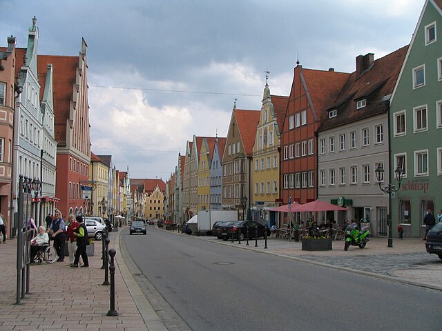
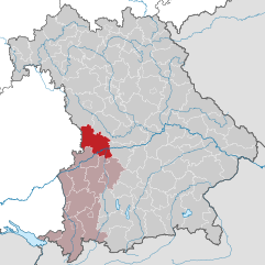
Donau-Ries is a beautiful region in Bavaria, Germany, known for its stunning landscapes, rich history, and cultural significance. Spanning both the Danube River and the Ries crater, this area offers diverse hiking opportunities for both beginners and more experienced trekkers....
- Country:

- Capital: Donauwörth
- Licence Plate Code: NÖ; DON
- Coordinates: 48° 49' 48" N, 10° 40' 12" E


- GPS tracks (wikiloc): [Link]
- AboveSeaLevel: 508 м m
- Area: 1275.00 sq km
- Population: 117483
- Web site: [Link]

Roth
- district in Bavaria, Germany
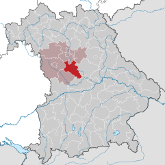
Roth district, located in Bavaria, Germany, offers a variety of beautiful landscapes and hiking opportunities that appeal to both novice and experienced hikers. The area is characterized by rolling hills, forests, and picturesque views. Here are some highlights and tips for hiking in Roth:...
- Country:

- Capital: Roth
- Licence Plate Code: RH; HIP
- Coordinates: 49° 15' 0" N, 11° 4' 48" E


- GPS tracks (wikiloc): [Link]
- AboveSeaLevel: 355 м m
- Area: 895.00 sq km
- Population: 103944
- Web site: [Link]


Ansbach
- district in Bavaria, Germany
Ansbach district, located in the region of Bavaria, Germany, offers a variety of hiking opportunities suitable for different skill levels. The region is characterized by its picturesque landscapes, including rolling hills, forests, and historical sites, making it a great destination for outdoor enthusiasts....
- Country:

- Capital: Ansbach
- Licence Plate Code: ROT; FEU; DKB; AN
- Coordinates: 49° 19' 48" N, 10° 30' 0" E


- GPS tracks (wikiloc): [Link]
- AboveSeaLevel: 426 м m
- Area: 1972.00 sq km
- Population: 157632
- Web site: [Link]
Eichstätt
- district of Bavaria, Germany
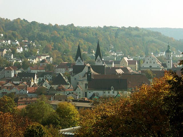
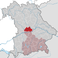
Eichstätt, located in Bavaria, Germany, is known for its scenic landscapes, historical towns, and rich natural beauty, making it a fantastic destination for hiking enthusiasts. Here are some highlights and tips for hiking in the Eichstätt district:...
- Country:

- Capital: Eichstätt
- Licence Plate Code: EI
- Coordinates: 48° 55' 12" N, 11° 19' 48" E


- GPS tracks (wikiloc): [Link]
- AboveSeaLevel: 475 м m
- Area: 1214.00 sq km
- Population: 97347
- Web site: [Link]
