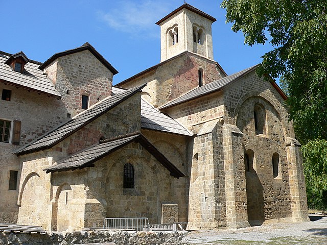
Puy-Sanières (Puy-Sanières)
- commune in Hautes-Alpes, France
 Hiking in Puy-Sanières
Puy-Sanières is a charming village located in the Hautes-Alpes region of France and offers stunning hiking opportunities in the surrounding areas. The region is characterized by its beautiful landscapes, including mountains, plateaus, and valleys, making it a great destination for outdoor enthusiasts.
Hiking Trails
-
Sentier des Crêtes: This trail offers breathtaking views of the surrounding peaks and valleys. It's moderately challenging and suitable for experienced hikers. Be prepared for some steep sections and rocky terrain.
-
Lac de l'Eychauda: A picturesque hike that takes you to a serene mountain lake. The trail is relatively easy and ideal for families, providing a perfect spot for a picnic by the water.
-
Col de la GUILLE: This is a more challenging hike that leads to a mountain pass, providing spectacular views over the region. Expect rocky paths and a significant elevation gain.
General Tips
- Weather: Be aware of the weather conditions, as they can change rapidly in the mountains. Always check forecasts before heading out.
- Gear: Make sure to wear sturdy hiking boots and bring layers of clothing. A good backpack with water, snacks, and a first aid kit is essential.
- Maps and Navigation: It's advisable to carry a detailed map of the area or use a reliable GPS app, as some trails may not be well-marked.
Best Times to Hike
The best time for hiking in Puy-Sanières is usually from late spring to early autumn, generally from May to October. Summer months can be busy, so early mornings are ideal for less crowded trails.
Local Culture
Take some time to enjoy the local culture and cuisine. The village has a rustic charm, with opportunities to taste traditional French alpine dishes.
Conclusion
Hiking in Puy-Sanières offers a wonderful opportunity to explore the natural beauty of the Hautes-Alpes region. Whether you are looking for easy walks or challenging mountain hikes, you'll find options to suit every level of experience. Happy hiking!
- Country:

- Postal Code: 05200
- Coordinates: 44° 33' 29" N, 6° 26' 3" E


- GPS tracks (wikiloc): [Link]
- Area: 11.38 sq km
- Population: 257
- Wikipedia en: wiki(en)
- Wikipedia: wiki(fr)
- Wikidata storage: Wikidata: Q1087594
- Wikipedia Commons Category: [Link]
- Freebase ID: [/m/03mfpl3]
- Freebase ID: [/m/03mfpl3]
- GeoNames ID: Alt: [6425614]
- GeoNames ID: Alt: [6425614]
- SIREN number: [210501110]
- SIREN number: [210501110]
- INSEE municipality code: 05111
- INSEE municipality code: 05111
Shares border with regions:
Crots
- commune in Hautes-Alpes, France
Hiking in Crots
Crots, located in the French Alps within the Hautes-Alpes department, is a beautiful destination for hiking enthusiasts. The area is known for its stunning landscapes, including mountains, valleys, and picturesque villages. If you're planning a hiking trip in Crots, here are some key points to consider:...
- Country:
- Postal Code: 05200
- Coordinates: 44° 32' 1" N, 6° 28' 16" E
- GPS tracks (wikiloc): [Link]
- AboveSeaLevel: 790 м m
- Area: 53.84 sq km
- Population: 1022
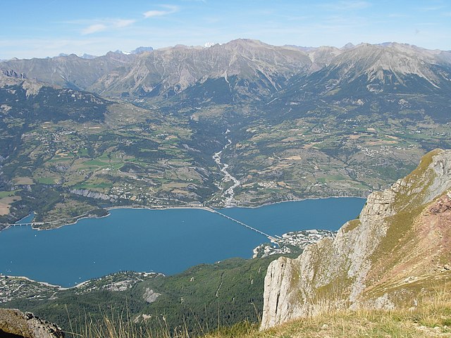
Savines-le-Lac
- commune in Hautes-Alpes, France
Hiking in Savines-le-Lac
Savines-le-Lac is a picturesque village located in the French Alps, near the Serre-Ponçon Lake in the Hautes-Alpes region. It's an excellent destination for hiking enthusiasts, offering a variety of trails that cater to different skill levels, with stunning views of the lake and surrounding mountains....
- Country:
- Postal Code: 05160
- Coordinates: 44° 31' 33" N, 6° 24' 18" E
- GPS tracks (wikiloc): [Link]
- AboveSeaLevel: 790 м m
- Area: 25.13 sq km
- Population: 1063
- Web site: [Link]

Embrun
- commune in Hautes-Alpes, France
Hiking in Embrun
Embrun, located in the Hautes-Alpes region of France, is a fantastic destination for hiking enthusiasts. Nestled in the French Alps, the area boasts stunning landscapes, diverse flora and fauna, and a variety of trails suitable for all skill levels....
- Country:
- Postal Code: 05200
- Coordinates: 44° 33' 54" N, 6° 29' 43" E
- GPS tracks (wikiloc): [Link]
- AboveSeaLevel: 1789 м m
- Area: 36.39 sq km
- Population: 6177
- Web site: [Link]

Puy-Saint-Eusèbe
- commune in Hautes-Alpes, France
Hiking in Puy-Saint-Eusèbe
Puy-Saint-Eusèbe is a charming destination for hiking enthusiasts, nestled in the region of Auvergne-Rhône-Alpes in southeastern France. The area is known for its stunning landscapes, characterized by rolling hills, deep valleys, and picturesque views of the surrounding mountains....
- Country:
- Postal Code: 05200
- Coordinates: 44° 34' 4" N, 6° 24' 4" E
- GPS tracks (wikiloc): [Link]
- Area: 11.31 sq km
- Population: 137