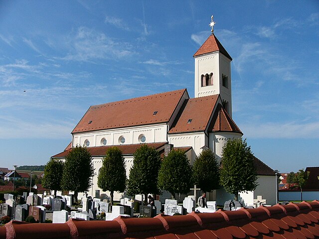
Rögling (Rögling)

- municipality of Germany
 Hiking in Rögling
Rögling is not widely recognized as a hiking destination, so it's possible you may be referring to a lesser-known area or a specific locality. If you meant Röglingen in Germany or another location, I'd be happy to provide general advice and insights about hiking in typical regions characterized by similar landscapes.
In many rural and picturesque regions in Germany or nearby areas, you can often find:
-
Scenic Trails: Many regions feature marked hiking trails that take you through forests, hills, and along rivers. Look for local trail maps or visitor centers for the best routes.
-
Natural Beauty: Expect beautiful landscapes, including scenic viewpoints, charming villages, and rich flora and fauna. Ideal for photography and enjoying nature.
-
Variety of Difficulty Levels: Trails may vary from easy walks to challenging hikes. Make sure to choose a trail that matches your fitness level.
-
Cultural Heritage: Hiking trails often pass by historical sites, old farms, and traditional architecture, providing a glimpse into the local culture and history.
-
Local Cuisine: If you hike in the region, consider stopping at local restaurants or family-run inns to enjoy traditional food, providing a nice break during your adventure.
If you have specific trails, landmarks, or parks in the Rögling area, feel free to specify, and I can provide more tailored information or tips!
- Country:

- Postal Code: 86703
- Local Dialing Code: 09094
- Licence Plate Code: DON
- Coordinates: 48° 51' 0" N, 10° 57' 0" E


- GPS tracks (wikiloc): [Link]
- AboveSeaLevel: 530 м m
- Area: 10.74 sq km
- Population: 676
- Web site: http://www.roegling.de
- Wikipedia en: wiki(en)
- Wikipedia: wiki(de)
- Wikidata storage: Wikidata: Q504128
- Wikipedia Commons Category: [Link]
- Freebase ID: [/m/02q1103]
- GeoNames ID: Alt: [6557297]
- VIAF ID: Alt: [240902630]
- OSM relation ID: [962648]
- GND ID: Alt: [4246510-2]
- Library of Congress authority ID: Alt: [n2014008169]
- Historical Gazetteer (GOV) ID: [ROGINGJN58LU]
- Bavarikon ID: [ODB_A00000860]
- German municipality key: 09779206
Shares border with regions:
Tagmersheim
- municipality of Germany
Hiking in Tagmersheim
Tagmersheim is a lovely village located in Bavaria, Germany, that offers a range of hiking opportunities for outdoor enthusiasts. Nestled in a picturesque landscape, it provides access to scenic trails that showcase the region’s natural beauty....
- Country:
- Postal Code: 86704
- Local Dialing Code: 09094
- Licence Plate Code: DON
- Coordinates: 48° 49' 0" N, 10° 58' 0" E
- GPS tracks (wikiloc): [Link]
- AboveSeaLevel: 500 м m
- Area: 15.94 sq km
- Population: 1025
- Web site: [Link]

Monheim
- municipality in Bavaria, Germany
Hiking in Monheim
Monheim, located in Bavaria, Germany, is a charming small town that offers various outdoor activities, including hiking. The region surrounding Monheim is characterized by beautiful landscapes, rolling hills, and lush forests, making it a great destination for nature enthusiasts....
- Country:
- Postal Code: 86653
- Local Dialing Code: 09091
- Licence Plate Code: DON
- Coordinates: 48° 50' 0" N, 10° 50' 0" E
- GPS tracks (wikiloc): [Link]
- AboveSeaLevel: 495 м m
- Area: 69.35 sq km
- Population: 4123
- Web site: [Link]


Mörnsheim
- municipality of Germany
Hiking in Mörnsheim
Mörnsheim is a small town located in thebeautiful Altmühltal region of Bavaria, Germany, known for its stunning landscapes, rich history, and excellent hiking opportunities. The area is characterized by limestone hills, deep valleys, and the picturesque Altmühl River, making it a perfect destination for outdoor enthusiasts....
- Country:
- Postal Code: 91804
- Local Dialing Code: 09145
- Licence Plate Code: EI
- Coordinates: 48° 52' 59" N, 11° 0' 0" E
- GPS tracks (wikiloc): [Link]
- AboveSeaLevel: 408 м m
- Area: 33.48 sq km
- Population: 1862
- Web site: [Link]