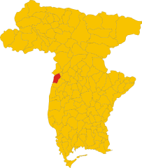
Ragogna (Ragogna)
- Italian comune
Ragogna is a lovely location situated in the Friuli Venezia Giulia region of northeastern Italy. Nestled in the foothills of the Alps, it offers stunning landscapes and a variety of hiking opportunities. Here are some key points to consider when planning a hike in Ragogna:
Trails and Scenic Routes
-
Natural Trails: There are several trails that vary in difficulty, making the area suitable for beginners and experienced hikers alike. The terrain typically includes hills, forests, and some rocky spots, providing a rewarding challenge.
-
Cultural and Historical Aspects: Hiking in Ragogna not only allows you to enjoy nature but also provides an opportunity to encounter historical sites such as medieval castles and ancient churches along some trails.
-
Scenic Views: The region is characterized by beautiful landscapes featuring vineyards, picturesque valleys, and the distant Alpine peaks. Be sure to take the time to enjoy the panoramic views along the way.
Recommended Hikes
-
Ragogna to Castelnuovo: This is a popular hike where you can explore beautiful hills and rural scenery. The trail often takes you past local vineyards.
-
Nature Reserves: Consider exploring surrounding nature reserves where you can witness diverse flora and fauna.
Preparation
-
Maps and Guides: It's advisable to carry a detailed map or a guidebook, as some trails may not be well-marked.
-
Weather Considerations: Check the weather conditions before heading out, as mountain weather can change rapidly.
-
Packing Essentials: Bring enough water, snacks, and a first aid kit. Good hiking boots and weather-appropriate clothing are essential for comfort and safety.
Local Culture
Don’t miss the chance to enjoy the local culture after your hike. Ragogna and nearby areas offer excellent local cuisine, particularly dishes featuring local cheeses, cured meats, and wines.
Safety Tips
- Hike with a Buddy: It's generally safer to hike with a partner, especially on more remote trails.
- Inform Someone: Always let someone know your hiking plans and expected return time.
Hiking in Ragogna can be an unforgettable experience, combining the beauty of nature with historical and cultural discovery. Enjoy your adventure!
- Country:

- Postal Code: 33030
- Local Dialing Code: 0432
- Licence Plate Code: UD
- Coordinates: 46° 11' 18" N, 12° 59' 42" E


- GPS tracks (wikiloc): [Link]
- AboveSeaLevel: 235 м m
- Area: 22.03 sq km
- Population: 2858
- Web site: http://www.comune.ragogna.ud.it/
- Wikipedia en: wiki(en)
- Wikipedia: wiki(it)
- Wikidata storage: Wikidata: Q53327
- Wikipedia Commons Gallery: [Link]
- Wikipedia Commons Category: [Link]
- Freebase ID: [/m/0gk9vf]
- GeoNames ID: Alt: [6536252]
- VIAF ID: Alt: [237467407]
- OSM relation ID: [79146]
- UN/LOCODE: [ITRGB]
- Digital Atlas of the Roman Empire ID: [16545]
- Pleiades ID: [187528]
- ISTAT ID: 030087
- Italian cadastre code: H161
Shares border with regions:


Pinzano al Tagliamento
- Italian comune
 Hiking in Pinzano al Tagliamento
Pinzano al Tagliamento, located in the Friuli Venezia Giulia region of northeastern Italy, is an excellent destination for hiking enthusiasts. The area is characterized by its stunning natural landscapes, including rolling hills, the Tagliamento River, and lush forests....
- Country:

- Postal Code: 33094
- Local Dialing Code: 0432
- Licence Plate Code: PN
- Coordinates: 46° 10' 59" N, 12° 56' 43" E


- GPS tracks (wikiloc): [Link]
- AboveSeaLevel: 201 м m
- Area: 21.95 sq km
- Population: 1514
- Web site: [Link]


Forgaria nel Friuli
- Italian comune
Forgaria nel Friuli is a picturesque town located in the Friuli-Venezia Giulia region of Italy. Nestled near the eastern foothills of the Carnic Alps, it offers a range of hiking opportunities suitable for various skill levels. Here are some highlights of hiking in this area:...
- Country:

- Postal Code: 33030
- Local Dialing Code: 0427
- Licence Plate Code: UD
- Coordinates: 46° 13' 0" N, 12° 58' 0" E


- GPS tracks (wikiloc): [Link]
- AboveSeaLevel: 270 м m
- Area: 28.94 sq km
- Population: 1773
- Web site: [Link]


San Daniele del Friuli
- Italian comune
 Hiking in San Daniele del Friuli
San Daniele del Friuli, located in the Friuli Venezia Giulia region of northeastern Italy, is known not only for its famous prosciutto but also for its picturesque landscapes and hiking opportunities. The area is characterized by rolling hills, vineyards, and lush countryside, making it an appealing destination for hiking enthusiasts....
- Country:

- Postal Code: 33038
- Local Dialing Code: 0432
- Licence Plate Code: UD
- Coordinates: 46° 9' 0" N, 13° 1' 0" E


- GPS tracks (wikiloc): [Link]
- AboveSeaLevel: 252 м m
- Area: 34.78 sq km
- Population: 7987
- Web site: [Link]
