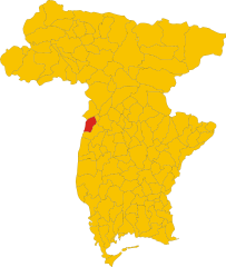
San Daniele del Friuli (San Daniele del Friuli)
.svg)
- Italian comune
 Hiking in San Daniele del Friuli
San Daniele del Friuli, located in the Friuli Venezia Giulia region of northeastern Italy, is known not only for its famous prosciutto but also for its picturesque landscapes and hiking opportunities. The area is characterized by rolling hills, vineyards, and lush countryside, making it an appealing destination for hiking enthusiasts.
Hiking Trails and Natural Features
-
Colli del Friuli: The hills surrounding San Daniele offer various trails that range in difficulty. The Colli del Friuli, in particular, provides splendid views of the Friuli plains and is dotted with vineyards. Trails here often vary from easy walks to more challenging hikes.
-
Cansiglio Forest: Not far from San Daniele, this vast forest area features a network of trails that allow hikers to experience dense forests, diverse flora, and wildlife. The forest is one of the largest in Italy and perfect for those looking for a longer trek.
-
Monte Nero: This peak offers a more challenging hike and rewards visitors with stunning panoramic views of the surrounding region, including glimpses of the Alps on clear days.
-
Ethnographic Trails: Some trails feature aspects of local culture, leading you through small villages and past historical landmarks. This can provide a great way to combine hiking with cultural exploration.
Tips for Hiking in the Area
-
Preparation: Make sure to wear appropriate hiking gear, including sturdy footwear and weather-appropriate clothing. Check trail conditions and maps before heading out.
-
Local Guidance: Consider joining a guided hike, especially if you're unfamiliar with the area. Local guides can provide insights into the culture and ecology of the region.
-
Hydration and Snacks: Bring plenty of water and snacks, particularly if you're planning to hike for extended periods.
-
Respect Nature: Practice Leave No Trace principles to keep the trails and natural surroundings pristine.
Best Time to Hike
-
Spring and Fall: These seasons are particularly beautiful for hiking, with mild temperatures and vibrant colors. Wildflowers bloom in spring, and the fall brings stunning foliage.
-
Summer: While hiking is popular in the summer, it can get quite warm, so plan for early morning or late afternoon hikes to avoid the heat.
-
Winter: Though not typical for hiking, some trails may be suitable for snowshoeing or winter hiking, but always check conditions and prepare accordingly.
Conclusion
San Daniele del Friuli offers a delightful mix of natural beauty and cultural richness that is perfect for hikers of all levels. Whether you're looking for a leisurely stroll through vineyards or a more challenging trek in the hills, the area has something to offer. Enjoy exploring this scenic part of Italy!
- Country:

- Postal Code: 33038
- Local Dialing Code: 0432
- Licence Plate Code: UD
- Coordinates: 46° 9' 0" N, 13° 1' 0" E


- GPS tracks (wikiloc): [Link]
- AboveSeaLevel: 252 м m
- Area: 34.78 sq km
- Population: 7987
- Web site: http://www.comune.sandanieledelfriuli.ud.it/
- Wikipedia en: wiki(en)
- Wikipedia: wiki(it)
- Wikidata storage: Wikidata: Q53354
- Wikipedia Commons Gallery: [Link]
- Wikipedia Commons Category: [Link]
- Freebase ID: [/m/0gkb0n]
- GeoNames ID: Alt: [6538391]
- VIAF ID: Alt: [123799316]
- OSM relation ID: [79100]
- archINFORM location ID: [12147]
- MusicBrainz area ID: [16a40f72-73cd-4e53-8ede-1b1b283e8f85]
- UN/LOCODE: [ITSDF]
- Facebook Places ID: [109566082395937]
- Digital Atlas of the Roman Empire ID: [43373]
- ISTAT ID: 030099
- Italian cadastre code: H816
Shares border with regions:


Pinzano al Tagliamento
- Italian comune
Hiking in Pinzano al Tagliamento
Pinzano al Tagliamento, located in the Friuli Venezia Giulia region of northeastern Italy, is an excellent destination for hiking enthusiasts. The area is characterized by its stunning natural landscapes, including rolling hills, the Tagliamento River, and lush forests....
- Country:
- Postal Code: 33094
- Local Dialing Code: 0432
- Licence Plate Code: PN
- Coordinates: 46° 10' 59" N, 12° 56' 43" E
- GPS tracks (wikiloc): [Link]
- AboveSeaLevel: 201 м m
- Area: 21.95 sq km
- Population: 1514
- Web site: [Link]


Spilimbergo
- Italian comune
Hiking in Spilimbergo
Spilimbergo, a charming town in the Friuli Venezia Giulia region of Italy, is surrounded by beautiful landscapes that offer numerous hiking opportunities. The area is rich in natural beauty, including rolling hills, vineyards, and the nearby Alps, making it an excellent destination for outdoor enthusiasts. Here are some key points to consider when planning a hiking trip in Spilimbergo:...
- Country:
- Postal Code: 33097
- Local Dialing Code: 0427
- Licence Plate Code: PN
- Coordinates: 46° 6' 41" N, 12° 54' 6" E
- GPS tracks (wikiloc): [Link]
- AboveSeaLevel: 132 м m
- Area: 71.88 sq km
- Population: 12151
- Web site: [Link]
Dignano
- Italian comune
Hiking in Dignano
Dignano, also known as Dignano di Dignano, is a small town located in the Istria region of Croatia, surrounded by beautiful landscapes and scenic trails. While it may not be as widely known as other hiking destinations in Croatia, it offers an authentic experience for those interested in exploring the natural beauty of the Istrian countryside....
- Country:
- Postal Code: 33030
- Local Dialing Code: 0432
- Licence Plate Code: UD
- Coordinates: 46° 5' 0" N, 12° 56' 0" E
- GPS tracks (wikiloc): [Link]
- AboveSeaLevel: 110 м m
- Area: 27.54 sq km
- Population: 2302
- Web site: [Link]


Forgaria nel Friuli
- Italian comune
Hiking in Forgaria nel Friuli
Forgaria nel Friuli is a picturesque town located in the Friuli-Venezia Giulia region of Italy. Nestled near the eastern foothills of the Carnic Alps, it offers a range of hiking opportunities suitable for various skill levels. Here are some highlights of hiking in this area:...
- Country:
- Postal Code: 33030
- Local Dialing Code: 0427
- Licence Plate Code: UD
- Coordinates: 46° 13' 0" N, 12° 58' 0" E
- GPS tracks (wikiloc): [Link]
- AboveSeaLevel: 270 м m
- Area: 28.94 sq km
- Population: 1773
- Web site: [Link]
Majano
- Italian comune
Hiking in Majano
Majano, a charming town in the Friuli Venezia Giulia region of northeastern Italy, offers a variety of hiking opportunities that showcase its beautiful landscapes, historic sites, and rich cultural heritage. Here are some key points to consider when planning a hiking trip in Majano and its surroundings:...
- Country:
- Postal Code: 33030
- Local Dialing Code: 0432
- Licence Plate Code: UD
- Coordinates: 46° 11' 0" N, 13° 4' 0" E
- GPS tracks (wikiloc): [Link]
- AboveSeaLevel: 170 м m
- Area: 28.28 sq km
- Population: 5932
- Web site: [Link]


Osoppo
- Italian comune
Hiking in Osoppo
Osoppo is a small town located in the Friuli Venezia Giulia region of northern Italy, surrounded by beautiful landscapes and a rich mix of natural and historical features. It offers various hiking opportunities that cater to different experience levels. Here are some key points about hiking in and around Osoppo:...
- Country:
- Postal Code: 33010
- Local Dialing Code: 0432
- Licence Plate Code: UD
- Coordinates: 46° 15' 0" N, 13° 5' 0" E
- GPS tracks (wikiloc): [Link]
- AboveSeaLevel: 185 м m
- Area: 22.4 sq km
- Population: 2865
- Web site: [Link]

Ragogna
- Italian comune
Hiking in Ragogna
Ragogna is a lovely location situated in the Friuli Venezia Giulia region of northeastern Italy. Nestled in the foothills of the Alps, it offers stunning landscapes and a variety of hiking opportunities. Here are some key points to consider when planning a hike in Ragogna:...
- Country:
- Postal Code: 33030
- Local Dialing Code: 0432
- Licence Plate Code: UD
- Coordinates: 46° 11' 18" N, 12° 59' 42" E
- GPS tracks (wikiloc): [Link]
- AboveSeaLevel: 235 м m
- Area: 22.03 sq km
- Population: 2858
- Web site: [Link]
Rive d'Arcano
- Italian comune
Hiking in Rive d'Arcano
Rive d'Arcano, located in the Friuli Venezia Giulia region of Italy, offers a variety of landscapes and hiking opportunities. The area is characterized by its picturesque hills, lush vineyards, and views of the surrounding mountains, making it an appealing destination for hikers of all skill levels....
- Country:
- Postal Code: 33030
- Local Dialing Code: 0432
- Licence Plate Code: UD
- Coordinates: 46° 8' 0" N, 13° 2' 0" E
- GPS tracks (wikiloc): [Link]
- AboveSeaLevel: 175 м m
- Area: 22.57 sq km
- Population: 2467
- Web site: [Link]