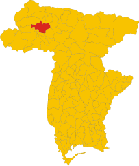
Ravascletto (Ravascletto)
.svg)
- place and commune in Italy
 Hiking in Ravascletto
Ravascletto, located in the Friuli Venezia Giulia region of Italy, is a beautiful destination for hiking enthusiasts. Nestled within the Carnic Alps, it offers a range of hiking trails that cater to various skill levels, making it an ideal spot for both beginners and experienced hikers.
Highlights of Hiking in Ravascletto:
-
Diverse Trails: The area around Ravascletto boasts a mix of paths, from leisurely walks to challenging mountain hikes. You can explore forested areas, alpine meadows, and rugged mountain terrain.
-
Scenic Views: Many trails offer breathtaking views of the surrounding mountains, valleys, and unspoiled natural landscapes. The panoramic views from the summits are particularly rewarding.
-
Wildlife and Flora: The region is home to diverse wildlife, and hikers might encounter various species of birds and other animals. The flora is equally rich, with many alpine flowers blooming in the spring and summer.
-
Access to the Sella Nevea and Zoncolan Mountains: Hikers can access the Sella Nevea and Monte Zoncolan areas, known for their spectacular trails and challenging routes, including ascendable paths that lead to higher altitudes.
-
Hiking Seasons: The best time for hiking in Ravascletto is typically from late spring to early autumn (May to October). However, some trails can be explored in winter for snowshoeing, offering a completely different experience.
-
Local Culture and Cuisine: After a day on the trails, you can enjoy the local culture, sample traditional Friulian dishes, and relax in the charming village environment.
-
Guided Tours: For those unfamiliar with the area or wishing to learn more about the local ecology and history, guided hiking tours are available. Local guides can enhance your experience by providing insights into the region.
Recommendations:
- Stay Hydrated and Prepared: Always carry enough water, snacks, a map or GPS, and appropriate gear for changing weather conditions.
- Respect Nature: Follow the Leave No Trace principles to preserve the beauty of the alpine environment.
- Check Trail Conditions: Before heading out, check the current conditions of the trails and any advisories.
Overall, hiking in Ravascletto offers an exceptional experience for nature lovers and adventure seekers alike. Whether you’re looking for a peaceful walk or a demanding climb, you’ll find routes that suit your preferences.
- Country:

- Postal Code: 33020
- Local Dialing Code: 0433
- Licence Plate Code: UD
- Coordinates: 46° 32' 0" N, 12° 55' 0" E


- GPS tracks (wikiloc): [Link]
- AboveSeaLevel: 952 м m
- Area: 26.48 sq km
- Population: 530
- Web site: http://www.comune.ravascletto.ud.it
- Wikipedia en: wiki(en)
- Wikipedia: wiki(it)
- Wikidata storage: Wikidata: Q53328
- Wikipedia Commons Category: [Link]
- Freebase ID: [/m/0gk9vt]
- GeoNames ID: Alt: [6538387]
- OSM relation ID: [79251]
- MusicBrainz area ID: [ca30bf2c-94ee-4c55-9ebb-5b715e4a00e6]
- ISTAT ID: 030088
- Italian cadastre code: H196
Shares border with regions:
Cercivento
- Italian comune
Hiking in Cercivento
Cercivento is a picturesque village located in the Friuli Venezia Giulia region of northeastern Italy, surrounded by stunning landscapes that offer a variety of hiking opportunities. The area is characterized by its beautiful mountains, rolling hills, and rich biodiversity....
- Country:
- Postal Code: 33020
- Local Dialing Code: 0433
- Licence Plate Code: UD
- Coordinates: 46° 32' 0" N, 12° 59' 0" E
- GPS tracks (wikiloc): [Link]
- AboveSeaLevel: 607 м m
- Area: 15.78 sq km
- Population: 672
- Web site: [Link]


Comeglians
- Italian comune
Hiking in Comeglians
Comeglians is a charming village located in the Friuli Venezia Giulia region of northeastern Italy, nestled in the heart of the Carnic Alps. The area is ideal for hiking enthusiasts, offering a variety of trails that cater to different skill levels and preferences. Here’s a breakdown of what you can expect when hiking in Comeglians:...
- Country:
- Postal Code: 33023
- Local Dialing Code: 0433
- Licence Plate Code: UD
- Coordinates: 46° 31' 0" N, 12° 53' 0" E
- GPS tracks (wikiloc): [Link]
- AboveSeaLevel: 553 м m
- Area: 19.41 sq km
- Population: 491
- Web site: [Link]

Ovaro
- Italian comune
Hiking in Ovaro
Ovaro is a beautiful town located in the Friuli Venezia Giulia region of northeastern Italy. It's situated in the Carnic Alps and is surrounded by stunning natural landscapes, making it a great destination for hiking enthusiasts. Here are some key points to consider when hiking in and around Ovaro:...
- Country:
- Postal Code: 33025
- Local Dialing Code: 0433
- Licence Plate Code: UD
- Coordinates: 46° 29' 0" N, 12° 52' 0" E
- GPS tracks (wikiloc): [Link]
- AboveSeaLevel: 525 м m
- Area: 57.9 sq km
- Population: 1875
- Web site: [Link]


Paluzza
- Italian comune
Hiking in Paluzza
Paluzza is a charming town situated in the Friuli Venezia Giulia region of northeastern Italy, surrounded by the stunning features of the Carnic Alps. Hiking in Paluzza offers a wide variety of trails suitable for different skill levels, making it a great destination for both beginners and experienced hikers....
- Country:
- Postal Code: 33026
- Local Dialing Code: 0433
- Licence Plate Code: UD
- Coordinates: 46° 32' 0" N, 13° 1' 0" E
- GPS tracks (wikiloc): [Link]
- AboveSeaLevel: 605 м m
- Area: 69.75 sq km
- Population: 2158
- Web site: [Link]


Sutrio
- Italian comune
Hiking in Sutrio
Sutrio is a charming village located in the Friuli Venezia Giulia region of northeastern Italy, and it's known for its stunning natural landscapes and rich cultural heritage. Hiking in this area can be a delightful experience, as it offers a variety of trails suitable for different skill levels....
- Country:
- Postal Code: 33020
- Local Dialing Code: 0433
- Licence Plate Code: UD
- Coordinates: 46° 30' 50" N, 12° 59' 25" E
- GPS tracks (wikiloc): [Link]
- AboveSeaLevel: 565 м m
- Area: 20.75 sq km
- Population: 1296
- Web site: [Link]