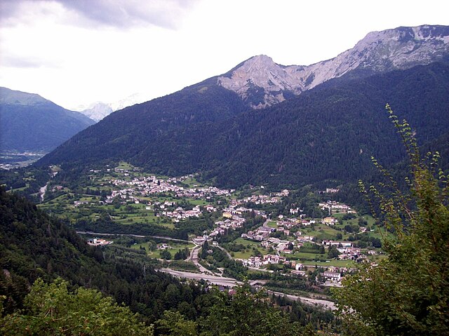
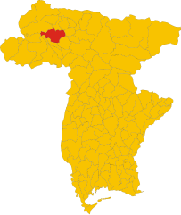
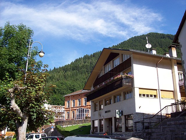
Sutrio (Sutrio)
.svg)
- Italian comune
 Hiking in Sutrio
Sutrio is a charming village located in the Friuli Venezia Giulia region of northeastern Italy, and it's known for its stunning natural landscapes and rich cultural heritage. Hiking in this area can be a delightful experience, as it offers a variety of trails suitable for different skill levels.
Popular Hiking Trails:
-
Trail to Monte Muro: This is a popular scenic hike that offers panoramic views of the surrounding valleys and mountains. The trail is well-marked and showcases the beautiful flora and fauna of the region.
-
Sella Chianzutan: A slightly more challenging hike, this route takes you through lush woodlands and alpine meadows, leading you to Sella Chianzutan, where you can enjoy breathtaking views of the Carnic Alps.
-
Valle del Fella: This area has several hiking paths that traverse along the river, offering opportunities for both leisurely walks and more strenuous hikes. The valley is known for its peaceful atmosphere and picturesque landscapes.
-
Alpe di Priu: For those looking for a more off-the-beaten-path experience, the trails around Alpe di Priu offer rugged terrain and fewer crowds, ideal for adventurers seeking solitude in nature.
Tips for Hiking in Sutrio:
- Proper Gear: Make sure to wear appropriate hiking shoes and carry a good backpack with water, snacks, a first-aid kit, and a map or GPS device.
- Weather Considerations: The weather can change rapidly in mountainous areas. Always check the forecast before you venture out and be prepared for different weather conditions.
- Take Your Time: Whether you’re an experienced hiker or a beginner, allow yourself to enjoy the scenery and take breaks as needed.
- Respect Nature: Follow local guidelines regarding wildlife, flora, and fauna. Stay on marked trails to minimize your impact on the environment.
- Local Guidance: Consider hiring a local guide if you want to explore more remote areas or learn about the local flora, fauna, and culture.
Cultural Factors:
Sutrio is known for its traditional architecture and crafts, particularly wood carving. After a day of hiking, take time to explore the village, enjoy local cuisine, and perhaps visit one of the workshops showcasing local craftsmanship.
Overall, hiking in Sutrio can be a rewarding experience with its combination of stunning natural beauty and cultural richness. Be sure to soak in the views and enjoy the tranquility of the great outdoors!
- Country:

- Postal Code: 33020
- Local Dialing Code: 0433
- Licence Plate Code: UD
- Coordinates: 46° 30' 50" N, 12° 59' 25" E


- GPS tracks (wikiloc): [Link]
- AboveSeaLevel: 565 м m
- Area: 20.75 sq km
- Population: 1296
- Web site: http://www.comune.sutrio.ud.it/
- Wikipedia en: wiki(en)
- Wikipedia: wiki(it)
- Wikidata storage: Wikidata: Q53368
- Wikipedia Commons Category: [Link]
- Freebase ID: [/m/0gkbd_]
- GeoNames ID: Alt: [6538394]
- VIAF ID: Alt: [238612831]
- OSM relation ID: [79179]
- archINFORM location ID: [1118]
- WOEID: [20144948]
- Digital Atlas of the Roman Empire ID: [13965]
- Pleiades ID: [187564]
- ISTAT ID: 030112
- Italian cadastre code: L018
Shares border with regions:

Arta Terme
- Italian comune
Hiking in Arta Terme
Arta Terme, located in the Friuli Venezia Giulia region of northeastern Italy, is a beautiful destination for hiking enthusiasts. This picturesque area is surrounded by the Carnic Alps and offers a range of trails suitable for all levels, from beginners to experienced hikers....
- Country:
- Postal Code: 33022
- Local Dialing Code: 0433
- Licence Plate Code: UD
- Coordinates: 46° 29' 0" N, 13° 1' 0" E
- GPS tracks (wikiloc): [Link]
- AboveSeaLevel: 422 м m
- Area: 42.77 sq km
- Population: 2076
- Web site: [Link]
Cercivento
- Italian comune
Hiking in Cercivento
Cercivento is a picturesque village located in the Friuli Venezia Giulia region of northeastern Italy, surrounded by stunning landscapes that offer a variety of hiking opportunities. The area is characterized by its beautiful mountains, rolling hills, and rich biodiversity....
- Country:
- Postal Code: 33020
- Local Dialing Code: 0433
- Licence Plate Code: UD
- Coordinates: 46° 32' 0" N, 12° 59' 0" E
- GPS tracks (wikiloc): [Link]
- AboveSeaLevel: 607 м m
- Area: 15.78 sq km
- Population: 672
- Web site: [Link]


Lauco
- Italian comune
Hiking in Lauco
Lauco, a beautiful area located in the Friuli Venezia Giulia region of northeastern Italy, is known for its stunning landscapes, rich biodiversity, and scenic trails. Here are some key points to consider if you’re planning to hike in Lauco:...
- Country:
- Postal Code: 33029
- Local Dialing Code: 0433
- Licence Plate Code: UD
- Coordinates: 46° 25' 0" N, 12° 56' 0" E
- GPS tracks (wikiloc): [Link]
- AboveSeaLevel: 719 м m
- Area: 34.76 sq km
- Population: 726
- Web site: [Link]

Ovaro
- Italian comune
Hiking in Ovaro
Ovaro is a beautiful town located in the Friuli Venezia Giulia region of northeastern Italy. It's situated in the Carnic Alps and is surrounded by stunning natural landscapes, making it a great destination for hiking enthusiasts. Here are some key points to consider when hiking in and around Ovaro:...
- Country:
- Postal Code: 33025
- Local Dialing Code: 0433
- Licence Plate Code: UD
- Coordinates: 46° 29' 0" N, 12° 52' 0" E
- GPS tracks (wikiloc): [Link]
- AboveSeaLevel: 525 м m
- Area: 57.9 sq km
- Population: 1875
- Web site: [Link]


Paluzza
- Italian comune
Hiking in Paluzza
Paluzza is a charming town situated in the Friuli Venezia Giulia region of northeastern Italy, surrounded by the stunning features of the Carnic Alps. Hiking in Paluzza offers a wide variety of trails suitable for different skill levels, making it a great destination for both beginners and experienced hikers....
- Country:
- Postal Code: 33026
- Local Dialing Code: 0433
- Licence Plate Code: UD
- Coordinates: 46° 32' 0" N, 13° 1' 0" E
- GPS tracks (wikiloc): [Link]
- AboveSeaLevel: 605 м m
- Area: 69.75 sq km
- Population: 2158
- Web site: [Link]

Ravascletto
- place and commune in Italy
Hiking in Ravascletto
Ravascletto, located in the Friuli Venezia Giulia region of Italy, is a beautiful destination for hiking enthusiasts. Nestled within the Carnic Alps, it offers a range of hiking trails that cater to various skill levels, making it an ideal spot for both beginners and experienced hikers....
- Country:
- Postal Code: 33020
- Local Dialing Code: 0433
- Licence Plate Code: UD
- Coordinates: 46° 32' 0" N, 12° 55' 0" E
- GPS tracks (wikiloc): [Link]
- AboveSeaLevel: 952 м m
- Area: 26.48 sq km
- Population: 530
- Web site: [Link]


Zuglio
- Italian comune
Hiking in Zuglio
Zuglio, located in the Friuli Venezia Giulia region of Italy, is a charming destination for hiking enthusiasts. This area is steeped in history and natural beauty, making it a perfect spot for both leisurely walks and more challenging hikes....
- Country:
- Postal Code: 33020
- Local Dialing Code: 0433
- Licence Plate Code: UD
- Coordinates: 46° 27' 44" N, 13° 1' 30" E
- GPS tracks (wikiloc): [Link]
- AboveSeaLevel: 425 м m
- Area: 18.21 sq km
- Population: 583
- Web site: [Link]