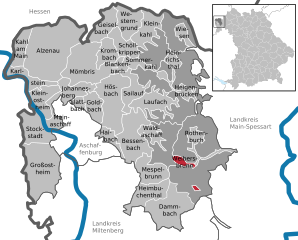
Rothenbucher Forst (Rothenbucher Forst)

- unincorporated area in Germany
 Hiking in Rothenbucher Forst
Rothenbucher Forst is a beautiful forest area located in Bavaria, Germany, known for its lush landscapes and diverse ecosystems. It offers a variety of hiking trails suitable for different skill levels, making it a great destination for both beginners and experienced hikers. Here are some highlights and tips for hiking in Rothenbucher Forst:
Trails
- Scenic Routes: The area features well-marked trails that wind through dense woodlands, alongside streams, and offer breathtaking views of the surrounding landscapes.
- Difficulty Levels: Trails range from easy loops perfect for families to more challenging paths for seasoned hikers.
- Length: Hikes can vary in length; some shorter routes are suitable for a quick day out, while longer trails can provide a more immersive experience in nature.
Nature & Wildlife
- Flora and Fauna: The forest is rich in biodiversity, with numerous plant species and wildlife. Keep an eye out for deer, birds, and other local wildlife.
- Seasonal Beauty: Each season brings a different charm to Rothenbucher Forst. Spring and summer are vibrant with greenery, while autumn offers stunning foliage.
Tips for Hiking
- Preparation: Always check the weather and trail conditions before heading out. Bring enough water and snacks, and wear appropriate footwear.
- Navigation: Though trails are generally well-marked, having a map or a GPS device can be helpful, especially for longer hikes.
- Respect Nature: Stay on marked paths to protect the ecosystem and minimize your impact. Carry out any trash you bring in.
- Safety: Inform someone about your hiking plans, especially if you’re going on a remote trail.
Attractions Nearby
- After a day of hiking, consider visiting nearby towns for a taste of local culture, food, and history.
- Look for local services such as guided tours or information centers, which can provide insights into the best hiking spots and tips.
Conclusion
Hiking in Rothenbucher Forst can be a rewarding experience filled with natural beauty, tranquility, and adventure. Plan your visit according to your hiking preferences, and ensure to embrace the beauty of this wonderful forest. Happy hiking!
- Country:

- Coordinates: 49° 58' 42" N, 9° 25' 7" E


- GPS tracks (wikiloc): [Link]
- Wikidata storage: Wikidata: Q964615
- Wikipedia Commons Category: [Link]
- OSM relation ID: [534766]
Shares border with regions:
Forst Lohrerstraße
- unincorporated area in Germany
Hiking in Forst Lohrerstraße
Forst Lohrerstraße is located in the beautiful region of Bavaria, Germany. While it may not be as widely known as some of the larger national parks or hiking regions, it offers a scenic environment for outdoor enthusiasts. Here are some highlights and tips for hiking in and around Forst Lohrerstraße:...
- Country:
- Coordinates: 49° 58' 17" N, 9° 29' 4" E
- GPS tracks (wikiloc): [Link]

Neuhütten
- municipality of Germany
Hiking in Neuhütten
Neuhütten, located in Germany, offers a variety of hiking opportunities for outdoor enthusiasts. Nestled in the picturesque Spessart forest region, it features dense woods, rolling hills, and beautiful landscapes. Here are some highlights and tips for hiking in Neuhütten:...
- Country:
- Postal Code: 97843
- Local Dialing Code: 06020
- Licence Plate Code: MSP
- Coordinates: 50° 0' 0" N, 9° 25' 0" E
- GPS tracks (wikiloc): [Link]
- AboveSeaLevel: 270 м m
- Area: 5.95 sq km
- Population: 1092
- Web site: [Link]

Weibersbrunn
- municipality of Germany
Hiking in Weibersbrunn
Weibersbrunn is a charming village located in the Bavarian region of Germany, surrounded by beautiful landscapes that are perfect for hiking enthusiasts. Here’s a general overview of hiking in Weibersbrunn:...
- Country:
- Postal Code: 63879
- Local Dialing Code: 06094
- Licence Plate Code: AB
- Coordinates: 49° 56' 0" N, 9° 22' 0" E
- GPS tracks (wikiloc): [Link]
- AboveSeaLevel: 358 м m
- Area: 2.89 sq km
- Population: 1934
- Web site: [Link]


Rothenbuch
- municipality of Germany
Hiking in Rothenbuch
Rothenbuch, situated in Bavaria, Germany, is a lovely destination for hiking enthusiasts. Nestled in the Spessart mountain range, it offers a variety of scenic trails suitable for all levels of hikers....
- Country:
- Postal Code: 63860
- Local Dialing Code: 06094
- Licence Plate Code: AB
- Coordinates: 49° 58' 0" N, 9° 24' 0" E
- GPS tracks (wikiloc): [Link]
- AboveSeaLevel: 359 м m
- Area: 7.05 sq km
- Population: 1764
- Web site: [Link]
Forst Hain im Spessart
- unincorporated area in Germany
Hiking in Forst Hain im Spessart
Forst Hain im Spessart is a wonderful location for hiking, situated in the Spessart forest region in Bavaria, Germany. Known for its picturesque landscapes, dense woodlands, rolling hills, and diverse flora and fauna, this area provides an excellent setting for outdoor enthusiasts of all skill levels....
- Country:
- Coordinates: 50° 0' 7" N, 9° 21' 31" E
- GPS tracks (wikiloc): [Link]


Waldaschaffer Forst
- unincorporated area in Germany
Hiking in Waldaschaffer Forst
Waldaschaffer Forst, located near the town of Waldaschaff in Bavaria, Germany, offers a variety of hiking opportunities for outdoor enthusiasts. This forested area is characterized by its stunning natural beauty, diverse ecosystems, and well-maintained trails, making it an excellent destination for hikers of all skill levels....
- Country:
- Coordinates: 49° 57' 22" N, 9° 19' 37" E
- GPS tracks (wikiloc): [Link]


Rohrbrunner Forst
- unincorporated area in Germany
Hiking in Rohrbrunner Forst
Rohrbrunner Forst, located in Germany, is a beautiful area for hiking that offers a mix of natural landscapes, tranquility, and a variety of trails suitable for different skill levels. Here are some key points to consider when hiking in Rohrbrunner Forst:...
- Country:
- Coordinates: 49° 54' 23" N, 9° 23' 12" E
- GPS tracks (wikiloc): [Link]