Rougemont-le-Château (Rougemont-le-Château)

- commune in Territoire de Belfort, France
- Country:

- Postal Code: 90110
- Coordinates: 47° 44' 8" N, 6° 58' 2" E


- GPS tracks (wikiloc): [Link]
- Area: 16.64 sq km
- Population: 1456
- Web site: http://www.rougemont-le-chateau.fr
- Wikipedia en: wiki(en)
- Wikipedia: wiki(fr)
- Wikidata storage: Wikidata: Q843568
- Wikipedia Commons Category: [Link]
- Freebase ID: [/m/03mhh0t]
- Freebase ID: [/m/03mhh0t]
- Freebase ID: [/m/03mhh0t]
- SIREN number: [219000890]
- SIREN number: [219000890]
- SIREN number: [219000890]
- BnF ID: [15280030s]
- BnF ID: [15280030s]
- BnF ID: [15280030s]
- VIAF ID: Alt: [181144928893154440507]
- VIAF ID: Alt: [181144928893154440507]
- VIAF ID: Alt: [181144928893154440507]
- Library of Congress authority ID: Alt: [n96041104]
- Library of Congress authority ID: Alt: [n96041104]
- Library of Congress authority ID: Alt: [n96041104]
- PACTOLS thesaurus ID: [pcrtIUmKPHFveY]
- PACTOLS thesaurus ID: [pcrtIUmKPHFveY]
- PACTOLS thesaurus ID: [pcrtIUmKPHFveY]
- INSEE municipality code: 90089
- INSEE municipality code: 90089
- INSEE municipality code: 90089
Shares border with regions:


Masevaux
- former commune in Haut-Rhin, France
- Country:
- Postal Code: 68290
- Coordinates: 47° 46' 25" N, 6° 59' 45" E
- GPS tracks (wikiloc): [Link]
- Area: 23.21 sq km
- Population: 3361
- Web site: [Link]


Étueffont
- commune in Territoire de Belfort, France
- Country:
- Postal Code: 90170
- Coordinates: 47° 43' 8" N, 6° 55' 18" E
- GPS tracks (wikiloc): [Link]
- Area: 12.53 sq km
- Population: 1487
- Web site: [Link]


Anjoutey
- commune in Territoire de Belfort, France
- Country:
- Postal Code: 90170
- Coordinates: 47° 42' 4" N, 6° 55' 57" E
- GPS tracks (wikiloc): [Link]
- Area: 7.69 sq km
- Population: 618


Leval
- commune in Territoire de Belfort, France
- Country:
- Postal Code: 90110
- Coordinates: 47° 43' 44" N, 6° 58' 54" E
- GPS tracks (wikiloc): [Link]
- Area: 6 sq km
- Population: 249


Romagny-sous-Rougemont
- commune in Territoire de Belfort, France
- Country:
- Postal Code: 90110
- Coordinates: 47° 43' 6" N, 6° 58' 6" E
- GPS tracks (wikiloc): [Link]
- Area: 2.47 sq km
- Population: 211

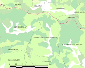
Lamadeleine-Val-des-Anges
- commune in Territoire de Belfort, France
- Country:
- Postal Code: 90170
- Coordinates: 47° 45' 40" N, 6° 54' 48" E
- GPS tracks (wikiloc): [Link]
- Area: 6.52 sq km
- Population: 39