Saint-Épain (Saint-Épain)

- commune in Indre-et-Loire, France
- Country:

- Postal Code: 37800
- Coordinates: 47° 8' 43" N, 0° 32' 13" E


- GPS tracks (wikiloc): [Link]
- Area: 62.65 sq km
- Population: 1563
- Web site: http://www.saint-epain.fr
- Wikipedia en: wiki(en)
- Wikipedia: wiki(fr)
- Wikidata storage: Wikidata: Q751795
- Wikipedia Commons Category: [Link]
- Freebase ID: [/m/03nvdlb]
- GeoNames ID: Alt: [2980375]
- SIREN number: [213702160]
- BnF ID: [15257766s]
- PACTOLS thesaurus ID: [pcrtjq4B8VP60h]
- WOEID: [623851]
- TGN ID: [1035222]
- Digital Atlas of the Roman Empire ID: [2462]
- INSEE municipality code: 37216
Shares border with regions:


Sainte-Catherine-de-Fierbois
- commune in Indre-et-Loire, France
- Country:
- Postal Code: 37800
- Coordinates: 47° 9' 27" N, 0° 39' 13" E
- GPS tracks (wikiloc): [Link]
- Area: 15.49 sq km
- Population: 747
- Web site: [Link]

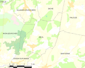
Neuil
- commune in Indre-et-Loire, France
- Country:
- Postal Code: 37190
- Coordinates: 47° 10' 17" N, 0° 30' 45" E
- GPS tracks (wikiloc): [Link]
- Area: 18.82 sq km
- Population: 436
- Web site: [Link]


Villeperdue
- commune in Indre-et-Loire, France
- Country:
- Postal Code: 37260
- Coordinates: 47° 12' 3" N, 0° 37' 56" E
- GPS tracks (wikiloc): [Link]
- Area: 11.95 sq km
- Population: 995

Thilouze
- commune in Indre-et-Loire, France
- Country:
- Postal Code: 37260
- Coordinates: 47° 13' 23" N, 0° 34' 49" E
- GPS tracks (wikiloc): [Link]
- Area: 33.75 sq km
- Population: 1661
- Web site: [Link]


Trogues
- commune in Indre-et-Loire, France
- Country:
- Postal Code: 37220
- Coordinates: 47° 6' 47" N, 0° 29' 42" E
- GPS tracks (wikiloc): [Link]
- Area: 9.38 sq km
- Population: 320


Pouzay
- commune in Indre-et-Loire, France
- Country:
- Postal Code: 37800
- Coordinates: 47° 4' 55" N, 0° 32' 3" E
- GPS tracks (wikiloc): [Link]
- Area: 14.07 sq km
- Population: 845


Crouzilles
- commune in Indre-et-Loire, France
- Country:
- Postal Code: 37220
- Coordinates: 47° 7' 24" N, 0° 27' 34" E
- GPS tracks (wikiloc): [Link]
- Area: 14.54 sq km
- Population: 550
- Web site: [Link]

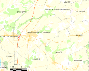
Sainte-Maure-de-Touraine
- commune in Indre-et-Loire, France
- Country:
- Postal Code: 37800
- Coordinates: 47° 6' 44" N, 0° 37' 16" E
- GPS tracks (wikiloc): [Link]
- Area: 40.41 sq km
- Population: 4351
- Web site: [Link]


Crissay-sur-Manse
- commune in Indre-et-Loire, France
- Country:
- Postal Code: 37220
- Coordinates: 47° 9' 1" N, 0° 29' 16" E
- GPS tracks (wikiloc): [Link]
- Area: 7.5 sq km
- Population: 97
- Web site: [Link]

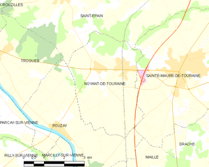
Noyant-de-Touraine
- commune in Indre-et-Loire, France
- Country:
- Postal Code: 37800
- Coordinates: 47° 6' 34" N, 0° 33' 33" E
- GPS tracks (wikiloc): [Link]
- Area: 13.74 sq km
- Population: 1206
- Web site: [Link]