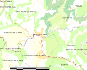
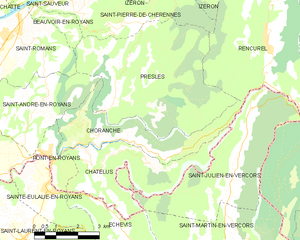
Saint-André-en-Royans (Saint-André-en-Royans)
- commune in Isère, France
 Hiking in Saint-André-en-Royans
Saint-André-en-Royans is a picturesque village located in the Drôme department of southeastern France, within the stunning Vercors Regional Natural Park. The area is known for its spectacular landscapes, rugged cliffs, lush forests, and unique geological formations, making it a great location for hiking enthusiasts of all levels.
Hiking Trails:
-
Montagne de Beure: This trail takes you to the summit of Montagne de Beure, offering breathtaking views of the surrounding valleys and mountains.
-
The Royans Plains: A more leisurely hike through the rolling hills and pastoral landscapes. This area is particularly beautiful in spring when wildflowers are in bloom.
-
Gorges de la Bourne: This trail features dramatic gorge views and is perfect for those seeking a mix of relaxation and adventure. The path often follows along the river, allowing for refreshing stops.
-
Vercors Discovery Trail: A network of trails that can be explored for different lengths and difficulties. Look for routes suited to your skill level and interests.
Tips for Hiking in Saint-André-en-Royans:
- Prepare for Varying Terrain: The hikes can range from easy walks to more challenging scrambles, so be sure to choose a trail that matches your fitness and experience level.
- Check the Weather: Conditions in the mountains can change rapidly. Be prepared with proper clothing and gear.
- Stay Hydrated and Nourished: Bring plenty of water and snacks, especially for longer hikes.
- Leave No Trace: Respect the natural environment by following the Leave No Trace principles, ensuring that the area remains pristine for future hikers.
- Wildlife Spotting: Keep an eye out for local wildlife, such as deer and various bird species, as the region is home to diverse flora and fauna.
Best Time to Visit:
The best seasons for hiking in the area are typically spring (April to June) and autumn (September to October) when the weather is mild, and the landscapes are particularly beautiful.
Local Attractions:
Besides hiking, you might want to explore the village itself, its charming architecture, local culture, and potential opportunities for other outdoor activities like rock climbing and mountain biking.
Remember to always let someone know your hiking plans and estimated return time, and enjoy your adventure in this beautiful region of France!
- Country:

- Postal Code: 38680
- Coordinates: 45° 5' 9" N, 5° 20' 19" E


- GPS tracks (wikiloc): [Link]
- Area: 10.42 sq km
- Population: 319
- Web site: http://st-andre-en-royans.sud-gresivaudan.org
- Wikipedia en: wiki(en)
- Wikipedia: wiki(fr)
- Wikidata storage: Wikidata: Q1068452
- Wikipedia Commons Category: [Link]
- Freebase ID: [/m/03nvj3f]
- GeoNames ID: Alt: [6433319]
- SIREN number: [213803562]
- BnF ID: [15258167q]
- PACTOLS thesaurus ID: [pcrtZfB1FIJMOH]
- INSEE municipality code: 38356
Shares border with regions:


Auberives-en-Royans
- commune in Isère, France
Auberives-en-Royans is a charming village located in the Isère department in the Auvergne-Rhône-Alpes region of southeastern France. The area is known for its picturesque landscapes, rich history, and outdoor activities, making it a great spot for hiking enthusiasts....
- Country:

- Postal Code: 38680
- Coordinates: 45° 3' 48" N, 5° 18' 5" E


- GPS tracks (wikiloc): [Link]
- Area: 5.07 sq km
- Population: 370


Saint-Just-de-Claix
- commune in Isère, France
Saint-Just-de-Claix is a charming village located in the Drôme department of the Auvergne-Rhône-Alpes region of southeastern France. It sits at the foothills of the Vercors Massif, a stunning area known for its dramatic landscapes, limestone cliffs, and extensive hiking trails. Here are some highlights of hiking in and around Saint-Just-de-Claix:...
- Country:

- Postal Code: 38680
- Coordinates: 45° 4' 29" N, 5° 17' 2" E


- GPS tracks (wikiloc): [Link]
- Area: 11.59 sq km
- Population: 1178


Presles
- commune in Isère, France
Presles is a charming village located in the Grand Chartreuse mountain range in the Isère department of the Auvergne-Rhône-Alpes region of France. It's known for its stunning natural beauty, making it a great destination for hiking enthusiasts. Here are some key points about hiking in and around Presles:...
- Country:

- Postal Code: 38680
- Coordinates: 45° 5' 28" N, 5° 22' 59" E


- GPS tracks (wikiloc): [Link]
- Area: 25.68 sq km
- Population: 89


Pont-en-Royans
- commune in Isère, France
Pont-en-Royans is a charming village located in the Isère department of the Auvergne-Rhône-Alpes region in southeastern France. It is known for its picturesque landscape and stunning cliffs that overlook the river Bourne, making it a fantastic destination for hiking enthusiasts....
- Country:

- Postal Code: 38680
- Coordinates: 45° 3' 47" N, 5° 20' 34" E


- GPS tracks (wikiloc): [Link]
- Area: 2.9 sq km
- Population: 785
- Web site: [Link]


Saint-Romans
- commune in Isère, France
Saint-Romans is a picturesque village located in the Isère department of the Auvergne-Rhône-Alpes region in southeastern France. This location offers various hiking opportunities for both novice and experienced hikers. Here are some highlights to consider when hiking in and around Saint-Romans:...
- Country:

- Postal Code: 38160
- Coordinates: 45° 6' 57" N, 5° 19' 37" E


- GPS tracks (wikiloc): [Link]
- Area: 17.04 sq km
- Population: 1786
- Web site: [Link]


Choranche
- commune in Isère, France
Choranche, located in the Isère department in the Auvergne-Rhône-Alpes region of France, is known for its stunning natural beauty and outdoor activities, including hiking. The area is particularly famous for its impressive gorges, limestone cliffs, and beautiful landscapes....
- Country:

- Postal Code: 38680
- Coordinates: 45° 4' 1" N, 5° 23' 28" E


- GPS tracks (wikiloc): [Link]
- Area: 10.63 sq km
- Population: 124
