Saint-Chaptes (Saint-Chaptes)

- commune in Gard, France
- Country:

- Postal Code: 30190
- Coordinates: 43° 58' 15" N, 4° 16' 45" E


- GPS tracks (wikiloc): [Link]
- Area: 13.07 sq km
- Population: 1851
- Wikipedia en: wiki(en)
- Wikipedia: wiki(fr)
- Wikidata storage: Wikidata: Q239795
- Wikipedia Commons Category: [Link]
- Freebase ID: [/m/03c7x0z]
- GeoNames ID: Alt: [2981204]
- SIREN number: [213002413]
- BnF ID: [152548817]
- VIAF ID: Alt: [241595282]
- PACTOLS thesaurus ID: [pcrteEoBR8niDb]
- INSEE municipality code: 30241
Shares border with regions:


Sainte-Anastasie
- commune in Gard, France
- Country:
- Postal Code: 30190
- Coordinates: 43° 56' 7" N, 4° 19' 18" E
- GPS tracks (wikiloc): [Link]
- AboveSeaLevel: 70 м m
- Area: 43.64 sq km
- Population: 1667


Moussac
- commune in Gard, France
- Country:
- Postal Code: 30190
- Coordinates: 43° 58' 52" N, 4° 13' 46" E
- GPS tracks (wikiloc): [Link]
- Area: 7.4 sq km
- Population: 1434
- Web site: [Link]

Saint-Dézéry
- commune in Gard, France
- Country:
- Postal Code: 30190
- Coordinates: 44° 0' 4" N, 4° 16' 11" E
- GPS tracks (wikiloc): [Link]
- Area: 6.01 sq km
- Population: 430


Dions
- commune in Gard, France
- Country:
- Postal Code: 30190
- Coordinates: 43° 55' 53" N, 4° 17' 49" E
- GPS tracks (wikiloc): [Link]
- Area: 11.32 sq km
- Population: 607
- Web site: [Link]
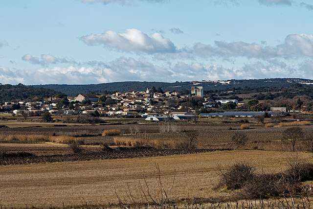
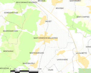
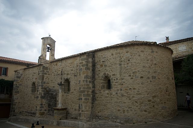
Saint-Geniès-de-Malgoirès
- commune in Gard, France
- Country:
- Postal Code: 30190
- Coordinates: 43° 56' 44" N, 4° 13' 0" E
- GPS tracks (wikiloc): [Link]
- Area: 11.54 sq km
- Population: 2975
- Web site: [Link]


Sauzet
- commune in Gard, France
- Country:
- Postal Code: 30190
- Coordinates: 43° 57' 41" N, 4° 12' 38" E
- GPS tracks (wikiloc): [Link]
- Area: 6.7 sq km
- Population: 740


La Calmette
- commune in Gard, France
- Country:
- Postal Code: 30190
- Coordinates: 43° 55' 26" N, 4° 15' 51" E
- GPS tracks (wikiloc): [Link]
- Area: 11.1 sq km
- Population: 2099
Garrigues-Sainte-Eulalie
- commune in Gard, France
- Country:
- Postal Code: 30190
- Coordinates: 43° 59' 36" N, 4° 18' 54" E
- GPS tracks (wikiloc): [Link]
- AboveSeaLevel: 120 м m
- Area: 10 sq km
- Population: 746