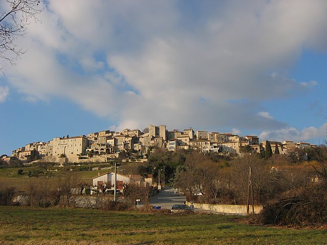
Saint-Christol-lès-Alès (Saint-Christol-lès-Alès)

- commune in Gard, France
- Country:

- Postal Code: 30380
- Coordinates: 44° 5' 4" N, 4° 4' 37" E


- GPS tracks (wikiloc): [Link]
- AboveSeaLevel: 134 м m
- Area: 20.25 sq km
- Population: 6978
- Web site: http://www.saintchristollezales.fr
- Wikipedia en: wiki(en)
- Wikipedia: wiki(fr)
- Wikidata storage: Wikidata: Q641639
- Wikipedia Commons Category: [Link]
- Freebase ID: [/m/02x2ryg]
- SIREN number: [213002439]
- BnF ID: [15254883x]
- VIAF ID: Alt: [126847716]
- Library of Congress authority ID: Alt: [n98069172]
- Trismegistos Geo ID: [21141]
- INSEE municipality code: 30243
Shares border with regions:

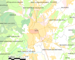
Alès
- commune in Gard, France
- Country:
- Postal Code: 30100
- Coordinates: 44° 7' 38" N, 4° 4' 51" E
- GPS tracks (wikiloc): [Link]
- AboveSeaLevel: 134 м m
- Area: 23.16 sq km
- Population: 39535
- Web site: [Link]

Vézénobres
- commune in Gard, France
- Country:
- Postal Code: 30360
- Coordinates: 44° 3' 11" N, 4° 8' 11" E
- GPS tracks (wikiloc): [Link]
- Area: 17.07 sq km
- Population: 1761
- Web site: [Link]
Ribaute-les-Tavernes
- commune in Gard, France
- Country:
- Postal Code: 30720
- Coordinates: 44° 2' 16" N, 4° 4' 51" E
- GPS tracks (wikiloc): [Link]
- Area: 14.27 sq km
- Population: 2098

Saint-Jean-du-Pin
- commune in Gard, France
- Country:
- Postal Code: 30140
- Coordinates: 44° 7' 0" N, 4° 3' 2" E
- GPS tracks (wikiloc): [Link]
- AboveSeaLevel: 200 м m
- Area: 13.96 sq km
- Population: 1509
- Web site: [Link]
Bagard
- commune in Gard, France
- Country:
- Postal Code: 30140
- Coordinates: 44° 4' 23" N, 4° 3' 3" E
- GPS tracks (wikiloc): [Link]
- Area: 14.55 sq km
- Population: 2599


Saint-Hilaire-de-Brethmas
- commune in Gard, France
- Country:
- Postal Code: 30560
- Coordinates: 44° 4' 51" N, 4° 7' 31" E
- GPS tracks (wikiloc): [Link]
- Area: 13.91 sq km
- Population: 4174
- Web site: [Link]