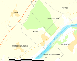
Saint-Denis-sur-Loire (Saint-Denis-sur-Loire)

- commune in Loir-et-Cher, France
- Country:

- Postal Code: 41000
- Coordinates: 47° 37' 30" N, 1° 23' 11" E


- GPS tracks (wikiloc): [Link]
- Area: 12.4 sq km
- Population: 838
- Wikipedia en: wiki(en)
- Wikipedia: wiki(fr)
- Wikidata storage: Wikidata: Q960021
- Wikipedia Commons Category: [Link]
- Freebase ID: [/m/03nw269]
- GeoNames ID: Alt: [6434103]
- SIREN number: [214102063]
- BnF ID: [152594800]
- VIAF ID: Alt: [310755573]
- SUDOC authorities ID: [180962167]
- INSEE municipality code: 41206
Shares border with regions:


Vineuil
- commune in Loir-et-Cher, France
- Country:
- Postal Code: 41350
- Coordinates: 47° 34' 50" N, 1° 22' 21" E
- GPS tracks (wikiloc): [Link]
- Area: 22.34 sq km
- Population: 7724
- Web site: [Link]
Villerbon
- commune in Loir-et-Cher, France
- Country:
- Postal Code: 41000
- Coordinates: 47° 39' 44" N, 1° 22' 18" E
- GPS tracks (wikiloc): [Link]
- Area: 17.28 sq km
- Population: 793


Villebarou
- commune in Loir-et-Cher, France
- Country:
- Postal Code: 41000
- Coordinates: 47° 37' 21" N, 1° 19' 24" E
- GPS tracks (wikiloc): [Link]
- Area: 9.11 sq km
- Population: 2478


La Chaussée-Saint-Victor
- commune in Loir-et-Cher, France
- Country:
- Postal Code: 41260
- Coordinates: 47° 36' 50" N, 1° 21' 55" E
- GPS tracks (wikiloc): [Link]
- Area: 6.63 sq km
- Population: 4510
- Web site: [Link]


Saint-Claude-de-Diray
- commune in Loir-et-Cher, France
- Country:
- Postal Code: 41350
- Coordinates: 47° 36' 55" N, 1° 24' 57" E
- GPS tracks (wikiloc): [Link]
- Area: 9.17 sq km
- Population: 1762
- Web site: [Link]

Menars
- commune in Loir-et-Cher, France
- Country:
- Postal Code: 41500
- Coordinates: 47° 38' 33" N, 1° 24' 31" E
- GPS tracks (wikiloc): [Link]
- Area: 4.5 sq km
- Population: 633