canton of Vizille (canton de Vizille)
- canton of France
Canton de Vizille, located in the Isère department in the Auvergne-Rhône-Alpes region of France, is an excellent destination for hiking enthusiasts. It's known for its beautiful natural landscapes, historical sites, and the proximity to the French Alps. Here are some highlights and tips for hiking in this area:
Natural Landscape
-
Vercors Regional Natural Park: Just to the southeast, the Vercors Massif offers stunning limestone cliffs, deep gorges, and extensive forests. You can find a plethora of hiking trails that cater to all levels of hikers, from easy walks to challenging climbs.
-
Dauphiné Mountains: The surrounding mountains provide numerous hiking routes with breathtaking views of valleys, rivers, and alpine flowers.
-
Lake of Vizille: The picturesque lake is surrounded by several trails ideal for leisurely hikes. The nearby Parc du Château de Vizille offers family-friendly paths and historical explorations.
Historical Significance
- Château de Vizille: This historical site is not just a beautiful castle but also a perfect starting point for several hiking routes in the area. The gardens and the historical context add a cultural dimension to your hiking experience.
Popular Trails
-
Sentier des Moulins: A trail that often takes you along the river and through scenic areas, where you can view old mills.
-
Les Crêtes du Vercors: This trail offers a more challenging hike with fantastic panoramic views of the Alps and the surrounding valleys.
Tips for Hiking in Canton de Vizille
-
Weather Preparation: Check the weather forecasts as conditions can change quickly in mountainous regions.
-
Proper Gear: Wear sturdy hiking boots and carry a rain jacket, especially if you're venturing into higher altitudes.
-
Hydration & Snacks: Always bring plenty of water and some high-energy snacks, particularly on longer trails.
-
Navigation: While many trails are well-marked, having a reliable map or a GPS device is beneficial, especially for less-traveled paths.
-
Respect Nature: Stay on marked trails to protect local wildlife and plants, and remember to follow Leave No Trace principles.
Accessibility
Canton de Vizille is easily accessible from Grenoble, which serves as a good base for exploring the area. Public transport options exist, but having a car can significantly enhance your flexibility in reaching various trailheads.
Overall, hiking in Canton de Vizille offers a combination of natural beauty and cultural history, making it a memorable destination for both novice and experienced hikers.
- Country:

- Capital: Vizille
- Coordinates: 45° 6' 13" N, 5° 42' 9" E


- GPS tracks (wikiloc): [Link]
- Wikidata storage: Wikidata: Q1727974
- INSEE canton code: [3844]
Includes regions:


Vaulnaveys-le-Haut
- commune in Isère, France
Vaulnaveys-le-Haut is a charming village located in the French Alps, nestled just south of Grenoble. This picturesque area offers a variety of hiking opportunities for outdoor enthusiasts of all skill levels. The beautiful landscapes, stunning mountain views, and rich natural surroundings make it an ideal destination for hiking....
- Country:

- Postal Code: 38410
- Coordinates: 45° 7' 6" N, 5° 48' 37" E


- GPS tracks (wikiloc): [Link]
- Area: 19.86 sq km
- Population: 3707
- Web site: [Link]


Saint-Jean-de-Vaulx
- commune in Isère, France
Saint-Jean-de-Vaulx is a charming village located in the Auvergne-Rhône-Alpes region of France, known for its beautiful landscapes and outdoor recreation opportunities, particularly hiking....
- Country:

- Postal Code: 38220
- Coordinates: 45° 0' 46" N, 5° 45' 30" E


- GPS tracks (wikiloc): [Link]
- Area: 10.73 sq km
- Population: 542
- Web site: [Link]


Champ-sur-Drac
- commune in Isère, France
Champ-sur-Drac is a charming commune located in the Isère department of the Auvergne-Rhône-Alpes region in southeastern France. The area is surrounded by beautiful natural landscapes, making it a great destination for hiking enthusiasts....
- Country:

- Postal Code: 38560
- Coordinates: 45° 4' 58" N, 5° 44' 3" E


- GPS tracks (wikiloc): [Link]
- Area: 8.92 sq km
- Population: 3037
- Web site: [Link]


Champagnier
- commune in Isère, France
Champagnier is a charming commune located near Grenoble, France, nestled in the picturesque Isère department. The area features stunning natural landscapes, making it a great destination for hiking enthusiasts of various skill levels. Here are some highlights and tips for hiking in Champagnier:...
- Country:

- Postal Code: 38800
- Coordinates: 45° 6' 44" N, 5° 43' 46" E


- GPS tracks (wikiloc): [Link]
- Area: 6.61 sq km
- Population: 1239
- Web site: [Link]

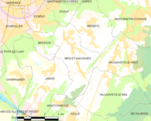
Brié-et-Angonnes
- commune in Isère, France
Brié-et-Angonnes is a charming commune located in the Auvergne-Rhône-Alpes region of France, situated near the city of Grenoble. The area offers a variety of hiking opportunities that cater to different skill levels, making it a great destination for both beginners and experienced hikers....
- Country:

- Postal Code: 38320
- Coordinates: 45° 6' 41" N, 5° 47' 12" E


- GPS tracks (wikiloc): [Link]
- Area: 9.7 sq km
- Population: 2531
- Web site: [Link]


Notre-Dame-de-Mésage
- commune in Isère, France
 Hiking in Notre-Dame-de-Mésage
Notre-Dame-de-Mésage, located in the Isère department in the Auvergne-Rhône-Alpes region of southeastern France, offers a variety of hiking opportunities that cater to different skill levels. This picturesque area is surrounded by natural beauty, including mountains, forests, and breathtaking views, making it an ideal location for outdoor enthusiasts....
- Country:

- Postal Code: 38220
- Coordinates: 45° 4' 13" N, 5° 45' 28" E


- GPS tracks (wikiloc): [Link]
- Area: 4.53 sq km
- Population: 1180
- Web site: [Link]


Montchaboud
- commune in Isère, France
Montchaboud is a picturesque mountain located in the French Alps, specifically in the Isère department. It is known for its stunning landscapes, diverse flora and fauna, and a variety of hiking trails suitable for different skill levels. Here are some key details about hiking in Montchaboud:...
- Country:

- Postal Code: 38220
- Coordinates: 45° 5' 43" N, 5° 45' 45" E


- GPS tracks (wikiloc): [Link]
- Area: 1.96 sq km
- Population: 360
- Web site: [Link]


Saint-Pierre-de-Mésage
- commune in Isère, France
 Hiking in Saint-Pierre-de-Mésage
Saint-Pierre-de-Mésage is a charming town located in the Isère department of the Auvergne-Rhône-Alpes region in southeastern France. It is nestled at the foothills of the French Alps, making it a fantastic destination for hiking enthusiasts....
- Country:

- Postal Code: 38220
- Coordinates: 45° 3' 7" N, 5° 45' 52" E


- GPS tracks (wikiloc): [Link]
- Area: 7.03 sq km
- Population: 757
- Web site: [Link]


Saint-Barthélemy-de-Séchilienne
- commune in Isère, France
 Hiking in Saint-Barthélemy-de-Séchilienne
Saint-Barthélemy-de-Séchilienne is a charming commune situated in the Isère department of the Auvergne-Rhône-Alpes region in southeastern France. Nestled in the foothills of the French Alps, this area offers beautiful scenery and a range of hiking opportunities for outdoor enthusiasts. Here's what you can expect when hiking in this region:...
- Country:

- Postal Code: 38220
- Coordinates: 45° 2' 39" N, 5° 49' 34" E


- GPS tracks (wikiloc): [Link]
- AboveSeaLevel: 450 м m
- Area: 12.1 sq km
- Population: 454


Notre-Dame-de-Commiers
- commune in Isère, France
 Hiking in Notre-Dame-de-Commiers
Notre-Dame-de-Commiers, located in the French Alps near Grenoble, is a beautiful destination for hiking enthusiasts. Nestled at the foot of the Chartreuse Mountains, the area offers a variety of trails that cater to different skill levels and preferences....
- Country:

- Postal Code: 38450
- Coordinates: 45° 0' 36" N, 5° 42' 0" E


- GPS tracks (wikiloc): [Link]
- Area: 4.79 sq km
- Population: 479
- Web site: [Link]

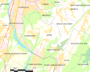
Jarrie
- commune in Isère, France
Jarrie, located in the Isère department of the Auvergne-Rhône-Alpes region in France, offers a range of hiking opportunities that are perfect for outdoor enthusiasts. Nestled at the foot of the Vercors Massif, the area is characterized by stunning alpine landscapes, diverse ecosystems, and beautiful views of the surrounding mountains....
- Country:

- Postal Code: 38560
- Coordinates: 45° 5' 49" N, 5° 44' 33" E


- GPS tracks (wikiloc): [Link]
- Area: 13.26 sq km
- Population: 3749
- Web site: [Link]


Séchilienne
- commune in Isère, France
Séchilienne is a charming village located in the Isère department of the Auvergne-Rhône-Alpes region in southeastern France. Nestled in the mountains, it offers beautiful hiking opportunities with stunning views of the surrounding landscapes....
- Country:

- Postal Code: 38220
- Coordinates: 45° 3' 17" N, 5° 50' 6" E


- GPS tracks (wikiloc): [Link]
- Area: 21.47 sq km
- Population: 1021


Vaulnaveys-le-Bas
- commune in Isère, France
Vaulnaveys-le-Bas is a charming village located in the Isère department of the Auvergne-Rhône-Alpes region in southeastern France. The area is surrounded by beautiful natural landscapes, making it an excellent destination for hiking enthusiasts. Here are some insights and tips for hiking in and around Vaulnaveys-le-Bas:...
- Country:

- Postal Code: 38410
- Coordinates: 45° 6' 22" N, 5° 48' 20" E


- GPS tracks (wikiloc): [Link]
- Area: 11.9 sq km
- Population: 1247
- Web site: [Link]

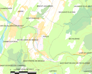
Vizille
- commune in Isère, France
Vizille, located in the Isère department of southeastern France, is a lovely area known for its picturesque landscapes, rich history, and access to the stunning scenery of the French Alps. Hiking in and around Vizille offers various trails that cater to different skill levels, from leisurely walks to more challenging hikes....
- Country:

- Postal Code: 38220
- Coordinates: 45° 4' 42" N, 5° 46' 19" E


- GPS tracks (wikiloc): [Link]
- Area: 10.51 sq km
- Population: 7468
- Web site: [Link]
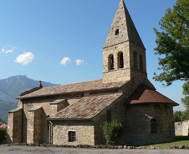
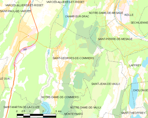
Saint-Georges-de-Commiers
- commune in Isère, France
 Hiking in Saint-Georges-de-Commiers
Saint-Georges-de-Commiers is a picturesque commune located in the Isère department of the Auvergne-Rhône-Alpes region in southeastern France. Nestled at the foothills of the Vercors Massif, it offers a variety of hiking opportunities that cater to different experience levels and preferences....
- Country:

- Postal Code: 38450
- Coordinates: 45° 2' 17" N, 5° 42' 13" E


- GPS tracks (wikiloc): [Link]
- Area: 14.62 sq km
- Population: 2134
- Web site: [Link]


Laffrey
- commune in Isère, France
Laffrey is a beautiful area located near Grenoble in the French Alps, offering stunning natural landscapes and a variety of hiking opportunities. Here are some details to help enhance your hiking experience in Laffrey:...
- Country:

- Postal Code: 38220
- Coordinates: 45° 1' 29" N, 5° 46' 25" E


- GPS tracks (wikiloc): [Link]
- Area: 6.72 sq km
- Population: 429
- Web site: [Link]
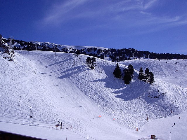

Chamrousse
- commune in Isère, France
Chamrousse, located in the French Alps, is a fantastic destination for hiking enthusiasts, offering stunning landscapes, a variety of trails, and the opportunity to experience the natural beauty of the region. Here are some key points to consider when planning a hiking trip in Chamrousse:...
- Country:

- Postal Code: 38410
- Coordinates: 45° 6' 42" N, 5° 52' 30" E


- GPS tracks (wikiloc): [Link]
- AboveSeaLevel: 1660 м m
- Area: 13.29 sq km
- Population: 462
- Web site: [Link]