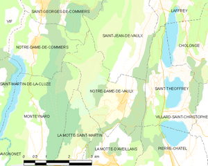
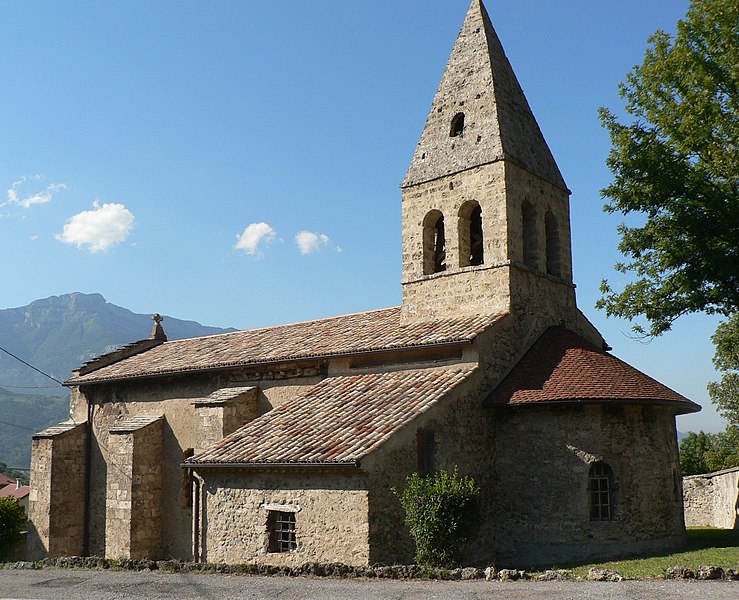
Saint-Jean-de-Vaulx (Saint-Jean-de-Vaulx)

- commune in Isère, France
 Hiking in Saint-Jean-de-Vaulx
Saint-Jean-de-Vaulx is a charming village located in the Auvergne-Rhône-Alpes region of France, known for its beautiful landscapes and outdoor recreation opportunities, particularly hiking.
Hiking Opportunities:
-
Scenic Trails: The area surrounding Saint-Jean-de-Vaulx offers a variety of hiking trails that cater to different skill levels, from easy walks for beginners to more challenging routes for experienced hikers. You can explore forests, valleys, and enjoy panoramic views of the surrounding mountains.
-
Natural Beauty: Hikers can enjoy the stunning natural scenery, including lush forests, rivers, and the unique geological formations typical of the region. The biodiversity in these areas provides opportunities for wildlife spotting as well.
-
Cultural Experience: As you hike, you may come across historical sites and traditional agricultural landscapes, allowing for a cultural immersion into local life. This includes small farms and quaint villages that showcase the architecture and lifestyle of the region.
Tips for Hiking:
- Maps and Guides: Ensure you have a good hiking map or GPS device, as trails may not always be clearly marked.
- Weather Preparedness: The weather can change rapidly in mountainous regions, so dress in layers and carry rain gear.
- Safety First: Always inform someone of your hiking plans, carry enough water and snacks, and be mindful of local wildlife.
- Respect Nature: Follow Leave No Trace principles to preserve the beauty of the trails and the environment.
Nearby Attractions:
- Vercors Regional Natural Park: A short drive from Saint-Jean-de-Vaulx, this park offers extensive hiking options and breathtaking scenery.
- Local Cuisine: After a day of hiking, enjoy traditional Auvergne dishes in local restaurants to experience the regional flavors.
Hiking in Saint-Jean-de-Vaulx can be a rewarding experience, combining physical activity with the beauty of nature and cultural richness. Make sure to plan ahead and enjoy your adventure!
- Country:

- Postal Code: 38220
- Coordinates: 45° 0' 46" N, 5° 45' 30" E


- GPS tracks (wikiloc): [Link]
- Area: 10.73 sq km
- Population: 542
- Web site: http://www.saint-jean-de-vaulx.fr
- Wikipedia en: wiki(en)
- Wikipedia: wiki(fr)
- Wikidata storage: Wikidata: Q1068175
- Wikipedia Commons Category: [Link]
- Freebase ID: [/m/03nvgy8]
- GeoNames ID: Alt: [6615050]
- SIREN number: [213804024]
- BnF ID: [15258212q]
- INSEE municipality code: 38402
Shares border with regions:

Notre-Dame-de-Vaulx
- commune in Isère, France
Hiking in Notre-Dame-de-Vaulx
Notre-Dame-de-Vaulx is a picturesque area located in the Auvergne-Rhône-Alpes region of France. While not as widely known as other hiking destinations, it offers several opportunities for outdoor enthusiasts to explore its natural beauty and serene landscapes....
- Country:
- Postal Code: 38144
- Coordinates: 44° 59' 11" N, 5° 44' 56" E
- GPS tracks (wikiloc): [Link]
- Area: 7.88 sq km
- Population: 510
- Web site: [Link]


Saint-Théoffrey
- commune in Isère, France
Hiking in Saint-Théoffrey
Saint-Théoffrey, located in the Isère department of the Auvergne-Rhône-Alpes region in southeastern France, offers a variety of scenic hiking opportunities. Nestled in the stunning Vercors Regional Natural Park, this charming village is surrounded by captivating landscapes that are perfect for both novice and experienced hikers....
- Country:
- Postal Code: 38119
- Coordinates: 44° 59' 56" N, 5° 46' 23" E
- GPS tracks (wikiloc): [Link]
- Area: 5.75 sq km
- Population: 492
- Web site: [Link]


Saint-Pierre-de-Mésage
- commune in Isère, France
Hiking in Saint-Pierre-de-Mésage
Saint-Pierre-de-Mésage is a charming town located in the Isère department of the Auvergne-Rhône-Alpes region in southeastern France. It is nestled at the foothills of the French Alps, making it a fantastic destination for hiking enthusiasts....
- Country:
- Postal Code: 38220
- Coordinates: 45° 3' 7" N, 5° 45' 52" E
- GPS tracks (wikiloc): [Link]
- Area: 7.03 sq km
- Population: 757
- Web site: [Link]
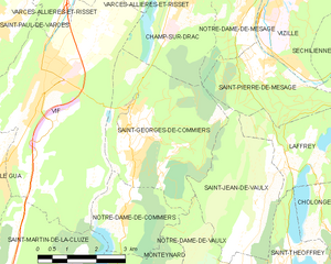
Saint-Georges-de-Commiers
- commune in Isère, France
Hiking in Saint-Georges-de-Commiers
Saint-Georges-de-Commiers is a picturesque commune located in the Isère department of the Auvergne-Rhône-Alpes region in southeastern France. Nestled at the foothills of the Vercors Massif, it offers a variety of hiking opportunities that cater to different experience levels and preferences....
- Country:
- Postal Code: 38450
- Coordinates: 45° 2' 17" N, 5° 42' 13" E
- GPS tracks (wikiloc): [Link]
- Area: 14.62 sq km
- Population: 2134
- Web site: [Link]


Laffrey
- commune in Isère, France
Hiking in Laffrey
Laffrey is a beautiful area located near Grenoble in the French Alps, offering stunning natural landscapes and a variety of hiking opportunities. Here are some details to help enhance your hiking experience in Laffrey:...
- Country:
- Postal Code: 38220
- Coordinates: 45° 1' 29" N, 5° 46' 25" E
- GPS tracks (wikiloc): [Link]
- Area: 6.72 sq km
- Population: 429
- Web site: [Link]