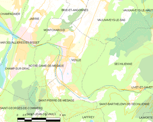
Saint-Pierre-de-Mésage (Saint-Pierre-de-Mésage)
- commune in Isère, France
 Hiking in Saint-Pierre-de-Mésage
Saint-Pierre-de-Mésage is a charming town located in the Isère department of the Auvergne-Rhône-Alpes region in southeastern France. It is nestled at the foothills of the French Alps, making it a fantastic destination for hiking enthusiasts.
Hiking Opportunities
-
Scenic Trails: The area offers various hiking trails that cater to different skill levels, from easy walks suitable for families to more challenging routes for experienced hikers. Many trails provide stunning views of the surrounding mountains and valleys.
-
Nature and Wildlife: Hikers can enjoy the diverse flora and fauna of the region. The trails often pass through forests, meadows, and along rivers, providing a chance to experience the natural beauty of the Alps.
-
Proximity to Major Trails: Saint-Pierre-de-Mésage serves as a great starting point for several longer hikes that lead into the more rugged terrain of the Alps. You might explore routes that connect to the Vercors Regional Natural Park or the Belledonne Range.
Popular Hiking Routes
- Le Col de Puy-Nègre: A moderate hike that offers breathtaking views and is accessible from the town. It's a well-marked trail that is popular among both locals and visitors.
- Path to Saint-Michel: A more challenging route that provides a rewarding experience for those willing to take on steeper inclines, leading to panoramic vistas.
Hiking Tips
- Weather Awareness: The weather in the Alps can change rapidly, so it's important to check forecasts and be prepared for varied conditions.
- Proper Gear: Wear sturdy hiking boots and bring plenty of water, snacks, and a map or GPS device.
- Respect Nature: Stay on marked trails to protect the local ecosystem and follow Leave No Trace principles.
Local Amenities
After a day of hiking, visitors can enjoy the local cuisine at nearby restaurants and cafes, which often feature regional dishes. You might also find accommodations ranging from hotels to rustic chalets.
Overall, Saint-Pierre-de-Mésage is a wonderful destination for hiking, offering both stunning scenery and a range of trails that cater to all levels of experience. Be sure to take your time to enjoy the natural beauty and local hospitality!
- Country:

- Postal Code: 38220
- Coordinates: 45° 3' 7" N, 5° 45' 52" E


- GPS tracks (wikiloc): [Link]
- Area: 7.03 sq km
- Population: 757
- Web site: http://www.mairiestpierredemesage.fr
- Wikipedia en: wiki(en)
- Wikipedia: wiki(fr)
- Wikidata storage: Wikidata: Q1154582
- Wikipedia Commons Category: [Link]
- Freebase ID: [/m/03g_4ws]
- SIREN number: [213804453]
- BnF ID: [152582539]
- VIAF ID: Alt: [316738455]
- INSEE municipality code: 38445
Shares border with regions:


Saint-Jean-de-Vaulx
- commune in Isère, France
Saint-Jean-de-Vaulx is a charming village located in the Auvergne-Rhône-Alpes region of France, known for its beautiful landscapes and outdoor recreation opportunities, particularly hiking....
- Country:

- Postal Code: 38220
- Coordinates: 45° 0' 46" N, 5° 45' 30" E


- GPS tracks (wikiloc): [Link]
- Area: 10.73 sq km
- Population: 542
- Web site: [Link]


Notre-Dame-de-Mésage
- commune in Isère, France
 Hiking in Notre-Dame-de-Mésage
Notre-Dame-de-Mésage, located in the Isère department in the Auvergne-Rhône-Alpes region of southeastern France, offers a variety of hiking opportunities that cater to different skill levels. This picturesque area is surrounded by natural beauty, including mountains, forests, and breathtaking views, making it an ideal location for outdoor enthusiasts....
- Country:

- Postal Code: 38220
- Coordinates: 45° 4' 13" N, 5° 45' 28" E


- GPS tracks (wikiloc): [Link]
- Area: 4.53 sq km
- Population: 1180
- Web site: [Link]


Saint-Barthélemy-de-Séchilienne
- commune in Isère, France
 Hiking in Saint-Barthélemy-de-Séchilienne
Saint-Barthélemy-de-Séchilienne is a charming commune situated in the Isère department of the Auvergne-Rhône-Alpes region in southeastern France. Nestled in the foothills of the French Alps, this area offers beautiful scenery and a range of hiking opportunities for outdoor enthusiasts. Here's what you can expect when hiking in this region:...
- Country:

- Postal Code: 38220
- Coordinates: 45° 2' 39" N, 5° 49' 34" E


- GPS tracks (wikiloc): [Link]
- AboveSeaLevel: 450 м m
- Area: 12.1 sq km
- Population: 454


Vizille
- commune in Isère, France
Vizille, located in the Isère department of southeastern France, is a lovely area known for its picturesque landscapes, rich history, and access to the stunning scenery of the French Alps. Hiking in and around Vizille offers various trails that cater to different skill levels, from leisurely walks to more challenging hikes....
- Country:

- Postal Code: 38220
- Coordinates: 45° 4' 42" N, 5° 46' 19" E


- GPS tracks (wikiloc): [Link]
- Area: 10.51 sq km
- Population: 7468
- Web site: [Link]


Laffrey
- commune in Isère, France
Laffrey is a beautiful area located near Grenoble in the French Alps, offering stunning natural landscapes and a variety of hiking opportunities. Here are some details to help enhance your hiking experience in Laffrey:...
- Country:

- Postal Code: 38220
- Coordinates: 45° 1' 29" N, 5° 46' 25" E


- GPS tracks (wikiloc): [Link]
- Area: 6.72 sq km
- Population: 429
- Web site: [Link]
