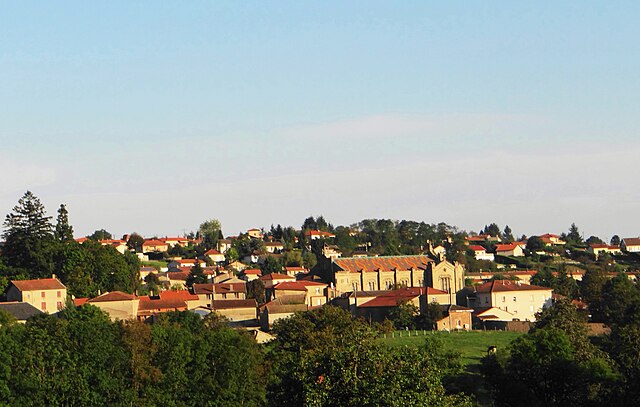
Saint-Marcel-de-Félines (Saint-Marcel-de-Félines)

- commune in Loire, France
- Country:

- Postal Code: 42122
- Coordinates: 45° 52' 6" N, 4° 11' 29" E


- GPS tracks (wikiloc): [Link]
- Area: 22.43 sq km
- Population: 826
- Web site: http://www.saint-marcel-de-felines.fr/
- Wikipedia en: wiki(en)
- Wikipedia: wiki(fr)
- Wikidata storage: Wikidata: Q1105624
- Wikipedia Commons Category: [Link]
- Freebase ID: [/m/0dq2n1]
- Freebase ID: [/m/0dq2n1]
- SIREN number: [214202541]
- SIREN number: [214202541]
- BnF ID: [15259821k]
- BnF ID: [15259821k]
- VIAF ID: Alt: [247449869]
- VIAF ID: Alt: [247449869]
- PACTOLS thesaurus ID: [pcrt6uqoQjYDN4]
- PACTOLS thesaurus ID: [pcrt6uqoQjYDN4]
- INSEE municipality code: 42254
- INSEE municipality code: 42254
Shares border with regions:


Néronde
- commune in Loire, France
- Country:
- Postal Code: 42510
- Coordinates: 45° 50' 18" N, 4° 14' 13" E
- GPS tracks (wikiloc): [Link]
- Area: 8.57 sq km
- Population: 462


Saint-Just-la-Pendue
- commune in Loire, France
- Country:
- Postal Code: 42540
- Coordinates: 45° 53' 39" N, 4° 14' 35" E
- GPS tracks (wikiloc): [Link]
- Area: 19.88 sq km
- Population: 1658
- Web site: [Link]


Pinay
- commune in Loire, France
- Country:
- Postal Code: 42590
- Coordinates: 45° 52' 24" N, 4° 8' 14" E
- GPS tracks (wikiloc): [Link]
- Area: 6.62 sq km
- Population: 277
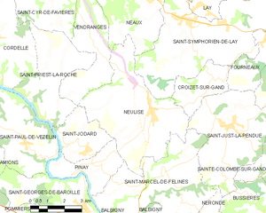
Neulise
- commune in Loire, France
- Country:
- Postal Code: 42590
- Coordinates: 45° 54' 8" N, 4° 10' 48" E
- GPS tracks (wikiloc): [Link]
- Area: 22.99 sq km
- Population: 1324
- Web site: [Link]

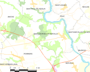
Saint-Georges-de-Baroille
- commune in Loire, France
- Country:
- Postal Code: 42510
- Coordinates: 45° 50' 59" N, 4° 7' 52" E
- GPS tracks (wikiloc): [Link]
- Area: 15.24 sq km
- Population: 404
- Web site: [Link]


Balbigny
- commune in Loire, France
- Country:
- Postal Code: 42510
- Coordinates: 45° 49' 5" N, 4° 11' 14" E
- GPS tracks (wikiloc): [Link]
- Area: 16.98 sq km
- Population: 2989
- Web site: [Link]