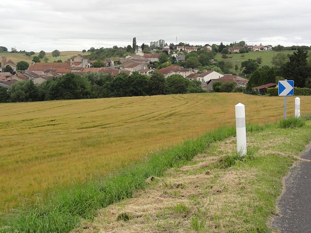
Saint-Mard (Saint-Mard)

- commune in Meurthe-et-Moselle, France
- Country:

- Postal Code: 54290
- Coordinates: 48° 30' 20" N, 6° 18' 20" E


- GPS tracks (wikiloc): [Link]
- Area: 2.95 sq km
- Population: 89
- Wikipedia en: wiki(en)
- Wikipedia: wiki(fr)
- Wikidata storage: Wikidata: Q212770
- Wikipedia Commons Category: [Link]
- Freebase ID: [/m/03qffbs]
- Freebase ID: [/m/03qffbs]
- GeoNames ID: Alt: [6436843]
- GeoNames ID: Alt: [6436843]
- SIREN number: [215404799]
- SIREN number: [215404799]
- BnF ID: [152645463]
- BnF ID: [152645463]
- VIAF ID: Alt: [587144783205545102865]
- VIAF ID: Alt: [587144783205545102865]
- Library of Congress authority ID: Alt: [n2010032818]
- Library of Congress authority ID: Alt: [n2010032818]
- INSEE municipality code: 54479
- INSEE municipality code: 54479
Shares border with regions:
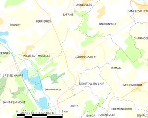
Haussonville
- commune in Meurthe-et-Moselle, France
- Country:
- Postal Code: 54290
- Coordinates: 48° 31' 44" N, 6° 19' 33" E
- GPS tracks (wikiloc): [Link]
- Area: 11.18 sq km
- Population: 303


Lorey
- commune in Meurthe-et-Moselle, France
- Country:
- Postal Code: 54290
- Coordinates: 48° 29' 55" N, 6° 18' 21" E
- GPS tracks (wikiloc): [Link]
- Area: 5.18 sq km
- Population: 114


Neuviller-sur-Moselle
- commune in Meurthe-et-Moselle, France
- Country:
- Postal Code: 54290
- Coordinates: 48° 29' 33" N, 6° 17' 14" E
- GPS tracks (wikiloc): [Link]
- AboveSeaLevel: 245 м m
- Area: 6.71 sq km
- Population: 214


Domptail-en-l'Air
- commune in Meurthe-et-Moselle, France
- Country:
- Postal Code: 54290
- Coordinates: 48° 30' 52" N, 6° 19' 38" E
- GPS tracks (wikiloc): [Link]
- Area: 3.13 sq km
- Population: 71


Saint-Remimont
- commune in Meurthe-et-Moselle, France
- Country:
- Postal Code: 54740
- Coordinates: 48° 29' 53" N, 6° 14' 59" E
- GPS tracks (wikiloc): [Link]
- AboveSeaLevel: 346 м m
- Area: 6.79 sq km
- Population: 347


Crévéchamps
- commune in Meurthe-et-Moselle, France
- Country:
- Postal Code: 54290
- Coordinates: 48° 31' 25" N, 6° 15' 56" E
- GPS tracks (wikiloc): [Link]
- Area: 4.86 sq km
- Population: 381
- Web site: [Link]