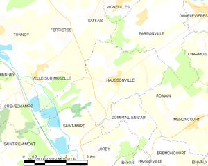
canton of Bayon (canton de Bayon)
- canton of France
- Country:

- Capital: Bayon
- Coordinates: 48° 29' 31" N, 6° 21' 40" E


- GPS tracks (wikiloc): [Link]
- Wikidata storage: Wikidata: Q1724410
- INSEE canton code: [5405]
Includes regions:


Haigneville
- commune in Meurthe-et-Moselle, France
- Country:
- Postal Code: 54290
- Coordinates: 48° 29' 11" N, 6° 20' 35" E
- GPS tracks (wikiloc): [Link]
- Area: 2.85 sq km
- Population: 54
Haussonville
- commune in Meurthe-et-Moselle, France
- Country:
- Postal Code: 54290
- Coordinates: 48° 31' 44" N, 6° 19' 33" E
- GPS tracks (wikiloc): [Link]
- Area: 11.18 sq km
- Population: 303
Barbonville
- commune in Meurthe-et-Moselle, France
- Country:
- Postal Code: 54360
- Coordinates: 48° 33' 15" N, 6° 20' 39" E
- GPS tracks (wikiloc): [Link]
- Area: 10.81 sq km
- Population: 441


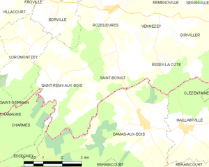
Saint-Rémy-aux-Bois
- commune in Meurthe-et-Moselle, France
- Country:
- Postal Code: 54290
- Coordinates: 48° 24' 57" N, 6° 23' 36" E
- GPS tracks (wikiloc): [Link]
- Area: 9.76 sq km
- Population: 76
Saint-Boingt
- commune in Meurthe-et-Moselle, France
- Country:
- Postal Code: 54290
- Coordinates: 48° 25' 49" N, 6° 26' 15" E
- GPS tracks (wikiloc): [Link]
- Area: 8.14 sq km
- Population: 73
Landécourt
- commune in Meurthe-et-Moselle, France
- Country:
- Postal Code: 54360
- Coordinates: 48° 29' 59" N, 6° 25' 0" E
- GPS tracks (wikiloc): [Link]
- Area: 5.82 sq km
- Population: 97


Einvaux
- commune in Meurthe-et-Moselle, France
- Country:
- Postal Code: 54360
- Coordinates: 48° 29' 23" N, 6° 23' 47" E
- GPS tracks (wikiloc): [Link]
- Area: 7.38 sq km
- Population: 341


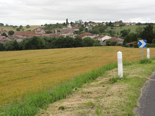
Bayon
- commune in Meurthe-et-Moselle, France
- Country:
- Postal Code: 54290
- Coordinates: 48° 28' 29" N, 6° 18' 55" E
- GPS tracks (wikiloc): [Link]
- Area: 6.05 sq km
- Population: 1593
- Web site: [Link]


Méhoncourt
- commune in Meurthe-et-Moselle, France
- Country:
- Postal Code: 54360
- Coordinates: 48° 30' 38" N, 6° 22' 32" E
- GPS tracks (wikiloc): [Link]
- Area: 7.87 sq km
- Population: 234


Blainville-sur-l'Eau
- commune in Meurthe-et-Moselle, France
- Country:
- Postal Code: 54360
- Coordinates: 48° 33' 21" N, 6° 24' 25" E
- GPS tracks (wikiloc): [Link]
- Area: 11.74 sq km
- Population: 3955

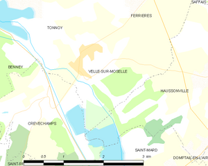
Velle-sur-Moselle
- commune in Meurthe-et-Moselle, France
- Country:
- Postal Code: 54290
- Coordinates: 48° 31' 49" N, 6° 16' 35" E
- GPS tracks (wikiloc): [Link]
- Area: 4.47 sq km
- Population: 281
- Web site: [Link]


Charmois
- commune in Meurthe-et-Moselle, France
- Country:
- Postal Code: 54360
- Coordinates: 48° 32' 23" N, 6° 23' 0" E
- GPS tracks (wikiloc): [Link]
- Area: 5.41 sq km
- Population: 186


Saint-Mard
- commune in Meurthe-et-Moselle, France
- Country:
- Postal Code: 54290
- Coordinates: 48° 30' 20" N, 6° 18' 20" E
- GPS tracks (wikiloc): [Link]
- Area: 2.95 sq km
- Population: 89

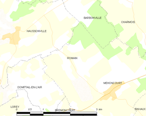
Romain
- commune in Meurthe-et-Moselle, France
- Country:
- Postal Code: 54360
- Coordinates: 48° 30' 58" N, 6° 21' 34" E
- GPS tracks (wikiloc): [Link]
- Area: 3.15 sq km
- Population: 70


Lorey
- commune in Meurthe-et-Moselle, France
- Country:
- Postal Code: 54290
- Coordinates: 48° 29' 55" N, 6° 18' 21" E
- GPS tracks (wikiloc): [Link]
- Area: 5.18 sq km
- Population: 114

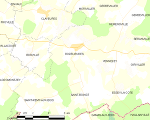
Rozelieures
- commune in Meurthe-et-Moselle, France
- Country:
- Postal Code: 54290
- Coordinates: 48° 27' 2" N, 6° 26' 4" E
- GPS tracks (wikiloc): [Link]
- Area: 9.38 sq km
- Population: 191


Saint-Germain
- commune in Meurthe-et-Moselle, France
- Country:
- Postal Code: 54290
- Coordinates: 48° 25' 52" N, 6° 20' 20" E
- GPS tracks (wikiloc): [Link]
- Area: 7.68 sq km
- Population: 160


Vigneulles
- commune in Meurthe-et-Moselle, France
- Country:
- Postal Code: 54360
- Coordinates: 48° 33' 38" N, 6° 19' 52" E
- GPS tracks (wikiloc): [Link]
- Area: 5.57 sq km
- Population: 250
Clayeures
- commune in Meurthe-et-Moselle, France
- Country:
- Postal Code: 54290
- Coordinates: 48° 28' 19" N, 6° 24' 22" E
- GPS tracks (wikiloc): [Link]
- Area: 9.21 sq km
- Population: 194


Domptail-en-l'Air
- commune in Meurthe-et-Moselle, France
- Country:
- Postal Code: 54290
- Coordinates: 48° 30' 52" N, 6° 19' 38" E
- GPS tracks (wikiloc): [Link]
- Area: 3.13 sq km
- Population: 71


Borville
- commune in Meurthe-et-Moselle, France
- Country:
- Postal Code: 54290
- Coordinates: 48° 26' 54" N, 6° 23' 35" E
- GPS tracks (wikiloc): [Link]
- Area: 4.71 sq km
- Population: 100


Brémoncourt
- commune in Meurthe-et-Moselle, France
- Country:
- Postal Code: 54290
- Coordinates: 48° 29' 17" N, 6° 21' 9" E
- GPS tracks (wikiloc): [Link]
- Area: 5.24 sq km
- Population: 161


Damelevières
- commune in Meurthe-et-Moselle, France
- Country:
- Postal Code: 54360
- Coordinates: 48° 33' 25" N, 6° 23' 17" E
- GPS tracks (wikiloc): [Link]
- Area: 8.12 sq km
- Population: 3170
- Web site: [Link]


Virecourt
- commune in Meurthe-et-Moselle, France
- Country:
- Postal Code: 54290
- Coordinates: 48° 27' 44" N, 6° 19' 11" E
- GPS tracks (wikiloc): [Link]
- Area: 5.06 sq km
- Population: 461


Loromontzey
- commune in Meurthe-et-Moselle, France
- Country:
- Postal Code: 54290
- Coordinates: 48° 26' 8" N, 6° 22' 39" E
- GPS tracks (wikiloc): [Link]
- Area: 7.68 sq km
- Population: 89


Villacourt
- commune in Meurthe-et-Moselle, France
- Country:
- Postal Code: 54290
- Coordinates: 48° 27' 21" N, 6° 20' 57" E
- GPS tracks (wikiloc): [Link]
- Area: 14.1 sq km
- Population: 420


Froville
- commune in Meurthe-et-Moselle, France
- Country:
- Postal Code: 54290
- Coordinates: 48° 28' 11" N, 6° 21' 14" E
- GPS tracks (wikiloc): [Link]
- Area: 5.89 sq km
- Population: 122