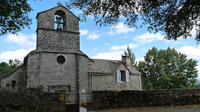
Saint-Rome-de-Dolan (Saint-Rome-de-Dolan)

- former commune in Lozère, France
- Country:

- Postal Code: 48500
- Coordinates: 44° 16' 25" N, 3° 12' 57" E


- GPS tracks (wikiloc): [Link]
- Area: 32.63 sq km
- Population: 64
- Wikipedia en: wiki(en)
- Wikipedia: wiki(fr)
- Wikidata storage: Wikidata: Q631723
- Wikipedia Commons Category: [Link]
- Freebase ID: [/m/02z0wqd]
- Freebase ID: [/m/02z0wqd]
- GeoNames ID: Alt: [6435178]
- GeoNames ID: Alt: [6435178]
- BnF ID: [15261583k]
- BnF ID: [15261583k]
- PACTOLS thesaurus ID: [pcrt3tPnqnn13l]
- PACTOLS thesaurus ID: [pcrt3tPnqnn13l]
- INSEE municipality code: 48180
- INSEE municipality code: 48180
Shares border with regions:


Mostuéjouls
- commune in Aveyron, France
- Country:
- Postal Code: 12720
- Coordinates: 44° 12' 10" N, 3° 11' 1" E
- GPS tracks (wikiloc): [Link]
- Area: 30.95 sq km
- Population: 313


Saint-Georges-de-Lévéjac
- former commune in Lozère, France
- Country:
- Postal Code: 48500
- Coordinates: 44° 19' 9" N, 3° 13' 51" E
- GPS tracks (wikiloc): [Link]
- Area: 56.26 sq km
- Population: 250
- Web site: [Link]

Saint-Pierre-des-Tripiers
- commune in Lozère, France
- Country:
- Postal Code: 48150
- Coordinates: 44° 11' 58" N, 3° 15' 28" E
- GPS tracks (wikiloc): [Link]
- Area: 34.74 sq km
- Population: 80


Les Vignes
- former commune in Lozère, France
- Country:
- Postal Code: 48210
- Coordinates: 44° 16' 40" N, 3° 13' 38" E
- GPS tracks (wikiloc): [Link]
- Area: 28.84 sq km
- Population: 101


Le Massegros
- former commune in Lozère, France
- Country:
- Postal Code: 48500
- Coordinates: 44° 18' 32" N, 3° 10' 28" E
- GPS tracks (wikiloc): [Link]
- Area: 17.94 sq km
- Population: 405