Saint-Victor-de-Cessieu (Saint-Victor-de-Cessieu)

- commune in Isère, France
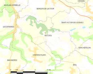
 Hiking in Saint-Victor-de-Cessieu
Saint-Victor-de-Cessieu is a charming commune located in the Isère department of France, nestled near the beautiful landscape of the Rhône-Alpes region. The area is known for its picturesque views, rolling hills, and diverse flora and fauna, making it an appealing destination for hiking enthusiasts.
Hiking Trails and Options
-
Local Trails: There are several local trails that can be explored, ranging from easy walks suitable for families to more challenging routes for experienced hikers. The trails often lead through forests, fields, and along rivers, providing a chance to experience the natural beauty of the region.
-
Regional Parks: The nearby Chartreuse Regional Natural Park and Vercors Regional Natural Park offer more extensive hiking options. These parks feature well-marked trails of varying difficulties, allowing hikers to explore breathtaking landscapes, limestone cliffs, and stunning viewpoints.
-
Nature Observations: Hiking in and around Saint-Victor-de-Cessieu offers opportunities for birdwatching and observing local wildlife. Taking a quiet hike can lead to encounters with various species of plants and animals native to the area.
Preparation and Safety
-
Trail Maps and Guides: It's advisable to carry a local map or guidebook to help navigate the trails. Many trails in the area are well-marked, but having a map can enhance your experience by providing additional insights into the landscape.
-
Weather Conditions: Always check the weather forecast before heading out, as the weather can change rapidly in the mountains. Dress in layers and prepare for varying conditions.
-
Safety Gear: Standard hiking gear, including sturdy walking shoes, a backpack, water, snacks, and a first aid kit, is essential for a safe and enjoyable hike. If hiking in more remote areas, consider bringing additional safety equipment.
-
Letting Someone Know: Always inform someone about your hiking plans, especially if you are venturing on more challenging trails or into less populated areas.
Best Time to Hike
The best seasons for hiking in Saint-Victor-de-Cessieu are typically late spring through early autumn (May to October), when the weather is milder and the trails are more accessible. Summer can be quite warm, so early morning hikes are often preferable.
Conclusion
Hiking in Saint-Victor-de-Cessieu provides a delightful experience for nature lovers and outdoor enthusiasts. With its beautiful surroundings, varied trails, and proximity to larger natural parks, you’re sure to have a rewarding adventure exploring the breathtaking landscapes of the Rhône-Alpes region. Always prepare adequately and respect nature to ensure a safe and enjoyable hiking experience.
- Country:

- Postal Code: 38110
- Coordinates: 45° 32' 27" N, 5° 23' 29" E


- GPS tracks (wikiloc): [Link]
- Area: 12.22 sq km
- Population: 2209
- Web site: http://www.saintvictordecessieu.fr
- Wikipedia en: wiki(en)
- Wikipedia: wiki(fr)
- Wikidata storage: Wikidata: Q974600
- Wikipedia Commons Category: [Link]
- Freebase ID: [/m/03nvhv4]
- GeoNames ID: Alt: [6433402]
- SIREN number: [213804644]
- BnF ID: [15258270w]
- INSEE municipality code: 38464
Shares border with regions:


Cessieu
- commune in Isère, France
Hiking in Cessieu
Cessieu is a charming commune located in the Auvergne-Rhône-Alpes region of France, nestled between the Rhône River and the foothills of the Alps. Although it may not be as widely recognized as some other hiking destinations, it offers various opportunities for outdoor enthusiasts....
- Country:
- Postal Code: 38110
- Coordinates: 45° 34' 0" N, 5° 22' 36" E
- GPS tracks (wikiloc): [Link]
- Area: 14.35 sq km
- Population: 2886
- Web site: [Link]
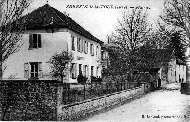

Sérézin-de-la-Tour
- commune in Isère, France
Hiking in Sérézin-de-la-Tour
Sérézin-de-la-Tour, nestled in the Auvergne-Rhône-Alpes region of France, offers charming hiking opportunities that attract both locals and visitors. The area is characterized by beautiful natural landscapes, including rolling hills, forests, and scenic views of the surrounding countryside....
- Country:
- Postal Code: 38300
- Coordinates: 45° 33' 27" N, 5° 20' 39" E
- GPS tracks (wikiloc): [Link]
- Area: 9.31 sq km
- Population: 1011
- Web site: [Link]

Sainte-Blandine
- commune in Isère, France
Hiking in Sainte-Blandine
Sainte-Blandine, located in the Isère department of the Auvergne-Rhône-Alpes region in southeastern France, is a charming village surrounded by beautiful natural landscapes ideal for hiking enthusiasts. Here are some highlights and tips for hiking in the area:...
- Country:
- Postal Code: 38110
- Coordinates: 45° 32' 48" N, 5° 26' 26" E
- GPS tracks (wikiloc): [Link]
- Area: 9.21 sq km
- Population: 963

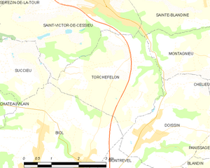
Torchefelon
- commune in Isère, France
Hiking in Torchefelon
Torchefelon is a beautiful destination for hiking, located in the Savoie region of the French Alps. The area is known for its stunning landscapes, with a mix of rugged mountain terrain, lush valleys, and alpine meadows. Here are some highlights and tips for hiking in Torchefelon:...
- Country:
- Postal Code: 38690
- Coordinates: 45° 31' 13" N, 5° 24' 1" E
- GPS tracks (wikiloc): [Link]
- Area: 8.68 sq km
- Population: 708
- Web site: [Link]


Saint-Jean-de-Soudain
- commune in Isère, France
Hiking in Saint-Jean-de-Soudain
Saint-Jean-de-Soudain is a picturesque village located in the Isère department of the Auvergne-Rhône-Alpes region in southeastern France. It's an excellent base for hikers looking to explore the natural landscapes and mountainous terrain nearby....
- Country:
- Postal Code: 38110
- Coordinates: 45° 34' 21" N, 5° 25' 44" E
- GPS tracks (wikiloc): [Link]
- Area: 7.48 sq km
- Population: 1572
- Web site: [Link]
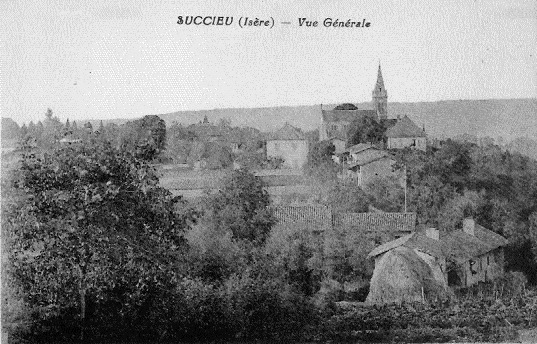
Succieu
- commune in Isère, France
Hiking in Succieu
Succieu is a charming village located in the Auvergne-Rhône-Alpes region of France, surrounded by beautiful landscapes that make it an appealing destination for hiking enthusiasts. While it may not be as well-known as some larger hiking areas, it offers a variety of trails that showcase the natural beauty of the region....
- Country:
- Postal Code: 38300
- Coordinates: 45° 31' 40" N, 5° 20' 20" E
- GPS tracks (wikiloc): [Link]
- Area: 8.35 sq km
- Population: 728
- Web site: [Link]