Cessieu (Cessieu)

- commune in Isère, France
 Hiking in Cessieu
Cessieu is a charming commune located in the Auvergne-Rhône-Alpes region of France, nestled between the Rhône River and the foothills of the Alps. Although it may not be as widely recognized as some other hiking destinations, it offers various opportunities for outdoor enthusiasts.
Hiking Opportunities in Cessieu
-
Trails: The area around Cessieu features a network of hiking trails that vary in difficulty, from beginner pathways to more challenging routes. These trails often pass through picturesque landscapes, including forests, fields, and views of the surrounding hills.
-
Natural Beauty: Hikers can enjoy the diverse flora and fauna of the region. The rural setting provides a serene environment, ideal for nature walks and birdwatching.
-
Local Attractions: If you’re a history or culture enthusiast, consider taking a hike that ends at local historical sites or charming villages nearby. This can be a great way to combine outdoor activity with cultural exploration.
-
Nearby Parks: Consider visiting nearby regional parks or nature reserves, which can offer more extensive trail systems and natural experiences.
-
Best Time to Hike: Spring and fall are particularly lovely for hiking, with mild weather and the chance to see blooming flowers or fall foliage. Summer can be warmer, but early morning hikes are refreshing.
-
Preparation: Make sure to wear appropriate hiking gear and bring plenty of water, especially if you plan on hiking for several hours. It’s also a good idea to have a map or GPS device if you’re venturing off well-marked paths.
Safety Tips
- Check Weather Conditions: As with any outdoor activity, be sure to check the weather forecast before embarking on your hike.
- Know Your Limits: Choose trails that match your fitness and experience level.
- Respect Nature: Stick to marked paths, and practice Leave No Trace principles to preserve the natural beauty of the area.
Conclusion
Cessieu and its surroundings can provide a wonderful hiking experience for those looking to explore the natural beauty of the Auvergne-Rhône-Alpes region. Make sure to plan your hike based on your interests and fitness level for the best experience!
- Country:

- Postal Code: 38110
- Coordinates: 45° 34' 0" N, 5° 22' 36" E


- GPS tracks (wikiloc): [Link]
- Area: 14.35 sq km
- Population: 2886
- Web site: http://www.cessieu.fr
- Wikipedia en: wiki(en)
- Wikipedia: wiki(fr)
- Wikidata storage: Wikidata: Q1002973
- Wikipedia Commons Category: [Link]
- Freebase ID: [/m/03nvg7m]
- GeoNames ID: Alt: [6455083]
- SIREN number: [213800642]
- BnF ID: [15257893z]
- PACTOLS thesaurus ID: [pcrtskK6AXcKSe]
- INSEE municipality code: 38064
Shares border with regions:
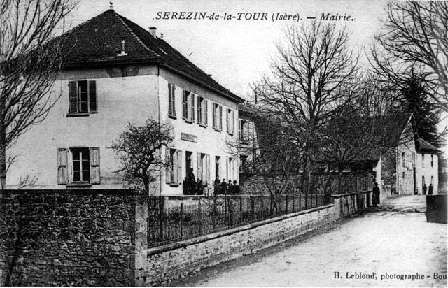

Sérézin-de-la-Tour
- commune in Isère, France
Hiking in Sérézin-de-la-Tour
Sérézin-de-la-Tour, nestled in the Auvergne-Rhône-Alpes region of France, offers charming hiking opportunities that attract both locals and visitors. The area is characterized by beautiful natural landscapes, including rolling hills, forests, and scenic views of the surrounding countryside....
- Country:
- Postal Code: 38300
- Coordinates: 45° 33' 27" N, 5° 20' 39" E
- GPS tracks (wikiloc): [Link]
- Area: 9.31 sq km
- Population: 1011
- Web site: [Link]
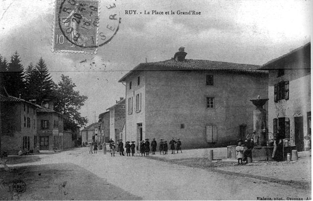

Ruy-Montceau
- commune in Isère, France
Hiking in Ruy-Montceau
Ruy, located in the Isère department of southeastern France, is a charming area that offers a variety of hiking opportunities, taking advantage of the beautiful natural landscapes of the region. Although Ruy itself may not be as widely recognized for hiking as some other areas in the Alps, it's conveniently located near various trails and natural parks that are ideal for outdoor enthusiasts....
- Country:
- Postal Code: 38300
- Coordinates: 45° 35' 18" N, 5° 19' 4" E
- GPS tracks (wikiloc): [Link]
- Area: 20.81 sq km
- Population: 4434
- Web site: [Link]


Saint-Jean-de-Soudain
- commune in Isère, France
Hiking in Saint-Jean-de-Soudain
Saint-Jean-de-Soudain is a picturesque village located in the Isère department of the Auvergne-Rhône-Alpes region in southeastern France. It's an excellent base for hikers looking to explore the natural landscapes and mountainous terrain nearby....
- Country:
- Postal Code: 38110
- Coordinates: 45° 34' 21" N, 5° 25' 44" E
- GPS tracks (wikiloc): [Link]
- Area: 7.48 sq km
- Population: 1572
- Web site: [Link]

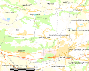
Rochetoirin
- commune in Isère, France
Hiking in Rochetoirin
Rochetoirin, located in the Auvergne-Rhône-Alpes region of France, is a charming destination for hiking enthusiasts. Nestled near the foothills of the Chartreuse Mountains, the area offers a variety of natural landscapes, from rolling hills to picturesque forests, and a glimpse of local flora and fauna....
- Country:
- Postal Code: 38110
- Coordinates: 45° 34' 54" N, 5° 25' 5" E
- GPS tracks (wikiloc): [Link]
- Area: 10.62 sq km
- Population: 1115
- Web site: [Link]

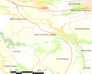
Saint-Victor-de-Cessieu
- commune in Isère, France
Hiking in Saint-Victor-de-Cessieu
Saint-Victor-de-Cessieu is a charming commune located in the Isère department of France, nestled near the beautiful landscape of the Rhône-Alpes region. The area is known for its picturesque views, rolling hills, and diverse flora and fauna, making it an appealing destination for hiking enthusiasts....
- Country:
- Postal Code: 38110
- Coordinates: 45° 32' 27" N, 5° 23' 29" E
- GPS tracks (wikiloc): [Link]
- Area: 12.22 sq km
- Population: 2209
- Web site: [Link]