Sainte-Blandine (Sainte-Blandine)

- commune in Isère, France
 Hiking in Sainte-Blandine
Sainte-Blandine, located in the Isère department of the Auvergne-Rhône-Alpes region in southeastern France, is a charming village surrounded by beautiful natural landscapes ideal for hiking enthusiasts. Here are some highlights and tips for hiking in the area:
Natural Scenery
- Diverse Terrain: The region features varied terrains, including rolling hills, forested areas, and stunning views of the surrounding mountains, making it perfect for different levels of hiking.
- Flora and Fauna: While hiking, you may encounter a rich diversity of plant and animal life, particularly in the nearby natural reserves and parks.
Recommended Hiking Trails
- Local Trails: Look for marked trails leading into the forests surrounding the village. These often range in difficulty and length, catering to both casual walkers and experienced hikers.
- Nearby Parks: Consider hiking in the Vercors Regional Natural Park, which is a short drive away. The park has numerous hiking trails with spectacular views and challenging routes.
Things to Consider
- Weather: Check the local weather conditions before heading out, as the weather can change quickly in mountainous areas.
- Safety: Always carry a map, use proper footwear, and tell someone your hiking plans.
- Equipment: Bring essential hiking gear, including water, snacks, and possibly trekking poles for more challenging trails.
Local Culture
- Community: The community in Sainte-Blandine is friendly and may have local events or gatherings, especially during hiking seasons, where you can encounter fellow outdoor enthusiasts.
Conclusion
Hiking in Sainte-Blandine offers a wonderful opportunity to explore the natural beauty of the Isère region while enjoying the peaceful atmosphere of a quaint French village. Make sure to plan ahead and take the necessary precautions to ensure a safe and enjoyable hiking experience!
- Country:

- Postal Code: 38110
- Coordinates: 45° 32' 48" N, 5° 26' 26" E


- GPS tracks (wikiloc): [Link]
- Area: 9.21 sq km
- Population: 963
- Wikipedia en: wiki(en)
- Wikipedia: wiki(fr)
- Wikidata storage: Wikidata: Q1068417
- Wikipedia Commons Category: [Link]
- Freebase ID: [/m/03g_5xs]
- GeoNames ID: Alt: [6433327]
- SIREN number: [213803695]
- BnF ID: [15258180x]
- PACTOLS thesaurus ID: [pcrtuXuHi6LSUp]
- INSEE municipality code: 38369
Shares border with regions:


Saint-Didier-de-la-Tour
- commune in Isère, France
Hiking in Saint-Didier-de-la-Tour
Saint-Didier-de-la-Tour is a charming commune located in the Isère department of the Auvergne-Rhône-Alpes region in southeastern France. The area is characterized by its natural beauty, including rolling hills, lush greenery, and proximity to the mountains, making it a great spot for hiking enthusiasts....
- Country:
- Postal Code: 38110
- Coordinates: 45° 33' 19" N, 5° 28' 59" E
- GPS tracks (wikiloc): [Link]
- Area: 14.63 sq km
- Population: 2003
- Web site: [Link]

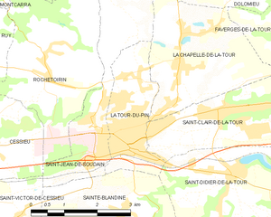
La Tour-du-Pin
- commune in Isère, France
Hiking in La Tour-du-Pin
La Tour-du-Pin is a charming town located in the Isère department of the Auvergne-Rhône-Alpes region in southeastern France. Its proximity to the French Alps and various natural parks makes it an excellent spot for hiking enthusiasts....
- Country:
- Postal Code: 38110
- Coordinates: 45° 33' 57" N, 5° 26' 42" E
- GPS tracks (wikiloc): [Link]
- Area: 4.77 sq km
- Population: 7970
- Web site: [Link]

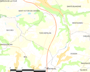
Torchefelon
- commune in Isère, France
Hiking in Torchefelon
Torchefelon is a beautiful destination for hiking, located in the Savoie region of the French Alps. The area is known for its stunning landscapes, with a mix of rugged mountain terrain, lush valleys, and alpine meadows. Here are some highlights and tips for hiking in Torchefelon:...
- Country:
- Postal Code: 38690
- Coordinates: 45° 31' 13" N, 5° 24' 1" E
- GPS tracks (wikiloc): [Link]
- Area: 8.68 sq km
- Population: 708
- Web site: [Link]


Montagnieu
- commune in Isère, France
Hiking in Montagnieu
Montagnieu, located in the department of Isère in the Auvergne-Rhône-Alpes region of France, offers a variety of hiking options that showcase the natural beauty of the surrounding landscapes. Here are some key points about hiking in this area:...
- Country:
- Postal Code: 38110
- Coordinates: 45° 31' 27" N, 5° 27' 9" E
- GPS tracks (wikiloc): [Link]
- Area: 8.83 sq km
- Population: 1023


Saint-Jean-de-Soudain
- commune in Isère, France
Hiking in Saint-Jean-de-Soudain
Saint-Jean-de-Soudain is a picturesque village located in the Isère department of the Auvergne-Rhône-Alpes region in southeastern France. It's an excellent base for hikers looking to explore the natural landscapes and mountainous terrain nearby....
- Country:
- Postal Code: 38110
- Coordinates: 45° 34' 21" N, 5° 25' 44" E
- GPS tracks (wikiloc): [Link]
- Area: 7.48 sq km
- Population: 1572
- Web site: [Link]

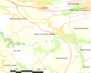
Saint-Victor-de-Cessieu
- commune in Isère, France
Hiking in Saint-Victor-de-Cessieu
Saint-Victor-de-Cessieu is a charming commune located in the Isère department of France, nestled near the beautiful landscape of the Rhône-Alpes region. The area is known for its picturesque views, rolling hills, and diverse flora and fauna, making it an appealing destination for hiking enthusiasts....
- Country:
- Postal Code: 38110
- Coordinates: 45° 32' 27" N, 5° 23' 29" E
- GPS tracks (wikiloc): [Link]
- Area: 12.22 sq km
- Population: 2209
- Web site: [Link]