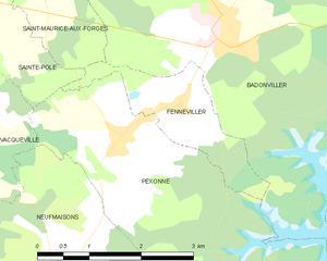
Sainte-Pôle (Sainte-Pôle)
- commune in Meurthe-et-Moselle, France
- Country:

- Postal Code: 54540
- Coordinates: 48° 30' 36" N, 6° 49' 28" E


- GPS tracks (wikiloc): [Link]
- Area: 5.69 sq km
- Population: 197
- Wikipedia en: wiki(en)
- Wikipedia: wiki(fr)
- Wikidata storage: Wikidata: Q604127
- Wikipedia Commons Category: [Link]
- Freebase ID: [/m/03qdmv7]
- Freebase ID: [/m/03qdmv7]
- GeoNames ID: Alt: [6436847]
- GeoNames ID: Alt: [6436847]
- SIREN number: [215404849]
- SIREN number: [215404849]
- BnF ID: [15264551p]
- BnF ID: [15264551p]
- INSEE municipality code: 54484
- INSEE municipality code: 54484
Shares border with regions:


Pexonne
- commune in Meurthe-et-Moselle, France
- Country:

- Postal Code: 54540
- Coordinates: 48° 29' 0" N, 6° 51' 57" E


- GPS tracks (wikiloc): [Link]
- Area: 13.43 sq km
- Population: 373


Vacqueville
- commune in Meurthe-et-Moselle, France
- Country:

- Postal Code: 54540
- Coordinates: 48° 28' 53" N, 6° 48' 51" E


- GPS tracks (wikiloc): [Link]
- Area: 9.96 sq km
- Population: 245


Montigny
- commune in Meurthe-et-Moselle, France
- Country:

- Postal Code: 54540
- Coordinates: 48° 30' 57" N, 6° 48' 0" E


- GPS tracks (wikiloc): [Link]
- Area: 6.11 sq km
- Population: 143


Saint-Maurice-aux-Forges
- commune in Meurthe-et-Moselle, France
- Country:

- Postal Code: 54540
- Coordinates: 48° 30' 37" N, 6° 50' 51" E


- GPS tracks (wikiloc): [Link]
- Area: 3.3 sq km
- Population: 106


Fenneviller
- commune in Meurthe-et-Moselle, France
- Country:

- Postal Code: 54540
- Coordinates: 48° 29' 14" N, 6° 52' 53" E


- GPS tracks (wikiloc): [Link]
- Area: 2.99 sq km
- Population: 92


Ancerviller
- commune in Meurthe-et-Moselle, France
- Country:

- Postal Code: 54450
- Coordinates: 48° 31' 56" N, 6° 50' 6" E


- GPS tracks (wikiloc): [Link]
- Area: 12.34 sq km
- Population: 273
