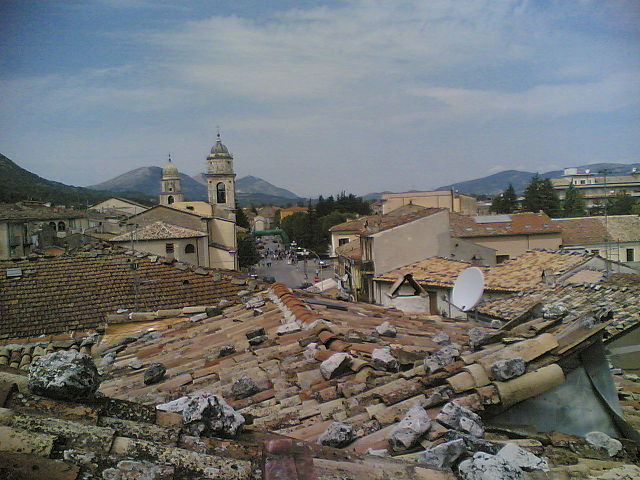
San Massimo (San Massimo)
.svg)
- Italian comune
 Hiking in San Massimo
San Massimo, located in the Molise region of Italy, is known for its stunning natural landscapes and rich cultural heritage. It offers a variety of hiking opportunities suitable for different skill levels. Here are some key points about hiking in San Massimo:
Trails and Routes
-
Main Trails: The area has numerous trails that explore the surrounding mountains and valleys. Popular routes often lead through the Sannio and Matese Regional Park, featuring scenic views, dense forests, and picturesque villages.
-
Difficulty Levels: There are trails for beginners to experienced hikers. Some paths may involve steep ascents and rocky terrains, while others are more accessible and suitable for families.
-
Nature and Wildlife: The region is rich in biodiversity, so hikers may have the chance to spot various wildlife species, including deer, foxes, and a variety of birds.
Best Hiking Season
- Spring and Fall: The best times to hike in San Massimo are during spring (April to June) and fall (September to October) when the weather is mild, and the landscapes are particularly beautiful.
- Summer: It can get quite hot, particularly in July and August, so early morning or late afternoon hikes are recommended.
Preparation Tips
- Footwear: Wear sturdy hiking boots for ankle support and better traction on rocky terrains.
- Gear: Bring sturdy trekking poles, a backpack with water, snacks, a map or GPS, and sun protection.
- Local Guidance: Consider hiring a local guide for an enjoyable experience, especially if you want to learn about the flora and fauna or explore off-the-beaten-path trails.
Cultural Sites
While hiking, you may encounter various cultural landmarks, including historical churches and ruins. Engaging with locals can enrich your experience as they often have stories and traditions tied to the land.
Safety Considerations
- Weather Awareness: Always check the weather conditions before setting out, as mountain weather can change rapidly.
- Trail Conditions: Some trails may be less maintained or marked, so having a reliable map or app can aid navigation.
Whether you're seeking a challenging trek or a leisurely walk to enjoy the serene landscapes, San Massimo has something to offer for every hiking enthusiast!
- Country:

- Postal Code: 86027
- Local Dialing Code: 0874
- Licence Plate Code: CB
- Coordinates: 41° 29' 0" N, 14° 25' 0" E


- GPS tracks (wikiloc): [Link]
- AboveSeaLevel: 630 м m
- Area: 27.33 sq km
- Population: 873
- Web site: http://www.comune.sanmassimo.cb.it/
- Wikipedia en: wiki(en)
- Wikipedia: wiki(it)
- Wikidata storage: Wikidata: Q278175
- Wikipedia Commons Category: [Link]
- Freebase ID: [/m/0gnpvv]
- GeoNames ID: Alt: [6540020]
- VIAF ID: Alt: [234842986]
- OSM relation ID: [41303]
- ISTAT ID: 070070
- Italian cadastre code: I023
Shares border with regions:

Bojano
- Italian comune
Hiking in Bojano
Bojano, located in the Molise region of Italy, offers a unique blend of natural beauty, rich history, and local culture, making it a worthwhile destination for hiking enthusiasts. Here are some highlights for hiking in and around Bojano:...
- Country:
- Postal Code: 86021
- Local Dialing Code: 0874
- Licence Plate Code: CB
- Coordinates: 41° 29' 0" N, 14° 28' 0" E
- GPS tracks (wikiloc): [Link]
- AboveSeaLevel: 480 м m
- Area: 52.63 sq km
- Population: 8178
- Web site: [Link]
Cantalupo nel Sannio
- Italian comune
Hiking in Cantalupo nel Sannio
Cantalupo nel Sannio is a picturesque village located in the Molise region of Italy, known for its natural beauty and rich cultural heritage. Hiking in this area offers a variety of trails that cater to different skill levels, allowing hikers to immerse themselves in the stunning landscapes and enjoy the tranquility of the surrounding nature....
- Country:
- Postal Code: 86092
- Local Dialing Code: 0865
- Licence Plate Code: IS
- Coordinates: 41° 31' 0" N, 14° 24' 0" E
- GPS tracks (wikiloc): [Link]
- AboveSeaLevel: 587 м m
- Area: 15.64 sq km
- Population: 764
- Web site: [Link]
Macchiagodena
- Italian comune
Hiking in Macchiagodena
Macchiagodena, located in the Molise region of Italy, is a charming area offering beautiful landscapes and ample opportunities for hiking enthusiasts. Here are some highlights about hiking in Macchiagodena:...
- Country:
- Postal Code: 86096
- Local Dialing Code: 0865
- Licence Plate Code: IS
- Coordinates: 41° 34' 0" N, 14° 24' 0" E
- GPS tracks (wikiloc): [Link]
- AboveSeaLevel: 864 м m
- Area: 34.35 sq km
- Population: 1808
- Web site: [Link]
Roccamandolfi
- Italian comune
Hiking in Roccamandolfi
Roccamandolfi, located in the Molise region of Italy, is a fantastic destination for hiking enthusiasts. Nestled in the Apennine Mountains, this area offers a blend of stunning natural landscapes, rich history, and a tranquil environment, making it ideal for both novice and experienced hikers....
- Country:
- Postal Code: 86092
- Local Dialing Code: 0865
- Licence Plate Code: IS
- Coordinates: 41° 30' 0" N, 14° 21' 0" E
- GPS tracks (wikiloc): [Link]
- AboveSeaLevel: 850 м m
- Area: 53.67 sq km
- Population: 937
- Web site: [Link]

San Gregorio Matese
- Italian comune
Hiking in San Gregorio Matese
San Gregorio Matese is a picturesque village located in the Campania region of Italy, nestled in the Matese mountain range. This area is known for its stunning natural beauty, offering a variety of hiking opportunities that cater to different skill levels. Here are some highlights and recommendations for hiking in San Gregorio Matese:...
- Country:
- Postal Code: 81010
- Local Dialing Code: 0823
- Licence Plate Code: CE
- Coordinates: 41° 23' 0" N, 14° 22' 0" E
- GPS tracks (wikiloc): [Link]
- AboveSeaLevel: 765 м m
- Area: 56.51 sq km
- Population: 946
- Web site: [Link]