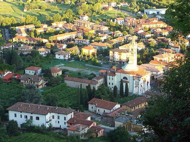
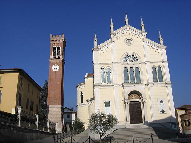
San Paolo d'Argon (San Paolo d'Argon)
.svg)
- Italian comune
 Hiking in San Paolo d'Argon
San Paolo d'Argon, located in the province of Bergamo in northern Italy, offers a variety of hiking opportunities amidst beautiful landscapes. The region is characterized by its rolling hills, vineyards, and scenic views of the surrounding valleys and mountains, including the nearby Orobian Alps.
Hiking Trails
-
Sentiero dei Monte Riscoprire: This trail takes you through picturesque woods and leads to stunning panoramic viewpoints. It’s suitable for hikers of all levels and is well-marked.
-
Vineyard Trails: The area is known for its vineyards, and hiking through these paths can be a delightful experience. You can often combine hiking with wine tasting at local vineyards.
-
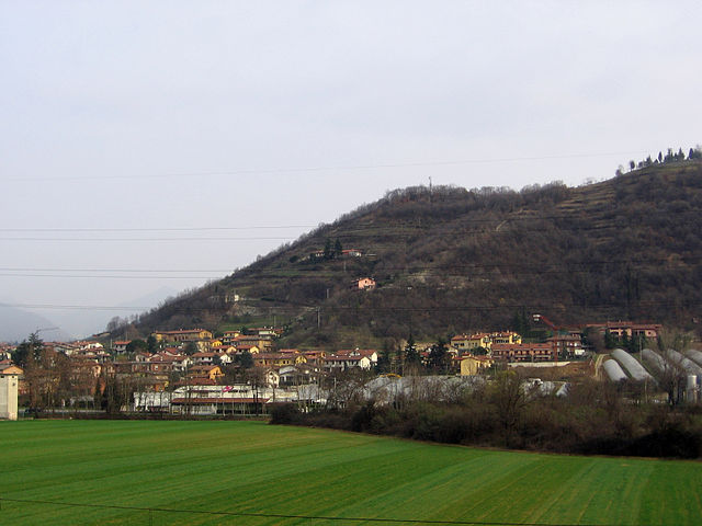
Monte Misma: Climbing to the summit of Monte Misma offers a more challenging hike. The views from the top are rewarding, and you can see the entire surrounding area, including the city of Bergamo.
Tips for Hiking in San Paolo d'Argon
- Best Time to Hike: Spring and fall are ideal times to hike due to pleasant weather and vibrant scenery. Summer can be hot, while winter may bring snow to higher elevations.
- Gear: Ensure you have appropriate hiking gear, including sturdy footwear, weather-appropriate clothing, a backpack with water, snacks, and a map or navigation device.
- Local Guidance: Consider hiring a local guide if you're unfamiliar with the area or looking for hidden trails. They can provide insights into the local flora and fauna as well as cultural history.
- Respect Nature: As always, follow the principles of Leave No Trace to keep the area pristine for future hikers.
Accessibility
San Paolo d'Argon is easily accessible from Bergamo and other nearby cities. Public transport options are available, making it convenient to start your hiking adventure.
Whether you're a seasoned hiker or just looking for a leisurely walk in nature, San Paolo d'Argon offers a mix of scenic beauty and cultural richness, making it a fantastic hiking destination in the Lombardy region.
- Country:

- Postal Code: 24060
- Local Dialing Code: 035
- Licence Plate Code: BG
- Coordinates: 45° 41' 21" N, 9° 48' 11" E


- GPS tracks (wikiloc): [Link]
- AboveSeaLevel: 255 м m
- Area: 5.25 sq km
- Population: 5725
- Web site: http://www.comune.sanpaolodargon.bg.it/
- Wikipedia en: wiki(en)
- Wikipedia: wiki(it)
- Wikidata storage: Wikidata: Q101548
- Wikipedia Commons Gallery: [Link]
- Wikipedia Commons Category: [Link]
- Freebase ID: [/m/0gjdlp]
- GeoNames ID: Alt: [6542571]
- VIAF ID: Alt: [123304108]
- OSM relation ID: [45727]
- UN/LOCODE: [ITPLR]
- ISTAT ID: 016189
- Italian cadastre code: B310
Shares border with regions:


Cenate Sotto
- Italian comune
Hiking in Cenate Sotto
Cenate Sotto is a charming town located in the province of Bergamo in Lombardy, Italy. It's surrounded by beautiful landscapes, making it an excellent destination for hiking enthusiasts. Here’s a brief overview of what you can expect when hiking in this area:...
- Country:
- Postal Code: 24069
- Local Dialing Code: 035
- Licence Plate Code: BG
- Coordinates: 45° 42' 0" N, 9° 49' 0" E
- GPS tracks (wikiloc): [Link]
- AboveSeaLevel: 267 м m
- Area: 4.62 sq km
- Population: 3825
- Web site: [Link]


Gorlago
- Italian comune
Hiking in Gorlago
Gorlago is a picturesque town located in the Lombardy region of northern Italy, near the city of Bergamo. The area around Gorlago offers a variety of hiking opportunities that showcase the stunning landscapes of the Italian countryside, including rolling hills, forests, and panoramic views of the surrounding mountains....
- Country:
- Postal Code: 24060
- Local Dialing Code: 035
- Licence Plate Code: BG
- Coordinates: 45° 40' 0" N, 9° 49' 0" E
- GPS tracks (wikiloc): [Link]
- AboveSeaLevel: 233 м m
- Area: 5.7 sq km
- Population: 5188
- Web site: [Link]


Montello, Lombardy
- Italian comune
Hiking in Montello, Lombardy
Montello is a beautiful area in Lombardy, Italy, known for its picturesque landscapes, rich natural beauty, and various outdoor activities, including hiking. Here are some key points about hiking in Montello:...
- Country:
- Postal Code: 24060
- Local Dialing Code: 035
- Licence Plate Code: BG
- Coordinates: 45° 40' 0" N, 9° 48' 0" E
- GPS tracks (wikiloc): [Link]
- AboveSeaLevel: 229 м m
- Area: 1.82 sq km
- Population: 3263
- Web site: [Link]

Scanzorosciate
- Italian comune
Hiking in Scanzorosciate
Scanzorosciate is a charming town located in the Lombardy region of northern Italy, near the city of Bergamo. The area offers a variety of hiking opportunities that allow you to explore its stunning landscapes, nature, and cultural heritage....
- Country:
- Postal Code: 24020
- Local Dialing Code: 035
- Licence Plate Code: BG
- Coordinates: 45° 42' 41" N, 9° 44' 9" E
- GPS tracks (wikiloc): [Link]
- AboveSeaLevel: 297 м m
- Area: 10.69 sq km
- Population: 10076
- Web site: [Link]

Torre de' Roveri
- Italian comune
Hiking in Torre de' Roveri
Torre de' Roveri is a charming town located in the province of Bergamo, Lombardy, Italy. It's surrounded by beautiful landscapes, making it a great spot for hiking enthusiasts. Here are some highlights and tips for hiking in and around Torre de' Roveri:...
- Country:
- Postal Code: 24060
- Local Dialing Code: 035
- Licence Plate Code: BG
- Coordinates: 45° 42' 0" N, 9° 46' 20" E
- GPS tracks (wikiloc): [Link]
- AboveSeaLevel: 271 м m
- Area: 2.69 sq km
- Population: 2470
- Web site: [Link]


Trescore Balneario
- Italian comune
Hiking in Trescore Balneario
Trescore Balneario, located in the province of Bergamo in northern Italy, is a charming town known for its thermal baths and scenic landscapes. While it's not as widely recognized for hiking as some other areas in the Italian Alps, it can serve as a great base for exploring nearby trails and natural attractions....
- Country:
- Postal Code: 24069
- Local Dialing Code: 035
- Licence Plate Code: BG
- Coordinates: 45° 42' 0" N, 9° 51' 0" E
- GPS tracks (wikiloc): [Link]
- AboveSeaLevel: 271 м m
- Area: 13.51 sq km
- Population: 9814
- Web site: [Link]

Albano Sant'Alessandro
- Italian comune
Hiking in Albano Sant'Alessandro
Albano Sant'Alessandro is a charming town located in the province of Bergamo, in the Lombardy region of northern Italy. It's situated in a picturesque area characterized by lush landscapes, hills, and proximity to the beautiful Orobie Alps, making it a fantastic destination for hiking enthusiasts....
- Country:
- Postal Code: 24061
- Local Dialing Code: 035
- Licence Plate Code: BG
- Coordinates: 45° 41' 9" N, 9° 46' 4" E
- GPS tracks (wikiloc): [Link]
- AboveSeaLevel: 243 м m
- Area: 5.12 sq km
- Population: 8244
- Web site: [Link]