Sanvensa (Sanvensa)

- commune in Aveyron, France
- Country:

- Postal Code: 12200
- Coordinates: 44° 17' 32" N, 2° 2' 56" E


- GPS tracks (wikiloc): [Link]
- Area: 25.48 sq km
- Population: 663
- Wikipedia en: wiki(en)
- Wikipedia: wiki(fr)
- Wikidata storage: Wikidata: Q1363417
- Wikipedia Commons Category: [Link]
- Freebase ID: [/m/03m95vs]
- GeoNames ID: Alt: [6427050]
- SIREN number: [211202593]
- BnF ID: [15247235x]
- INSEE municipality code: 12259
Shares border with regions:


Monteils
- commune in Aveyron, France
- Country:
- Postal Code: 12200
- Coordinates: 44° 15' 56" N, 1° 59' 52" E
- GPS tracks (wikiloc): [Link]
- AboveSeaLevel: 234 м m
- Area: 17.19 sq km
- Population: 532
- Web site: [Link]


La Fouillade
- commune in Aveyron, France
- Country:
- Postal Code: 12270
- Coordinates: 44° 13' 52" N, 2° 2' 31" E
- GPS tracks (wikiloc): [Link]
- Area: 32.54 sq km
- Population: 1069
- Web site: [Link]

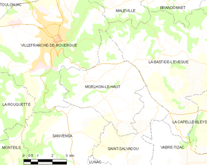
Morlhon-le-Haut
- commune in Aveyron, France
- Country:
- Postal Code: 12200
- Coordinates: 44° 19' 29" N, 2° 3' 45" E
- GPS tracks (wikiloc): [Link]
- Area: 22.09 sq km
- Population: 565
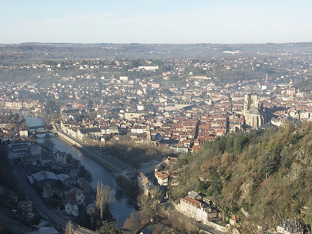
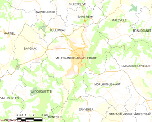
Villefranche-de-Rouergue
- commune in Aveyron, France
- Country:
- Postal Code: 12200
- Coordinates: 44° 21' 9" N, 2° 2' 3" E
- GPS tracks (wikiloc): [Link]
- AboveSeaLevel: 290 м m
- Area: 45.85 sq km
- Population: 11892
- Web site: [Link]

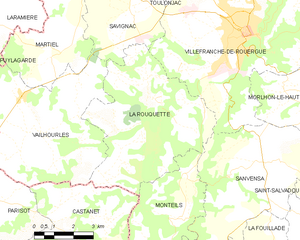
La Rouquette
- commune in Aveyron, France
- Country:
- Postal Code: 12200
- Coordinates: 44° 18' 8" N, 1° 58' 28" E
- GPS tracks (wikiloc): [Link]
- Area: 29.81 sq km
- Population: 775
- Web site: [Link]

Lunac
- commune in Aveyron, France
- Country:
- Postal Code: 12270
- Coordinates: 44° 14' 8" N, 2° 6' 48" E
- GPS tracks (wikiloc): [Link]
- Area: 18.78 sq km
- Population: 430
- Web site: [Link]