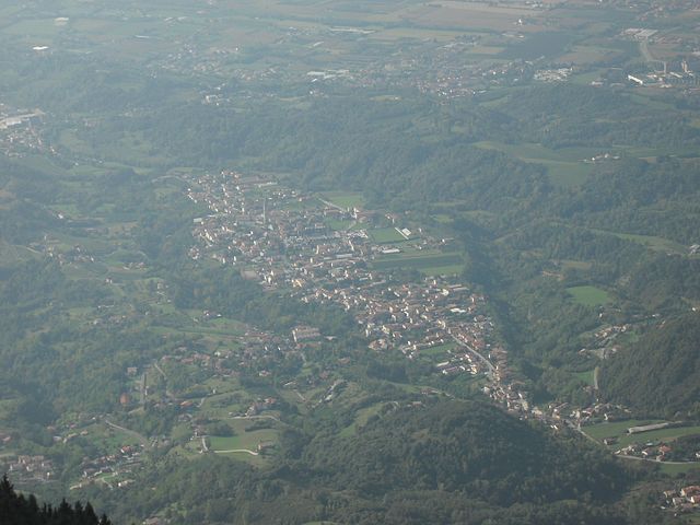
Sarmede (Sarmede)
.svg)
- Italian comune
 Hiking in Sarmede
Sarmede, a charming village located in the province of Treviso in the Veneto region of Italy, offers some wonderful opportunities for hiking. Surrounded by the picturesque landscapes of the Valdobbiadene hills and the nearby Prealps, Sarmede is an ideal spot for nature lovers and hikers of all skill levels.
Key Highlights for Hiking in Sarmede:
-
Scenic Trails: The area surrounding Sarmede features a variety of trails that range from easy walks to more challenging hikes. Many trails offer stunning views of the surrounding hills, vineyards, and historical villages.
-
Cultural Stops: As you hike, you can explore the rich cultural heritage of the region. Sarmede is known for its artistic influences, and you might encounter various art installations and traditional architecture along the trails.
-
Natural Beauty: The trails often wind through lush forests, rolling hills, and fields, allowing hikers to immerse themselves in the local flora and fauna. The region is known for its biodiversity, and you might spot various bird species and local wildlife.
-
Wine and Gastronomy: The area is famous for its Prosecco vineyards. After your hike, consider visiting a local winery to sample fine wines and enjoy traditional Veneto cuisine at nearby trattorias.
-
Accessibility: Sarmede is accessible by car and public transport from larger cities, making it a convenient destination for a day hike or a longer stay.
-
Seasonal Considerations: The best time for hiking in Sarmede is during the spring and fall when the weather is mild, and the scenery is particularly stunning. Summer can be hot, while winter might offer snow-capped views in the surrounding mountains, appealing to winter sport enthusiasts.
Tips for Hiking in Sarmede:
- Check Trail Maps: Local tourist information centers or hiking websites can provide detailed maps and conditions of trails.
- Stay Hydrated: Always carry enough water, especially if you're hiking during the warmer months.
- Wear Proper Gear: Good hiking shoes and appropriate clothing for changing weather conditions are essential.
- Respect Nature: Keep to marked trails, dispose of waste properly, and be mindful of wildlife.
- Local Guides: If you’re unfamiliar with the area, consider hiring a local guide for a more informative experience.
Hiking in Sarmede can be a delightful blend of natural exploration and cultural discovery, making it a fantastic destination for outdoor enthusiasts!
- Country:

- Postal Code: 31026
- Local Dialing Code: 0438
- Licence Plate Code: TV
- Coordinates: 45° 58' 39" N, 12° 23' 7" E


- GPS tracks (wikiloc): [Link]
- AboveSeaLevel: 103 м m
- Area: 18.01 sq km
- Population: 3061
- Web site: http://www.comune.sarmede.tv.it
- Wikipedia en: wiki(en)
- Wikipedia: wiki(it)
- Wikidata storage: Wikidata: Q46822
- Wikipedia Commons Category: [Link]
- Freebase ID: [/m/0gk3gw]
- GeoNames ID: Alt: [6538309]
- VIAF ID: Alt: [157266992]
- OSM relation ID: [46677]
- TGN ID: [7040272]
- UN/LOCODE: [ITSM5]
- ISTAT ID: 026078
- Italian cadastre code: I435
Shares border with regions:


Cappella Maggiore
- Italian comune
Hiking in Cappella Maggiore
Cappella Maggiore, located in the Veneto region of Italy, offers a picturesque setting for hiking enthusiasts. The area is characterized by its stunning natural landscapes, including rolling hills, forests, and scenic viewpoints. Here are some tips and highlights for hiking in Cappella Maggiore:...
- Country:
- Postal Code: 31012
- Local Dialing Code: 0438
- Licence Plate Code: TV
- Coordinates: 45° 58' 0" N, 12° 22' 0" E
- GPS tracks (wikiloc): [Link]
- AboveSeaLevel: 115 м m
- Area: 11.09 sq km
- Population: 4692
- Web site: [Link]

Fregona
- Italian comune
Hiking in Fregona
Fregona, a charming village located in the Treviso region of Italy, offers several opportunities for hikers and outdoor enthusiasts. Nestled within the foothills of the Prealps, it's surrounded by beautiful landscapes, scenic trails, and historical sites....
- Country:
- Postal Code: 31010
- Local Dialing Code: 0438
- Licence Plate Code: TV
- Coordinates: 46° 0' 29" N, 12° 20' 19" E
- GPS tracks (wikiloc): [Link]
- AboveSeaLevel: 251 м m
- Area: 42.72 sq km
- Population: 2970
- Web site: [Link]


Cordignano
- Italian comune
Hiking in Cordignano
Cordignano is a small municipality located in the province of Treviso, in the Veneto region of Italy. It is known for its picturesque landscapes, rolling hills, and a variety of outdoor activities, making it a great spot for hiking enthusiasts....
- Country:
- Postal Code: 31016
- Local Dialing Code: 0438
- Licence Plate Code: TV
- Coordinates: 45° 57' 0" N, 12° 25' 0" E
- GPS tracks (wikiloc): [Link]
- AboveSeaLevel: 56 м m
- Area: 26.25 sq km
- Population: 7024
- Web site: [Link]
Caneva
- Italian comune
Hiking in Caneva
Caneva is a charming town located in the Province of Treviso in northern Italy, not far from the picturesque landscape of the Friuli Venezia Giulia region. The area is known for its beautiful countryside, vineyards, and proximity to the foothills of the Alps. While Caneva itself may not be as famous for hiking as some other locations, there are still several hiking opportunities in and around this region....
- Country:
- Postal Code: 33070
- Local Dialing Code: 0434
- Licence Plate Code: PN
- Coordinates: 45° 58' 0" N, 12° 27' 0" E
- GPS tracks (wikiloc): [Link]
- AboveSeaLevel: 57 м m
- Area: 41.79 sq km
- Population: 6339
- Web site: [Link]