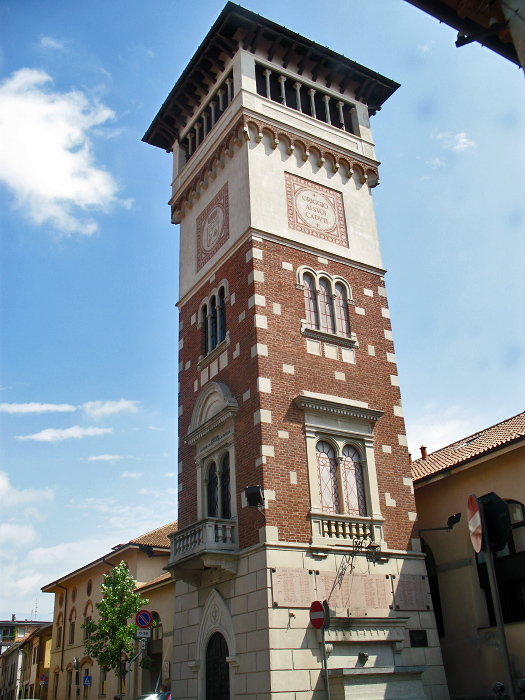
Saronno (Saronno)
.svg)
- Italian comune
 Hiking in Saronno
Saronno, located in the Lombardy region of northern Italy, is not primarily known as a hiking destination, but it does have access to some beautiful trails and natural areas nearby. Here are a few points to consider if you're looking to hike around Saronno:
Access to Natural Areas
- Parco della Spina Verde: A nearby park offering scenic trails through natural landscapes, perfect for hiking and exploring.
- Monte Rosa: A bit further afield but accessible for those who want to venture into the mountains. The trails here provide stunning views.
Local Trails
While Saronno itself may not have extensive hiking trails, you can find options in surrounding areas:
- Lakes and Parks: The nearby Lake Como and Lake Maggiore regions have numerous hiking trails with varying levels of difficulty and breathtaking views.
- Exploration of Villages: Many hikes around Saronno can lead you to picturesque villages where you can enjoy local culture and cuisine.
Preparing for Your Hike
- Trail Maps: Before heading out, check local resources for trail maps and conditions. Websites or apps that focus on hiking in Italy can provide additional information.
- Gear: Ensure you have appropriate hiking gear, including sturdy shoes, weather-appropriate clothing, and enough water and snacks.
- Local Regulations: Be aware of any park regulations or trail restrictions.
Transportation
Saronno is well-connected by public transport, making it easier to reach trailheads in nearby areas without needing a car.
Season Considerations
- Best Time to Hike: Spring (April to June) and early fall (September to October) offer the most pleasant weather for hiking in this region, with mild temperatures and beautiful scenery.
While Saronno may not be a hiking hub, its proximity to various natural attractions and terrains makes it a great base for those looking to explore the outdoors. Always remember to check local conditions and plan your hikes accordingly!
- Country:

- Postal Code: 21047
- Local Dialing Code: 02
- Licence Plate Code: VA
- Coordinates: 45° 37' 32" N, 9° 2' 13" E


- GPS tracks (wikiloc): [Link]
- AboveSeaLevel: 212 м m
- Area: 11.06 sq km
- Population: 39419
- Web site: http://www.comune.saronno.va.it/
- Wikipedia en: wiki(en)
- Wikipedia: wiki(it)
- Wikidata storage: Wikidata: Q40862
- Wikipedia Commons Gallery: [Link]
- Wikipedia Commons Category: [Link]
- Freebase ID: [/m/0bgh5h]
- GeoNames ID: Alt: [6537086]
- VIAF ID: Alt: [150099995]
- OSM relation ID: [45496]
- PACTOLS thesaurus ID: [pcrtPWSnLjAoTS]
- MusicBrainz area ID: [9e767e91-24bd-4392-8a11-059ab278d4a9]
- Quora topic ID: [Saronno]
- UN/LOCODE: [ITSRN]
- ISTAT ID: 012119
- Italian cadastre code: I441
- US National Archives Identifier: 10045208
Shares border with regions:
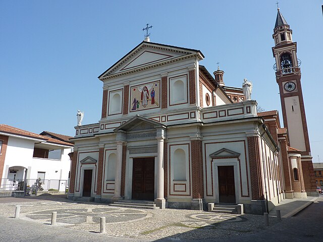
Cogliate
- Italian comune
Hiking in Cogliate
Cogliate is a charming area located in the Lombardy region of Italy, not far from the beautiful town of Monza and the vibrant city of Milan. While it may not be as famous as some other hiking destinations in Italy, it offers a variety of outdoor activities and natural beauty....
- Country:
- Postal Code: 20815
- Local Dialing Code: 02
- Licence Plate Code: MB
- Coordinates: 45° 38' 0" N, 9° 5' 0" E
- GPS tracks (wikiloc): [Link]
- AboveSeaLevel: 236 м m
- Area: 6.96 sq km
- Population: 8558
- Web site: [Link]


Gerenzano
- Italian comune
Hiking in Gerenzano
Gerenzano is a small town located in the Lombardy region of Italy, near Como and Milan. While it may not be widely known as a primary hiking destination, there are opportunities for outdoor enthusiasts in and around the area....
- Country:
- Postal Code: 21040
- Local Dialing Code: 02
- Licence Plate Code: VA
- Coordinates: 45° 38' 26" N, 9° 0' 7" E
- GPS tracks (wikiloc): [Link]
- AboveSeaLevel: 226 м m
- Area: 9.79 sq km
- Population: 10914
- Web site: [Link]

Origgio
- Italian comune
Hiking in Origgio
Origgio, located in the Lombardy region of Italy, is surrounded by beautiful landscapes and offers various opportunities for hiking and outdoor activities. While it may not be as well-known for hiking as some other regions in Italy, there are still some lovely trails and outdoor spots nearby that you can explore....
- Country:
- Postal Code: 21040
- Local Dialing Code: 02
- Licence Plate Code: VA
- Coordinates: 45° 35' 49" N, 9° 1' 6" E
- GPS tracks (wikiloc): [Link]
- AboveSeaLevel: 191 м m
- Area: 7.92 sq km
- Population: 7827
- Web site: [Link]
Uboldo
- Italian comune
Hiking in Uboldo
Uboldo is a small town located in the Lombardy region of Italy, near the foothills of the Alps. While Uboldo itself may not be a famous hiking destination, there are several nearby trails and natural areas that you can explore. Here are some tips and suggestions for hiking in and around Uboldo:...
- Country:
- Postal Code: 21040
- Local Dialing Code: 02
- Licence Plate Code: VA
- Coordinates: 45° 37' 0" N, 9° 0' 0" E
- GPS tracks (wikiloc): [Link]
- AboveSeaLevel: 205 м m
- Area: 10.74 sq km
- Population: 10565
- Web site: [Link]
Caronno Pertusella
- Italian comune
Hiking in Caronno Pertusella
Caronno Pertusella, located in the Lombardy region of Italy, is not primarily known as a hiking destination, but it does offer access to various natural areas and nearby trails that can be enjoyable for outdoor enthusiasts. Here are some key points to consider for hiking in and around Caronno Pertusella:...
- Country:
- Postal Code: 21042
- Local Dialing Code: 02
- Licence Plate Code: VA
- Coordinates: 45° 36' 0" N, 9° 3' 0" E
- GPS tracks (wikiloc): [Link]
- AboveSeaLevel: 194 м m
- Area: 8.4 sq km
- Population: 17775
- Web site: [Link]


Ceriano Laghetto
- Italian comune
Hiking in Ceriano Laghetto
Ceriano Laghetto is a small town in the Lombardy region of Italy, not widely known for extensive hiking trails compared to more mountainous areas. However, it does offer some opportunities for outdoor activities, including hiking, particularly in the surrounding areas....
- Country:
- Postal Code: 20816
- Local Dialing Code: 02
- Licence Plate Code: MB
- Coordinates: 45° 38' 0" N, 9° 5' 0" E
- GPS tracks (wikiloc): [Link]
- AboveSeaLevel: 216 м m
- Area: 7.08 sq km
- Population: 6519
- Web site: [Link]

Solaro
- Italian comune
Hiking in Solaro
Solaro is a charming town located in the Lombardy region of northern Italy, though it is more commonly known as a residential area within the metropolitan region of Milan. Being close to the foothills of the Alps, it offers access to beautiful hiking trails and natural landscapes that can be explored....
- Country:
- Postal Code: 20020
- Local Dialing Code: 02
- Licence Plate Code: MI
- Coordinates: 45° 36' 54" N, 9° 5' 2" E
- GPS tracks (wikiloc): [Link]
- AboveSeaLevel: 211 м m
- Area: 6.68 sq km
- Population: 14223
- Web site: [Link]
Rovello Porro
- Italian comune
Hiking in Rovello Porro
Rovello Porro, located in the Lombardy region of Italy, is a charming town that offers a variety of outdoor activities, including hiking. While it may not be as widely recognized for hiking as some other locations in Italy, there are still great opportunities to explore the natural beauty of the surrounding area....
- Country:
- Postal Code: 22070
- Local Dialing Code: 02
- Licence Plate Code: CO
- Coordinates: 45° 39' 0" N, 9° 2' 0" E
- GPS tracks (wikiloc): [Link]
- AboveSeaLevel: 240 м m
- Area: 5.53 sq km
- Population: 6122
- Web site: [Link]