Sasnières (Sasnières)

- commune in Loir-et-Cher, France
- Country:

- Postal Code: 41310
- Coordinates: 47° 43' 6" N, 0° 56' 8" E


- GPS tracks (wikiloc): [Link]
- Area: 7.83 sq km
- Population: 107
- Wikipedia en: wiki(en)
- Wikipedia: wiki(fr)
- Wikidata storage: Wikidata: Q1170105
- Wikipedia Commons Category: [Link]
- Freebase ID: [/m/03nw2kq]
- GeoNames ID: Alt: [2975915]
- SIREN number: [214102360]
- INSEE municipality code: 41236
Shares border with regions:

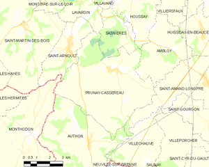
Prunay-Cassereau
- commune in Loir-et-Cher, France
- Country:
- Postal Code: 41310
- Coordinates: 47° 41' 43" N, 0° 55' 16" E
- GPS tracks (wikiloc): [Link]
- Area: 32.85 sq km
- Population: 623
- Web site: [Link]


Houssay
- commune in Loir-et-Cher, France
- Country:
- Postal Code: 41800
- Coordinates: 47° 45' 10" N, 0° 56' 19" E
- GPS tracks (wikiloc): [Link]
- Area: 16.56 sq km
- Population: 390

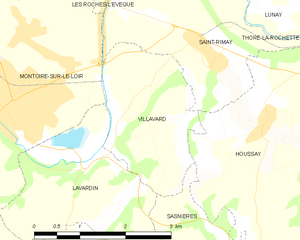
Villavard
- commune in Loir-et-Cher, France
- Country:
- Postal Code: 41800
- Coordinates: 47° 45' 32" N, 0° 54' 18" E
- GPS tracks (wikiloc): [Link]
- Area: 5.18 sq km
- Population: 127


Lavardin
- commune in Loir-et-Cher, France
- Country:
- Postal Code: 41800
- Coordinates: 47° 44' 31" N, 0° 53' 10" E
- GPS tracks (wikiloc): [Link]
- Area: 6.71 sq km
- Population: 188
- Web site: [Link]