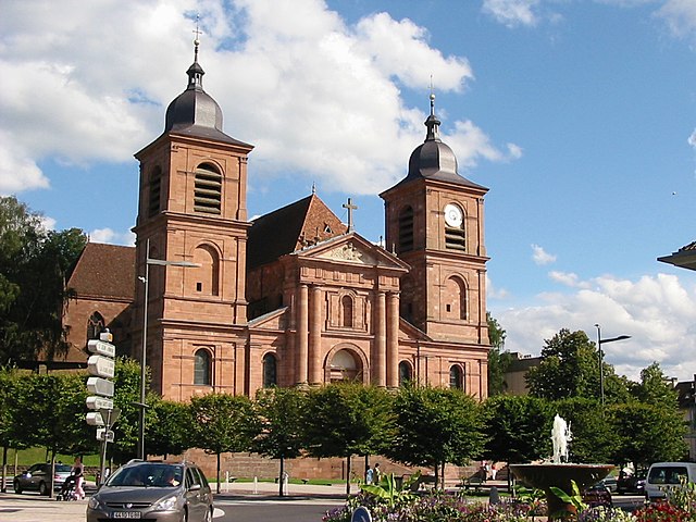
Saulcy-sur-Meurthe (Saulcy-sur-Meurthe)

- commune in Vosges, France
- Country:

- Postal Code: 88580
- Coordinates: 48° 14' 11" N, 6° 57' 35" E


- GPS tracks (wikiloc): [Link]
- Area: 16.37 sq km
- Population: 2339
- Web site: http://www.saulcy-sur-meurthe.fr
- Wikipedia en: wiki(en)
- Wikipedia: wiki(fr)
- Wikidata storage: Wikidata: Q1410001
- Wikipedia Commons Category: [Link]
- Freebase ID: [/m/03qh6j4]
- Freebase ID: [/m/03qh6j4]
- GeoNames ID: Alt: [2975833]
- GeoNames ID: Alt: [2975833]
- SIREN number: [218804458]
- SIREN number: [218804458]
- BnF ID: [15279364w]
- BnF ID: [15279364w]
- INSEE municipality code: 88445
- INSEE municipality code: 88445
Shares border with regions:

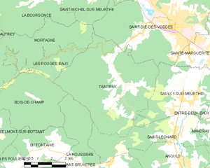
Taintrux
- commune in Vosges, France
- Country:
- Postal Code: 88100
- Coordinates: 48° 14' 59" N, 6° 54' 8" E
- GPS tracks (wikiloc): [Link]
- Area: 31.69 sq km
- Population: 1558


Saint-Léonard
- commune in Vosges, France
- Country:
- Postal Code: 88650
- Coordinates: 48° 12' 59" N, 6° 56' 38" E
- GPS tracks (wikiloc): [Link]
- Area: 14.57 sq km
- Population: 1355
- Web site: [Link]


Entre-deux-Eaux
- commune in Vosges, France
- Country:
- Postal Code: 88650
- Coordinates: 48° 13' 53" N, 6° 59' 31" E
- GPS tracks (wikiloc): [Link]
- Area: 8.47 sq km
- Population: 516


Sainte-Marguerite
- commune in Vosges, France
- Country:
- Postal Code: 88100
- Coordinates: 48° 16' 9" N, 6° 58' 35" E
- GPS tracks (wikiloc): [Link]
- AboveSeaLevel: 360 м m
- Area: 5.55 sq km
- Population: 2346
- Web site: [Link]

Saint-Dié-des-Vosges
- commune in Vosges, France
- Country:
- Postal Code: 88100
- Coordinates: 48° 17' 3" N, 6° 56' 57" E
- GPS tracks (wikiloc): [Link]
- AboveSeaLevel: 343 м m
- Area: 46.15 sq km
- Population: 20079
- Web site: [Link]