Schärding District (Bezirk Schärding)

- district of Austria
 Hiking in Schärding District
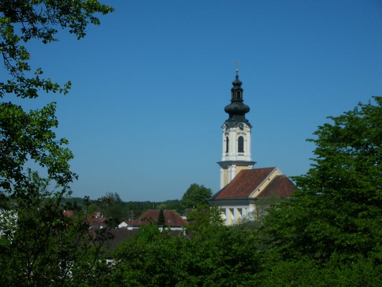
Schärding District, located in Upper Austria, is known for its picturesque landscapes, charming towns, and well-marked hiking trails. The area is characterized by rolling hills, lush forests, and the scenic banks of the Inn River, making it an excellent destination for hikers of all skill levels.
Popular Hiking Trails:
-
Inn River Trail: This trail runs along the Inn River, offering stunning views of the water and surrounding landscapes. It's a relatively easy hike, perfect for families and beginners. Along the way, you can enjoy quaint villages and historical sites.
-
Pöndorf Forest Trails: For those seeking a more wooded experience, the trails in the Pöndorf area provide a mix of shaded paths and occasional steep sections. Wildlife sightings are possible here, and the trails are well-maintained.
-
Drachenwand Mountain: A challenging hike that rewards with spectacular views of the surrounding area, including the Inn Valley. This trail is suitable for more experienced hikers, as it features steeper ascents.
-
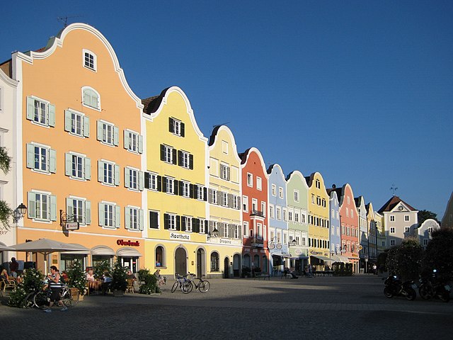
Schärding Town Walk: Not a classic hiking trail but definitely worth exploring, the streets of Schärding are perfect for leisurely walks. You can discover baroque architecture, the famous Pfarrkirche St. Georg, and the beautiful town square.
Tips for Hiking in Schärding District:
-
Prepare for Varying Weather: The weather can change quickly, so it's advisable to check the forecast and be prepared for rain or chilly conditions. Carrying a waterproof jacket and layers is a good idea.
-
Stay Hydrated and Snack Smart: Bring sufficient water and snacks to keep your energy levels up, especially on longer hikes.
-
Respect Nature: Follow local guidelines for nature conservation, and stay on marked paths to protect the environment.
-
Check Trail Conditions: Some trails may be affected by weather or maintenance work, so it's a good practice to check local resources or websites before heading out.
-
Local Guides and Tours: Consider joining a guided hike if you're unfamiliar with the area or want to learn more about the local ecology and history.
Conclusion:
Hiking in Schärding District provides a wonderful opportunity to connect with nature and explore the unique landscapes of Upper Austria. Whether you're a seasoned hiker or simply enjoy beautiful walks in nature, this area has something to offer everyone. Don't forget to take your camera to capture the stunning vistas along the way!
- Country:

- Capital: Schärding
- Licence Plate Code: SD
- Coordinates: 48° 26' 24" N, 13° 34' 41" E


- GPS tracks (wikiloc): [Link]
- AboveSeaLevel: 489 м m
- Area: 618.49 sq km
- Web site: http://www.bh-schaerding.gv.at/
- Wikipedia en: wiki(en)
- Wikipedia: wiki(de)
- Wikidata storage: Wikidata: Q47482
- Wikipedia Commons Category: [Link]
- Freebase ID: [/m/0dy_jf]
- GeoNames ID: Alt: [2766154]
- GND ID: Alt: [4104734-5]
- archINFORM location ID: [14678]
- Library of Congress authority ID: Alt: [n92025440]
- Quora topic ID: [Schärding]
Includes regions:
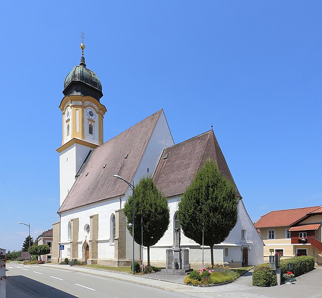
Zell an der Pram
- municipality in Austria
Hiking in Zell an der Pram
Zell an der Pram is a charming village located in the Austrian state of Upper Austria, surrounded by beautiful landscapes that offer various hiking opportunities. The region is characterized by rolling hills, forests, and views of the surrounding countryside, making it an excellent destination for both casual walkers and avid hikers....
- Country:
- Postal Code: 4755
- Local Dialing Code: 07764
- Licence Plate Code: SD
- Coordinates: 48° 19' 0" N, 13° 38' 0" E
- GPS tracks (wikiloc): [Link]
- AboveSeaLevel: 367 м m
- Area: 23.39 sq km
- Population: 2013
- Web site: [Link]

Taufkirchen an der Pram
- municipality in Austria
Hiking in Taufkirchen an der Pram
Taufkirchen an der Pram is a picturesque village located in the Upper Austria region, known for its beautiful landscapes and rural charm. When it comes to hiking in the area, you'll find a variety of trails that showcase the natural beauty of the surrounding countryside. Here are some aspects to consider for hiking in Taufkirchen an der Pram:...
- Country:
- Postal Code: 4775
- Local Dialing Code: 07719
- Licence Plate Code: SD
- Coordinates: 48° 25' 0" N, 13° 32' 0" E
- GPS tracks (wikiloc): [Link]
- AboveSeaLevel: 338 м m
- Area: 29.15 sq km
- Population: 2925
- Web site: [Link]

Schardenberg
- municipality in Austria
Hiking in Schardenberg
Schardenberg, located in Upper Austria near the Austrian-German border, offers a variety of hiking opportunities that combine beautiful landscapes, rich natural diversity, and cultural experiences. Here are some highlights and tips for hiking in the area:...
- Country:
- Postal Code: 4784
- Local Dialing Code: 07713
- Licence Plate Code: SD
- Coordinates: 48° 31' 13" N, 13° 29' 51" E
- GPS tracks (wikiloc): [Link]
- AboveSeaLevel: 543 м m
- Area: 32 sq km
- Population: 2407
- Web site: [Link]
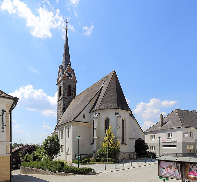
Schärding
- municipality in Austria
Hiking in Schärding
Schärding, a picturesque town in Austria located near the border with Germany, is known for its beautiful baroque architecture and scenic landscapes. The surrounding region offers various hiking opportunities that cater to different skill levels and preferences. Here are some highlights of hiking in and around Schärding:...
- Country:
- Postal Code: 4780
- Local Dialing Code: 07712
- Licence Plate Code: SD
- Coordinates: 48° 27' 25" N, 13° 25' 54" E
- GPS tracks (wikiloc): [Link]
- AboveSeaLevel: 313 м m
- Area: 3.96 sq km
- Population: 5253
- Web site: [Link]

Raab
- municipality in Upper Austria
Hiking in Raab
Raab, located in Hungary, is known for its beautiful landscapes, historic sites, and extensive opportunities for hiking. The region features a mix of rolling hills, forests, and rivers, making it a picturesque area for outdoor enthusiasts....
- Country:
- Postal Code: 4760
- Local Dialing Code: 07762
- Licence Plate Code: SD
- Coordinates: 48° 21' 0" N, 13° 39' 0" E
- GPS tracks (wikiloc): [Link]
- AboveSeaLevel: 381 м m
- Area: 23 sq km
- Population: 2270
- Web site: [Link]

Altschwendt
- municipality in Austria
Hiking in Altschwendt
Altschwendt is a charming small village located in Austria, which offers various outdoor activities, including hiking. The area around Altschwendt features beautiful landscapes, rolling hills, and opportunities to explore natural surroundings, making it ideal for both casual hikers and more experienced trekkers....
- Country:
- Postal Code: 4721
- Local Dialing Code: 07762
- Licence Plate Code: SD
- Coordinates: 48° 19' 0" N, 13° 41' 0" E
- GPS tracks (wikiloc): [Link]
- AboveSeaLevel: 432 м m
- Area: 13 sq km
- Population: 700
- Web site: [Link]

Andorf
- municipality in Austria
Hiking in Andorf
Andorf, located in the Innviertel region of Austria, offers a charming setting for hiking enthusiasts. The area is characterized by rolling hills, picturesque landscapes, and a mix of forests and open fields, making it suitable for various hiking levels....
- Country:
- Postal Code: 4770
- Local Dialing Code: 07766
- Licence Plate Code: SD
- Coordinates: 48° 22' 0" N, 13° 34' 0" E
- GPS tracks (wikiloc): [Link]
- AboveSeaLevel: 346 м m
- Area: 38 sq km
- Population: 5174
- Web site: [Link]

Dorf an der Pram
- municipality in Austria
Hiking in Dorf an der Pram
Dorf an der Pram is a charming village located in Austria, nestled in a picturesque natural setting that offers a variety of hiking opportunities. Surrounded by beautiful landscapes, forests, and hills, it’s a great destination for both novice and experienced hikers....
- Country:
- Postal Code: 4751
- Local Dialing Code: 07764
- Licence Plate Code: SD
- Coordinates: 48° 16' 40" N, 13° 37' 40" E
- GPS tracks (wikiloc): [Link]
- AboveSeaLevel: 395 м m
- Area: 13 sq km
- Population: 1039
- Web site: [Link]

Engelhartszell an der Donau
- municipality in Austria
Hiking in Engelhartszell an der Donau
Engelhartszell an der Donau, located in the Austrian region of Upper Austria, is a charming destination for hikers and nature enthusiasts. It’s nestled along the banks of the Danube River and offers a variety of scenic trails that showcase the natural beauty of the area....
- Country:
- Postal Code: 4090
- Local Dialing Code: 07717
- Licence Plate Code: SD
- Coordinates: 48° 30' 0" N, 13° 44' 0" E
- GPS tracks (wikiloc): [Link]
- AboveSeaLevel: 302 м m
- Area: 19 sq km
- Population: 942
- Web site: [Link]


Wernstein am Inn
- municipality in Austria
Hiking in Wernstein am Inn
Wernstein am Inn is a charming village located in Upper Austria, near the border with Germany. It sits along the banks of the Inn River and is surrounded by picturesque landscapes, making it a great destination for hiking enthusiasts. Here are some details to consider while planning your hiking adventures in the area:...
- Country:
- Postal Code: 4783
- Local Dialing Code: 07713
- Licence Plate Code: SD
- Coordinates: 48° 30' 31" N, 13° 27' 37" E
- GPS tracks (wikiloc): [Link]
- AboveSeaLevel: 319 м m
- Area: 16 sq km
- Population: 1566
- Web site: [Link]

Vichtenstein
- municipality in Austria
Hiking in Vichtenstein
Vichtenstein, nestled in the heart of Europe, is recognized for its stunning landscapes, which include mountains, valleys, and picturesque villages. While you might be referring to "Liechtenstein," the charming, landlocked principality between Switzerland and Austria, it's a fantastic destination for hiking enthusiasts....
- Country:
- Postal Code: 4091
- Local Dialing Code: 07714
- Licence Plate Code: SD
- Coordinates: 48° 32' 0" N, 13° 39' 0" E
- GPS tracks (wikiloc): [Link]
- AboveSeaLevel: 554 м m
- Area: 10.7 sq km
- Population: 611
- Web site: [Link]
Enzenkirchen
- municipality in Austria
Hiking in Enzenkirchen
Enzenkirchen is a scenic area located in Austria, known for its beautiful landscapes and outdoor recreational opportunities, including hiking. Although it may not be as well-known as some of Austria’s larger hiking destinations, it offers a charming experience for those looking to explore the countryside....
- Country:
- Postal Code: 4761
- Local Dialing Code: 07762
- Licence Plate Code: SD
- Coordinates: 48° 23' 0" N, 13° 39' 0" E
- GPS tracks (wikiloc): [Link]
- AboveSeaLevel: 373 м m
- Area: 23 sq km
- Population: 1772
- Web site: [Link]

Sankt Florian am Inn
- municipality in Austria
Hiking in Sankt Florian am Inn
Sankt Florian am Inn is a picturesque village located in the Innviertel region of Upper Austria, right along the banks of the River Inn. The area is known for its natural beauty, rolling hills, and varied landscapes, making it a fantastic destination for hikers of all levels. Here are some highlights to consider:...
- Country:
- Postal Code: 4782
- Licence Plate Code: SD
- Coordinates: 48° 26' 0" N, 13° 36' 0" E
- GPS tracks (wikiloc): [Link]
- AboveSeaLevel: 321 м m
- Area: 24 sq km
- Population: 3150
- Web site: [Link]
Riedau
- municipality in Austria
Hiking in Riedau
Riedau, a charming village located in Austria, offers beautiful landscapes and scenic trails for hiking enthusiasts. The surrounding region is characterized by rolling hills, lush forests, and picturesque farmland, making it an appealing destination for both casual walkers and more experienced hikers....
- Country:
- Postal Code: 4752
- Local Dialing Code: 07764
- Licence Plate Code: SD
- Coordinates: 48° 18' 4" N, 13° 38' 3" E
- GPS tracks (wikiloc): [Link]
- AboveSeaLevel: 376 м m
- Area: 8 sq km
- Population: 2069
- Web site: [Link]

Mayrhof
- municipality in Austria
Hiking in Mayrhof
Mayrhofen, located in the Zillertal Valley of Austria, is a renowned destination for hiking enthusiasts. The region offers a stunning array of trails that cater to all skill levels, making it an ideal spot for both novice and experienced hikers. Here are some key points about hiking in Mayrhofen:...
- Country:
- Postal Code: 4777
- Local Dialing Code: 07767
- Licence Plate Code: SD
- Coordinates: 48° 21' 0" N, 13° 30' 0" E
- GPS tracks (wikiloc): [Link]
- AboveSeaLevel: 430 м m
- Area: 5 sq km
- Population: 322
- Web site: [Link]

Rainbach im Innkreis
- municipality in Austria
Hiking in Rainbach im Innkreis
Rainbach im Innkreis is a charming area located in the Upper Austria region, surrounded by beautiful natural landscapes that are perfect for hiking enthusiasts. The region features rolling hills, lush forests, and scenic views, making it an inviting destination for both casual walkers and experienced trekkers....
- Country:
- Local Dialing Code: 07716
- Licence Plate Code: SD
- Coordinates: 48° 27' 0" N, 13° 32' 0" E
- GPS tracks (wikiloc): [Link]
- AboveSeaLevel: 371 м m
- Area: 25 sq km
- Population: 1478
- Web site: [Link]

Münzkirchen
- municipality in Austria
Hiking in Münzkirchen
Münzkirchen, located in the Austrian state of Upper Austria, is surrounded by beautiful landscapes, making it a great destination for hiking enthusiasts. Here are some highlights about hiking in that area:...
- Country:
- Postal Code: 4792
- Local Dialing Code: 07716
- Licence Plate Code: SD
- Coordinates: 48° 29' 0" N, 13° 34' 0" E
- GPS tracks (wikiloc): [Link]
- AboveSeaLevel: 486 м m
- Area: 21 sq km
- Population: 2545
- Web site: [Link]

Sankt Marienkirchen bei Schärding
- municipality in Austria
Hiking in Sankt Marienkirchen bei Schärding
Sankt Marienkirchen bei Schärding, located in Austria, offers a beautiful backdrop for hiking enthusiasts. Nestled in the scenic Innviertel region, it features a mix of gentle hills, lush green landscapes, and stunning views of the surrounding countryside, including the nearby River Inn....
- Country:
- Postal Code: 4774
- Local Dialing Code: 07711
- Licence Plate Code: SD
- Coordinates: 48° 23' 0" N, 13° 27' 0" E
- GPS tracks (wikiloc): [Link]
- AboveSeaLevel: 338 м m
- Area: 25 sq km
- Population: 1832
- Web site: [Link]


Waldkirchen am Wesen
- municipality in Austria
Hiking in Waldkirchen am Wesen
Waldkirchen am Wesen is a charming village located in the beautiful region of Austria, specifically in the Upper Austria province. Nestled among the rolling hills and lush forests, it provides a fantastic backdrop for hikers of all levels. Here are some highlights and tips for hiking in this scenic area:...
- Country:
- Postal Code: 4085
- Local Dialing Code: 07718
- Licence Plate Code: SD
- Coordinates: 48° 27' 0" N, 13° 49' 0" E
- GPS tracks (wikiloc): [Link]
- AboveSeaLevel: 550 м m
- Area: 21.4 sq km
- Population: 1171
- Web site: [Link]

Sigharting
- municipality in Austria
Hiking in Sigharting
Sigharting is a lovely area in Austria that offers some wonderful hiking opportunities amidst picturesque landscapes. While it may not be as widely known as some other hiking destinations in the country, it still provides a variety of trails that cater to different skill levels....
- Country:
- Postal Code: 4771
- Local Dialing Code: 07766
- Licence Plate Code: SD
- Coordinates: 48° 24' 0" N, 13° 36' 0" E
- GPS tracks (wikiloc): [Link]
- AboveSeaLevel: 343 м m
- Area: 5.66 sq km
- Population: 848
- Web site: [Link]

Suben
- municipality in Austria
Hiking in Suben
Suben is a small town in Austria, located in the Upper Austria region. It's known for its scenic landscapes, including lush forests and rolling hills, which can provide some lovely hiking opportunities. When exploring hiking in and around Suben, here are a few things to consider:...
- Country:
- Postal Code: 4975
- Local Dialing Code: 07711
- Licence Plate Code: SD
- Coordinates: 48° 25' 0" N, 13° 26' 0" E
- GPS tracks (wikiloc): [Link]
- AboveSeaLevel: 329 м m
- Area: 6 sq km
- Population: 1508
- Web site: [Link]
Eggerding
- municipality in Austria
Hiking in Eggerding
Eggerding, a small village located in Austria, is surrounded by beautiful landscapes that offer a range of hiking opportunities. The region is characterized by picturesque alpine scenery, rolling hills, and lush forests, making it a great destination for hikers of all skill levels....
- Country:
- Postal Code: 4773
- Local Dialing Code: 07767
- Licence Plate Code: SD
- Coordinates: 48° 21' 0" N, 13° 29' 0" E
- GPS tracks (wikiloc): [Link]
- AboveSeaLevel: 382 м m
- Area: 22 sq km
- Population: 1320
- Web site: [Link]
Diersbach
- municipality in Austria
Hiking in Diersbach
Diersbach, situated in Austria, offers various hiking opportunities for both beginners and experienced hikers due to its picturesque landscapes and diverse terrain. Here are a few highlights you might find enjoyable:...
- Country:
- Postal Code: 4776
- Local Dialing Code: 07719
- Licence Plate Code: SD
- Coordinates: 48° 25' 0" N, 13° 34' 0" E
- GPS tracks (wikiloc): [Link]
- AboveSeaLevel: 335 м m
- Area: 28 sq km
- Population: 1583
- Web site: [Link]
Sankt Willibald
- municipality in Austria
Hiking in Sankt Willibald
Sankt Willibald, located in Bavaria, Germany, is a charming area known for its scenic landscapes and hiking opportunities. The region is characterized by its beautiful rolling hills, lush forests, and picturesque views, making it ideal for both novice and experienced hikers....
- Country:
- Postal Code: 4762
- Local Dialing Code: 07762
- Licence Plate Code: SD
- Coordinates: 48° 22' 0" N, 13° 41' 0" E
- GPS tracks (wikiloc): [Link]
- AboveSeaLevel: 455 м m
- Area: 15 sq km
- Population: 1100
- Web site: [Link]
Freinberg
- municipality in Austria
Hiking in Freinberg
Freinberg is a fantastic hiking destination located in Austria, particularly known for its scenic landscapes and variety of trails suitable for different skill levels. Here are some key points about hiking in the Freinberg area:...
- Country:
- Postal Code: 4785
- Local Dialing Code: 07713
- Licence Plate Code: SD
- Coordinates: 48° 34' 0" N, 13° 31' 0" E
- GPS tracks (wikiloc): [Link]
- AboveSeaLevel: 455 м m
- Area: 20 sq km
- Population: 1458
- Web site: [Link]


Sankt Aegidi
- municipality in Austria
Hiking in Sankt Aegidi
Sankt Aegidi, located in Austria, offers a variety of hiking opportunities that allow you to enjoy the stunning landscapes of the region. The area is characterized by its picturesque rolling hills, lush green meadows, and scenic views of the surrounding mountains....
- Country:
- Postal Code: 4725
- Local Dialing Code: 07717
- Licence Plate Code: SD
- Coordinates: 48° 29' 0" N, 13° 44' 0" E
- GPS tracks (wikiloc): [Link]
- AboveSeaLevel: 599 м m
- Area: 29 sq km
- Population: 1556
- Web site: [Link]

Sankt Roman
- municipality in Austria
Hiking in Sankt Roman
Sankt Roman, located in Upper Austria, offers a variety of hiking opportunities that cater to different skill levels and preferences. Nestled within a picturesque landscape of rolling hills, forests, and meadows, it provides a tranquil escape for nature lovers and outdoor enthusiasts....
- Country:
- Postal Code: 4793
- Local Dialing Code: 07716
- Licence Plate Code: SD
- Coordinates: 48° 28' 55" N, 13° 36' 40" E
- GPS tracks (wikiloc): [Link]
- AboveSeaLevel: 569 м m
- Area: 31.77 sq km
- Population: 1711
- Web site: [Link]
Brunnenthal
- municipality in Austria
Hiking in Brunnenthal
Brunnenthal is a charming area located in Austria, known for its picturesque landscapes and outdoor activities. Hiking enthusiasts will find a variety of trails that offer stunning views, lush greenery, and opportunities to explore the natural beauty of the region....
- Country:
- Postal Code: 4786
- Local Dialing Code: 07712
- Licence Plate Code: SD
- Coordinates: 48° 28' 0" N, 13° 28' 0" E
- GPS tracks (wikiloc): [Link]
- AboveSeaLevel: 383 м m
- Area: 15 sq km
- Population: 2032
- Web site: [Link]

Esternberg
- municipality in Austria
Hiking in Esternberg
Esternberg, located in Austria, is a charming destination for hiking enthusiasts. Nestled in the scenic landscapes of Upper Austria, the area offers a range of beautiful trails that cater to various skill levels, from beginners to experienced hikers....
- Country:
- Postal Code: 4092
- Local Dialing Code: 07714
- Licence Plate Code: SD
- Coordinates: 48° 33' 0" N, 13° 34' 0" E
- GPS tracks (wikiloc): [Link]
- AboveSeaLevel: 510 м m
- Area: 40 sq km
- Population: 2855
- Web site: [Link]
Kopfing im Innkreis
- municipality in Austria
Hiking in Kopfing im Innkreis
Kopfing im Innkreis, located in Austria's Upper Austria region, offers a charming environment for hiking enthusiasts. The area is characterized by beautiful landscapes, rolling hills, and serene natural settings, making it perfect for a variety of hiking trails suitable for different skill levels....
- Country:
- Postal Code: 4794
- Local Dialing Code: 07763
- Licence Plate Code: SD
- Coordinates: 48° 25' 59" N, 13° 39' 0" E
- GPS tracks (wikiloc): [Link]
- AboveSeaLevel: 547 м m
- Area: 33.34 sq km
- Population: 2008
- Web site: [Link]
Shares border with regions:

Passau
- district of Bavaria, Germany
Hiking in Passau
Hiking in the Passau district, located in the southeast of Bavaria, Germany, offers an array of scenic trails and beautiful landscapes characterized by hills, forests, rivers, and charming villages. The Passau area is known for its impressive natural beauty, making it a great destination for hikers of all experience levels. Below are some highlights of hiking in the region:...
- Country:

- Capital: Passau
- Licence Plate Code: PA
- Coordinates: 48° 30' 0" N, 13° 19' 48" E
- GPS tracks (wikiloc): [Link]
- AboveSeaLevel: 364 м m
- Area: 1530.04 sq km
- Population: 162355
- Web site: [Link]